The Waterfalls of Strathcona Park

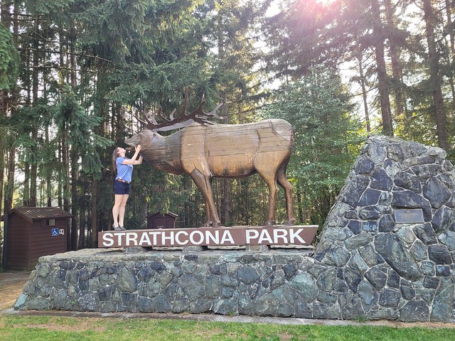
This has turned into quite the series about Strathcona Park, with my backpacking trips to Landslide Lake and Bedwell Bay being some of the highlights. But I want to spend a bit of time talking about waterfalls because there are so many to explore in the park and most of them are extremely easy to get to!

First up is Lady Falls. It’s located in the North end of the park along Highway 28 (as opposed to the road along Buttle Lake). If you’re going to Landslide Lake or Gold River, it’s a good stop along the way. There’s a small parking lot and it’s 500 metres each way (and 50m elevation gain) to get to the waterfall. There’s a platform from which to watch the falls thundering down into the ravine and you even catch some of the spray. Of the short waterfall hikes, Lady Falls is the easiest to get to and more impressive than Lupin Falls.

20220913_181407

If you’re heading down Western Mines Road to the south end of the park, make sure to stop at Lupin Falls on the way there. It wasn’t as impressive as Lady Falls when we visited, but that’s because it was early September and extremely dry – I suspect it has a much higher flow in the Spring. It’s flat and less than 1km as a round trip hike through the woods. The waterfall was more of a trickle when we visited, but there are some beautiful tall trees to enjoy along the way.

20220913_185252

Continuing on Western Mines Road, you’ll hit the parking lot for Lower Myra Falls at the south end of the lake, after the road for Bedwell Lakes. It’s a further drive than Lady Falls and Lupin Falls, but in my opinion, Lower Myra Falls is the best waterfall in the park (except for Della Falls). It starts with a steep hike down towards the lake, about 500 metres, but with 100m in elevation loss. There are two options for viewing – you can take the first left and see the upper falls and pool at the viewpoint – and then you can continue down to the middle falls where there’s another pool and you can explore around the rocks. You can walk along the edge of the falls as it cascades down towards the lake.

20220914_145612

Our first trip was in the early morning, so it was too cold to swim and we decided to come back later in the afternoon. On the second visit, we went for a dip in the middle pool before climbing down over the rocks to the lake – “climbing” being the key word. There are various paths cutting through the woods, but none of them are official, so we just found the least dangerous route down to the lake where there was a large sandbar. I’m not sure if the sandbar is there year round though (lake level was very low when we visited), so exercise caution around the rocks as it would be easy to slip and fall.

20220914_102344

We loved swimming in the lake. The waterfall pool was freezing cold, but the lake was a very balmy temperature and we enjoyed a proper swim before climbing back up to the parking lot. There’s a dam on the lake, so there are still all kinds of large tree stumps in the water from when they impounded the reservoir. It’s fun to swim out and stand on them, but be careful because they are slippery and have lots of sharp edges.

20220914_151637

Our last waterfall was Upper Myra Falls. At 8km round trip, this is the longest waterfall hike in the park (that we did). If I we’re to rank them all, I would put Upper Myra Falls below Lower Myra Falls and Lady Falls, but above Lupin Falls. It’s a very high, narrow waterfall that comes out through the trees and cascades down to the forest floor. There’s no accessible pool, but there is a platform from which you can view it. It took us about an hour to hike the 4km to the platform and we hung around for a half hour and had lunch before heading back again. There’s only about 80m of elevation gain along the whole trail, so it’s not very difficult.

20220914_125921

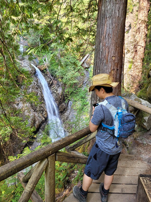
While it wasn’t my favourite waterfall, it still made for a nice little adventure. You have to drive through the active Westin Mine to get to the trailhead, which is an experience in itself, and the forest on the way to the falls is amazing! This trail is through old-growth forest, which is pretty rare in BC these days, so I enjoyed the tall, wide trees, and the chaos that makes up the undergrowth of an old growth forest.

And those are the waterfalls of Strathcona Park! There are more waterfalls that are accessible through other park entrances, the most notable of which is Della Falls and is only accessible by boat, but we only had time for the core area of the park on this trip. Overall I had a blast and would highly recommend this park, which is so large it feels more like a National Park!

20220914_104306

Strathcona Provincial Park

Well, after my 8 post series on the Sunshine Coast Trail, I needed a little break, but now it’s time to catch up on the week I spent in Strathcona Provincial Park immediately after.

It’s unreal how many provincial parks we have in BC. Me and Brandon were all booked to hike the Skyline Trail in Jasper National Park in early September, but then 3 days before the trip we got an email from Parks Canada asking us not to come because of the wildfires. Technically our trail wasn’t closed, but the entire town of Jasper was without power and Parks Canada was encouraging people to cancel, so we listened and made other plans.

20220911_160047

We floated around a lot of ideas for where to go instead, but we had so little time in which to execute the trip that a lot of them were quickly ruled out. Brandon suggested Strathcona Provincial Park, which has been on his bucket list for a long time, and it sounded like the perfect place to do a mix of front and backcountry camping with limited preparations. It was the second week of September, so fortunately the crowds were gone and we didn’t have to worry about reservations. We hoped on the ferry on Sunday morning to spend a week exploring the park!

First off, Strathcona Provincial Park is huge! There are other large provincial parks nearby, like Garibaldi, but Strathcona is largely accessible by car, so it gave us a lot of National Park vibes as we were driving through, though you can tell it receives much less funding than a National Park. It’s not so far from Vancouver that you couldn’t visit over a long weekend, but the size definitely warrants a longer trip. What makes it tricky is that it has multiple entrances and they are all very far away from each other. For example, there are some great trails that can be accessed through Mount Washington and Courtney, but we opted to skip these to focus on the core park area, which is closer to Gold River and a bit of a further drive.

20220911_171333

The core area of the park is centralized around Buttle Lake, which extends from tip to toe of the park. There are tons of backcountry campsites, but only 2 frontcountry campgrounds, both located on the lake. The Buttle Lake Campground is at the top of the lake, while the Ralph River Campground is down closer to the bottom. We opted to start at Buttle Lake and spent our first night exploring around the lake. It was a bit smoky when we arrived and the water level of the lake was really low. We went for a walk from our campsite and were able to walk right on to Rainbow Island due to the low water level. There’s a marine backcountry site located on Rainbow Island and I’m now keen to return to Buttle Lake with my kayak because there are several marine sites located along the opposite shore of the lake that would be fun to explore!

Since there’s so much to do, we only spent one night at Buttle Lake before making an overnight trek up to Landslide Lake, which is one of Vancouver Islands most popular backcountry hikes! Landslide Lake is a 20km trek on the northwest side of the park that is best done over 1-2 nights. We opted for 1 night and day hiked from the campsite up to Landslide and Foster Lakes. There’s a lot to talk about between those 2 lakes, so I’m going to write a whole separate post about that hike!

20220912_161033

After we finished the Landslide Lake hike, we decided to make a quick stop into Gold River to get lunch. It’s a tiny little town, but it has a lot of great eco tourism! It’s the launching spot if you’re doing the Nootka Trail, as well as if you’re doing any paddling around the coast. It has fishing and some great little tourist attractions if you’re just there for the day. We stopped into a little cafe for lunch and our waitress gave us a hot tip to check out the Heber River, which has the most beautiful little swimming hole! The water is vibrant blue and super clear, but boy is it cold! We both went for a dip, but it was a quick one!

20220913_152504

After our swim we got another hot tip when we were stocking up at the liquor store about an easily accessible cave system. About 20 mins west of Gold River, there’s a small Rec Site called Upana Caves. It’s a network of caves with 4 that are easily accessible after only 10 minutes of walking – just make sure to bring your headlamp! I’m a bit of a chicken when it comes to caving, but Brandon convinced me to go into a few and we ended up spending an hour crawling around. Our favourite was the last cave in the system, Resurgence Cave, which has a little river flowing through it and is pretty scenic. A bit of a different activity for us, but well worth the detour!

20220913_165056

Once we headed back into the park, we went on a bit of a tourist circuit of the easily accessible trails. There’s a ton of waterfalls in the park, most of which are located right off the highway. We stopped into Lady Falls, Lupin Falls, and Lower and Upper Myra Falls. Lower Myra Falls is definitely the shining gem of the park, so if you can’t get to them all, make sure you visit that one. You can swim in the falls, though it’s very cold. If you’re more adventurous, you can climb down from the falls to the bottom end of Myra Lake, which is a much nicer place to swim. Brandon and I had a proper bath here since we were in the park for a full week and neither of the campgrounds have showers.

20220914_102344

Since Lower Myra Falls is located at the bottom of the park, we opted to stay at the Ralph River Campground for 2 nights. Some of the sites appear to be “lakefront” which had us excited, but because the water level was so low, it was much more of a swamp then we were anticipating. We lugged all our gear out to the “beach” one night to cook, which was still nice, but I wouldn’t recommend it as a good place for swimming! In our case it started raining on us in the middle of our meal, but we were troopers and stuck it out anyways.

20220914_104306

The very end of the park is interesting because there’s actually an active mine right in the park! So a small part of the park is designated as “Strathcona-Westin Provincial Park”, which is basically just the extents of the mine. From what I understand, the mine already existed when they formed the park, so they let it continue operating. You actually have to drive right through it to get to some of the trailheads, including for Upper Myra Falls, so it’s an interesting experience!

We decided to finish the trip with a second overnight hike up to Bedwell Lake. It’s also a very popular hike and our plan was to do both Bedwell and Cream Lakes. Unfortunately, the weather didn’t really co-operate with us for this hike. It was really nice when we started, but it got foggier and foggier the closer we got to the lake. After talking to some other people, it sounds like most of the park was clear that day, but a bunch of clouds got hung up in our area and unfortunately, we couldn’t see a thing. But I’m also going to do a full post about Bedwell Lakes, because it was still an eventful trip, even with the odd weather.

20220915_153608

We had planned to do one more hike in the park via Courtney on the way home, called Century Sam, but we got notice on the way to Courtney that the gate to the trailhead was closed. The road to the trail is on private property, so you are at the mercy of the property owners if you choose to visit that trail. There is no service anywhere in Strathcona Park, so be prepared for that when you visit.

The salmon were just starting to run when we were leaving the park, so we stopped along the river on our way out to watch people fishing and then hightailed it to the ferry when we heard Century Sam was closed. We ended up having a bit of a wait for the ferry, but were able to make it home the same night. So overall, I really liked Strathcona and I don’t think it’s a place I would likely have planned to visit without such an opportunity. That said, I left the park with even more trails on my bucket list then when I entered!

20220914_175941

Chance Cove Coastal Trail

I recently made my annual summer trip home to Newfoundland for 10 days in early June and had the best time exploring some new trails! I wasn’t thrilled about going home in June because it’s not the nicest weather in Newfoundland at that time, but I ended up having to eat my words because I had really good luck while I was home! I got such fine weather I ended up doing 55km worth of hikes in just 7 days – the first of which was Chance Cove Coastal Trail.

IMG-20220613-WA0016

Chance Cove is located about an hour and half outside of St. John’s on the far end of the Avalon peninsula on the isthmus. Chance Cove has definitely been trending on Newfoundland social media throughout the pandemic and I was starting to feel like everyone I knew on the island had been there over the past year. It looks incredibly scenic in photos, so I admit to being drawn to this hike by Instagram and I was determined to check it out for myself.

We got nice weather on our first weekend home and I convinced both mine and Seth’s families to do the hike with us. It’s only ~4km round trip and is fairly easy terrain, but it’s so scenic it ended up taking us 2.5 hours to do the whole thing!

20220612_124701

What makes this hike especially nice is that it’s a double loop hike (kind of like a figure 8), so you get different topography along the entire hike. We started by climbing up into the woods until we reached Chance Cove Beach, which extends across the cove to the main road, then we switched back to the coastal route up towards Green Head. It was overcast and extremely windy when we started, with Green Head being the most blustery part of the trail. We hiked up to the head, but didn’t stay long because it was so cold, though it was cool to watch the wind swirl erratic patterns through the water.

20220612_124910

From Green Head, you continue along the headland past Chance Cove Island to Island Cove Beach, where fortunately, the headland shelters you from the worst of the wind. There’s a newly constructed set of stairs going down to Island Cove Beach, so we took a long break on the beach to eat our snacks and enjoy the warmer (less windy) weather. As we continued on, the clouds started breaking up and pretty soon the sun was shining down on us!

20220612_131238

The next attraction is Patrick’s Cove (also known as Big Cove), but first you can hike up to a series of viewpoints between the two coves. With the sun shining, it completely transforms the landscape and the water turned the most vibrant shade of blue! You could almost be tricked into thinking you were somewhere tropical, if not for the wind.

20220612_133325

You can also hike down to Big Cove, which has a huge sea stack that is centered in most of the photos I’ve seen on social media. Unfortunately, there are no stairs going to Big Cove, just a large rope guiding you down the bank. I really wanted to see it, so I climbed down, but it’s still really steep and not for the faint of heart. The rope is positioned pretty awkwardly and some of my family members had some trouble, so I wouldn’t go down there if you’re not confident in your abilities. Definitely use caution.

PSX_20220612_182515
20220612_134748

If you do decide to climb down to beach, it is very lovely and would make a great place for a swim. Me and Emily toyed briefly with the idea of going for a dip, but we didn’t have swimsuits and it was a bit too breezy to air dry. We opted instead to wade out up to our knees. It wasn’t quite as cold as I was expecting at first, but it quickly starts to numb your feet and I had to stumble back to the beach to defrost!

PSX_20220615_101406

From there we hiked back up the bank to get what I’d call the “money shot” of the hike. A view from above of the curved beach and sea stack. It was no longer sunny when we got there, but no less scenic! After that it’s a pretty easy walk back to the parking lot. There’s a small climb and then you head back down towards Chance Cove. You can cross the beach if you prefer, but given the wind, we decided to just hike back along the water instead.

20220612_141428

We concluded our day with a visit to Baccalieu Trail Brewing Co. in Bay Roberts to sample some of their beer and “legendary” cod chowder. The sun returned while we sipped our beers on the patio and we congratulated ourselves on a very successful day. Chance Cove Coastal Trail definitely lives up to the hype and I would recommend it to pretty much anyone. Use caution if climbing down to the beach, but otherwise it’s a fairly easy hike that’s great for beginners! We had a great time.

20220612_155122