HBC Trail Backpacking Trip Part II

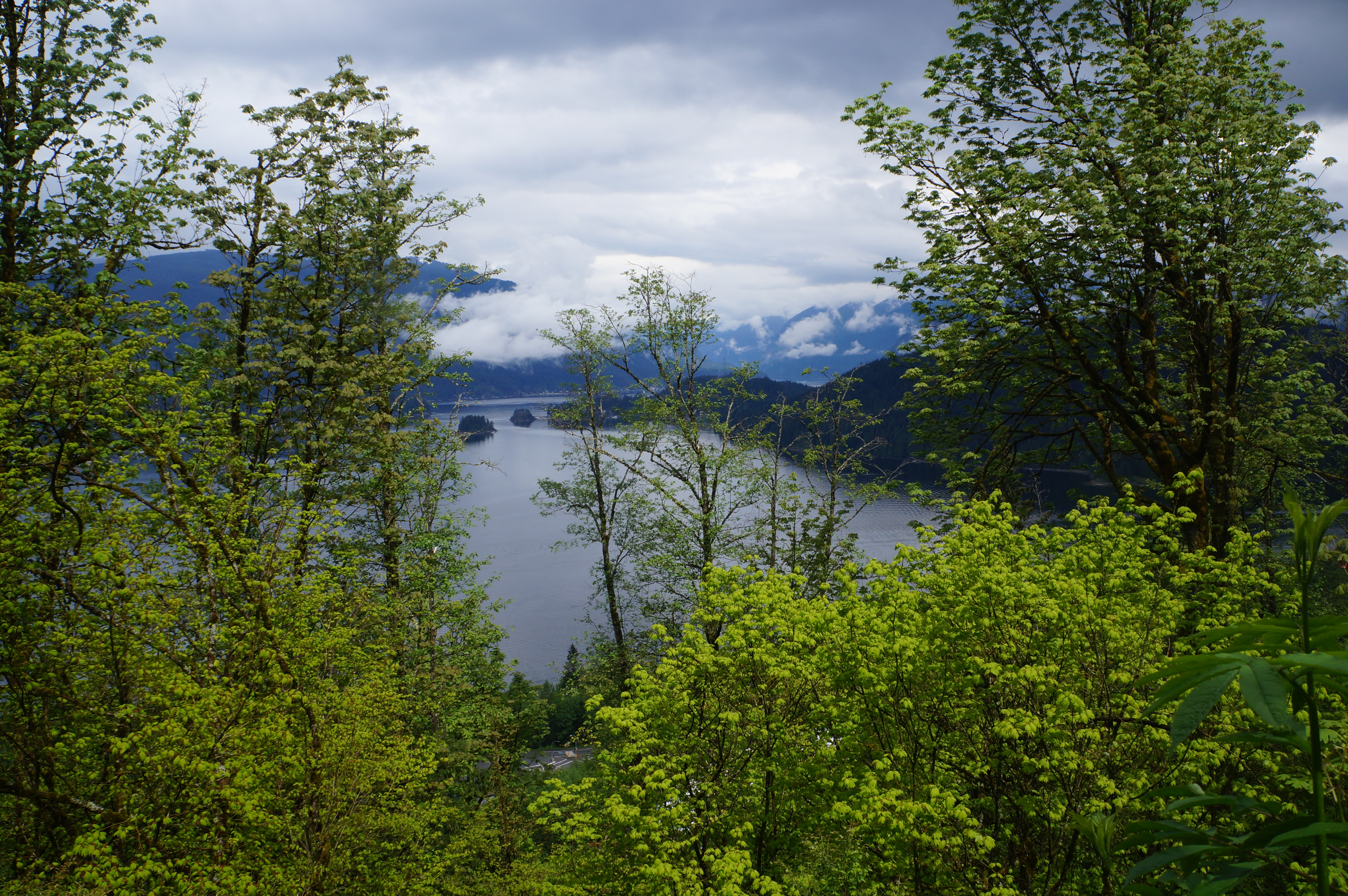
If you’ve been following along, Part I of this trip was riddled with warnings about how much this trail would challenge me. Prior to doing the HBC Trail, the North Coast Trail sticks out in my mind as one of the most challenging trails I’ve ever done. Realistically, the NCT is still a more challenging trail, but we set a very aggressive pace for the HBC, which is what made it so hard for me. This was compounded by the fact that I got injured on the trail, which has never happened to me before.

But I’m getting ahead of myself. By the end of Day 1, I was extremely tired, but happy with myself for what I’d accomplished. It was hard, but I made it through the day. The more you do it, the easier it is to push through on these types of hikes because I’ve always been confident in my recovery afterwards. This was the first time that was really tested for me and a good reminder to always respect your boundaries and set aside enough time to re-build your skills at the start of each new season. There’s a confidence that comes from having done something before, but you still need to re-new your skills.

PSX_20230804_090714
PSX_20230804_091202

I slept like a log on Saturday night. Carolyn was tossing and turning while clutching her bear spray over the noises of the night, but I was blissfully passed out. We got up at 6:30am to try and make an early start before the sun got too hot. We made our exit from Blackeye’s and continued into a section of trail known as the defiles, which is a beautiful valley carved out between the mountains, with lots of little streams flowing through. It’s a steady hike down the valley for 6km until you come to the historic Horseguard Camp. This camp is located on the Tulameen River, which is one of the best water sources on the trail. It was also just deep enough for a swim in one section, so we stopped on the beach for a quick dip. We were blessedly alone, so we took the opportunity to enjoy the water in our birthday suits.

There’s always something that will arise to plague you on every hike and at this section, it was chafing. I was surprised to get chafing on my thighs because I wore the same shorts all last season and it’s never happened before, but I guess I also never backpacked 30km in very hot weather before, so it could be expected. I made a bit of a poor choice and decided to tape over the chafing with sports tape. It wasn’t the most comfortable because some of the tape started to pull off while we continued hiking, but eventually that tape appeared to merge with my body and I ended up having to soak it off in the tub post hike!

Screenshot_20230816_091537_Gallery
PSX_20230804_091458

It was a weird day for distances because after the 6km hike to Horseguard, it was another 12km to the next campsite at Jacobson Lake. 18km before lunch is more than I like to do, but we knew it would be super scenic after Jacobson Lake, so we had a few snacks and decided to push forward. This was an interesting section because it was a slow uphill the whole way, but so gradual that it was relatively flat. It wasn’t a hard section of trail, but the energy just wasn’t there for me. It was a hot trip and I felt quite tired for most of it. I think I started off dehydrated because I drank 5L of water on Day 1 and was chugging 3 cups of electrolytes a day. Sometimes you have a good day, sometimes you don’t. It was my first big trip of the season, so I was admittedly struggling. That said, I think I was a bit hard on myself as it still only took us about 3.5 hours to do the 12km, which is quite reasonable.

Jacobson Lake is another rec site, similar to Lodestone, but was completely empty when we passed through. I heard there was a pretty big washout on the road to the lake, so we’re not sure if the lack of crowds was due to the fact that there was a washout or that it was 3pm on a Sunday and everyone was gone home. Lodestone Lake is pretty shallow and a bit mucky for swimming, but Jacobson Lake was completely unattractive. It was only about a foot deep around the edge and neither of us were willing to swim in it, nor was it a nice water source.

20230723_144049

We had 6km left to go to our campsite for the night at Deer Camp, but planned two breaks before arriving. Our first milestone was a 3km climb up to Conglomerate Flats, which we’d heard was a highlight of the trail. It was later in the day and cooling off, so overall I was feeling better as we started the climb up. Unfortunately, this is where calamity struck.

All of a sudden I started to feel some pain in the arch of my foot. I thought I’d just stepped on a root weird (which maybe I did), but there was a pinching pain with every step that didn’t go away. It happened just before Conglomerate Flats, so when we got there, I took my shoe off to check for anything in it and gave myself a little foot massage. Unfortunately it didn’t help and I wondered if I’d pinched a nerve. My feet always ache on a long hike, but this was more of a shooting pain then a dull ache and it was much more concerning to me then any of my previous grievances.

PSX_20230807_175855

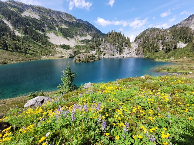
Conglomerate Flats is absolutely beautiful. It’s a wide open meadow at the base of Mount Davis with gorgeous little streams running through it. I really wanted to stay at Conglomerate, especially with my aching foot, but we wanted to push 3km further to save us a bit of time the following day. We had 1 more kilometre of uphill to Palmer’s Pond, which we’d heard was another highlight of the trail (well I’d heard, Carolyn doesn’t pay any attention to these things and had no idea about it).

PSX_20230808_204056
PSX_20230810_230039

My foot problem was in the arch, so the final climb up the side of Mount Davis wasn’t too bad, because I was putting most of my weight on the front of my foot, but it was still a struggle. A struggle that was worth it though because Palmer’s Pond is absolutely gorgeous! It’s a little hanging lake nestled next to Mount Davis with a sheer drop off the side of it. The sun was setting over the mountain, so we hurried down to the lake for the most divine swim of the weekend! The water was clear and pristine and warm and perfect for swimming. It was also great for our aching muscles and we enjoyed a nice little break.

20230723_180155

The trail is all downhill from Palmer’s Pond, so we stumbled down 2kms of trail to Deer Camp, arriving around 7pm, making for a slightly shorter day than Saturday, but still 25.5km and 11 hours of hiking overall. Deer Camp is a lovely campsite too – not as nice as Conglomerate, but still highly recommended. But I was really worried about my foot. I had no idea what was causing the pain – I hoped it was the kind of thing that would be healed overnight, but I had a nagging suspicion that it was a greater kind of injury and wondered if maybe I’d gotten a stress fracture from pushing too far.

Unfortunately, I had limited options, so we made it an early night in hopes of resting up as much as possible for the following day! Stay tuned for the final day in Part III.

PSX_20230810_225402

HBC Trail Backpacking Trip Part I

This is a cautionary tale.

Let’s get that little bit of foreshadowing out of the way and talk about the Hudson’s Bay Company Heritage Trail. It’s a little known trail that traverses through the rugged wilderness north of Manning Park, between Hope and Tulameen. The trail is a remnant from the fur-trading era and was used by both First Nations and settlers alike. The trail is 74km long and traverses mostly through mountain forest, with a few passes through the sub-alpine.

I make it a bit of a hobby to spend lots of time studying maps, which means I have a long list of trails that I want to complete, including the HBC Trail. While I’m hyper organized about my trail selection, Carolyn has a more chaotic energy and appears to just stumble upon trails and become fixated on it until she completes it. I’m not sure where she heard about the HBC Trail (quite possibly it was from me), but she decided she really wanted to do it this year. This got me hyped up to do it as well and I made a few bad choices in my excitement.

20230722_073737

I did a lot of kayaking this Spring and then I went home to Newfoundland for 2 weeks at the end of June, so all of a sudden I found myself in the middle of July and I had yet to do a single backpacking trip. In contrast, Carolyn solo hiked the West Coast Trail and the Juan de Fuca Trail back to back in late June (along with several other trips throughout the month), so she was in peak condition. We only had 3 days in which to do the trail, so I was on the fence about whether or not it was a good idea. 74km in 3 days is a lot of kms per day, and while I did hike that much when I did the Sunshine Coast Trail last year, that was at the end of my backpacking season as opposed to the start. In any case, I figured I’d just suffer through a few long days and then move on to other trails. Poor judgement on my part, but here we are.

So we decided to go for it! But we couldn’t have done it without the help of my generous husband. After work on a Friday in July, we drove my car and Carolyn’s car out to Hope. We left Carolyn’s car in Hope and then Seth proceeded to drive me and Carolyn (and our 2 dogs) all the way to Tulameen for the night. We all camped at Otter Lake and then Seth dropped us off at the trailhead in Tulameen at 7am on Saturday morning. So he basically drove us 4 hours out to Tulameen, just to drive all the way back alone with 2 dogs. He’s a keeper!

PSX_20230730_190101
PSX_20230802_081030

There’s a few more things you should know about the HBC Trail before I continue. Like I said, it’s a relatively unknown trail. It does have its own trail group on facebook, but it’s not a very popular trail. Most of the trail is in the woods with peek-a-boo views, with the exception of ~5km of trail around Palmer Pond. It’s 74km if you’re thru-hiking it, but there are several 4×4 access roads that are used for hikers doing day hikes or those that just want to do a 1 night backpack. Because of the extensive network of 4×4 trails, there are several rec sites that have pull in frontcountry campsites.

The most noteworthy thing about the trail right now is that it’s not in great condition. The flooding in 2021 did a lot of damage and because of the erosion, there’s a lot of trees knocked down along the trail. Volunteers have been out clearing the trails, so we knew some of the middle sections would be clear, but we knew there were other sections where we would have to contend with a lot of blowdown. Here’s my assessment of the trail sections as of July 24, 2023.

Copy of Green simple business model canvas poster - 1

Day 1 was our most ambitious day because we were aiming to go from Tulameen all the way to Blackeye’s Plateau, which is just over 28km and ended up tracking as 30km on my GPS. The trail starts with a river crossing. There are 3 crossings on the trail and the hardest one is Tulameen River. Fortunately for us, it’s been a very dry summer, so we got wet up to our knees, but it was a relatively easy crossing.

Right off the bat we learned that we were going to need to be vigilant with wayfinding on the trail. There’s a big sign showing where to start once you cross the river, but then it’s immediately not obvious where to go. We mostly found the trail by locating the log book, so look for that. As the slower hiker, we opted to have me hike first for most of the trail and be responsible for route finding (looking for signs and markers), while Carolyn would be keeping a close eye on the GPS to keep us on track.

Screenshot_20230815_091350_Gallery

Tulameen to Olivine is particularly confusing because there’s a lot of 4×4 roads running across the trail. You start on the road and we missed the first (and maybe second) turn offs to the trail because we just followed the road without thinking too much. There’s no issue with this if you would like a simpler hike – you won’t have to contend with blowdown and the incline will be more gradual, but be prepared to walk additional distance if you do. When we finally found the trail, we mistakenly went in the wrong direction and ended up back at the road where we’d just been, so we had to undo that mistake and after that we were much more diligent in checking the map.

We both use GaiaGPS for tracking, which served us pretty well, but some of the 4×4 roads are missing from Gaia, so there was definitely an advantage to also carrying a paper map. I had the HBC map, which you can get from the Hope Visitor Centre, and we used it a lot to check on some of the road crossings and water sources, so I definitely recommend getting a copy.

It’s a steady uphill climb to the first campsite at Olivine. I quickly learned that I had not done enough training for this hike and I really struggled on the uphill in the hot sun. It took us about 4 hours to go 9km to Olivine, so that gives you an idea about my pace and after only a few hours I was already severely doubting my ability to do the trail. I toyed with the idea of just doing part of the trail and then hiking back, but Carolyn astutely pointed out that our only vehicle was now in Hope, so I’d better get walking.

20230722_130351
20230722_120414

Olivine Camp is lovely. It’s located at the start of the sub-alpine along the ridge and it gave me really strong Manning Park vibes. There were tons of wildflowers in bloom just past the camp and it has a gorgeous view looking out over the ridgeline. In another life I’d love to stay at this campsite. But all we had time for was a visit to the water source to eat our lunch.

To give you an idea of how hot it was, I drank my entire 2L of water in the first section. Unfortunately, the water source at Olivine is 300m off the trail and it was down to the barest of trickles when we arrived. I think it must be a natural spring though, because it was actually a very clean and cold water source, it just took a while to fill our bladders. We enjoyed an hour long break to have lunch before continuing on towards Lodestone Lake.

I knew that the trail to Olivine had some of the worst blowdown along the entire trail, and it definitely slowed our pace on the way up. There were a lot of awkward sized trees at awkward heights that we had to crawl under or hop over. I was expecting more of the same going to Lodestone, but fortunately the trail was a lot flatter and there was a lot less blowdown, so we made much better time. In fact, aside from a very bad section around Sowaqua River, the section of trail between Tulameen and Olivine had probably the worst blowdown of the entire trip.

20230722_103134
20230724_141015

We almost lost the trail again along a logging road, but Carolyn’s funny feelings kept us on course and we were able to do some light bushwhacking to get back on track. The trail is relatively well marked, but it’s really easy to get off it and we relied a lot more on wayfinding with map and GPS than expected. The trail meanders up and down for a while before it starts a descent to the Tulameen FSR. After the FSR, you climb back up to Lodestone Lake, our second milestone for the day.

We had another setback after reaching the road. I was leading when Carolyn remarked “ewww, look at this!” It was a giant, runny pile of poo in the middle of the trail that I had walked through without realizing and now had shit all over my boots. I was trying to wipe it off on some leaves when I looked up to see a truly massive black bear about 5m away in the bushes, staring at me.

We backed up as safely as possible along the trail to the FSR where we made a lot of noise while gripping our bear spray. It was a really big bear – it didn’t seem interested in us, but it also didn’t seem like it was going to move any time soon, so Carolyn studied the map and remarked that there was an easy bypass along the road for that section of trail. So we continued up the road making lots of noise. Just as we rounded the bend to circle back, we saw the bear coming out of the bushes onto the road. Now this made me nervous because it meant the bear had followed our voices, so it was obviously interested in us. Carolyn gripped my arm tightly and started pushing us back down the road as I gripped my bear spray. The beast climbed out of the bushes, drawing itself up to full height…and…

IT WAS A COW.

20230722_151502

Our big scary bear was a cow the whole time. I walked through cow dung and then it followed my singing through the woods. As soon as the Bear-Cow came up on the road, it was joined by about 10-15 more of its friends and they all stared at us while we started to laugh. Eventually they lost interest and returned to the woods, so I guess some farmers just let their cows roam wild in the wilderness. It was a bit jarring, but generally we were relieved it was a cow and not a bear.

It was a very slow and hot ascent up to Lodestone Lake Rec Site, but overall our pace increased (even with the bear-cow incident). It took us about 3 hours to do the 9.5km between Olivine and Lodestone and we decided to go for a quick swim in the lake before having supper. Lodestone Lake is accessible by 4×4, so it was an extremely busy campsite and it was the only place on the entire trail where we saw other people. We were the only hikers though, as everyone else had driven there. The lake looks nice, but it’s pretty shallow and muddy, so not our favourite swim on the trail, but very refreshing nonetheless.

PSX_20230803_134116

We still had 10km more to go before we were done for the day though, so we tried to be quick leaving Lodestone. I think the only thing that kept me going was that I knew Lodestone to Blackeye’s Plateau was one of the easiest sections of the entire trail. The trail continues along the 4×4 road for 7.5km and it’s entirely flat. So it’s pretty easy walking, but it was also very boring. We passed a lot of off-roaders but didn’t really talk to anyone. Eventually you exit the road and it’s 2.5km of easy walking through meadows to Blackeye’s. By this point I was very much done and ready to crawl into bed.

The last section look us ~2.5 hours and we arrived at 7:30pm, meaning that we’d been hiking for almost 12 hours. My feet were tired and I was getting a little bit of chafing on my thighs, but overall I was relieved to have the hardest day behind me. We were very quick putting up the tent and because of the flies, quick going to bed. We hiked 30km, which is the longest I’ve ever hiked in a single day, and I did it on a backpacking trip (my previous record was 29km on a day hike). I was exhausted, but proud of myself. Sadly I didn’t know what trauma was yet to come.

Is the suspense killing you? Come back next week for Part II!

20230722_195426

Favourite Hikes in Southwestern BC: Part IV

If you’re thinking, “didn’t she just post her 10 favourite hikes last week?” You are correct, I did. But I have a severe backlog of trails to post about, so Part III featured my favourite trails from 2019-2020, while this post focuses on my 2021-2022 era. Part III was my “covid era”, so it featured a lot of trails closer to Vancouver. In my opinion, Part IV has some really scenic hikes because post-covid, all I wanted to do was hike and I discovered some real gems! Check out Part I, Part II, and Part III.

20220716_174404

#10 Hut Lake – Let’s start off with a really obscure hike. The snow pack was insanely high in 2022, which postponed my alpine hiking season. In our desperation to find somewhere low elevation to camp, we stumbled upon Levette and Hut Lake outside Squamish. Levette is well known by the locals, but if you continue past Levette, you’ll eventually come to the much less popular Hut Lake Rec Site. It seems to be mostly used by the 4×4 community, but we had it to ourselves on a weekend in mid-July. The hike is entirely in the forest and it’s not the most memorable lake, but I still had the best time swimming in the insanely warm water and recommend it as a good Spring hike or rainy day trail. (8km, 500m elevation gain, 4 hours)

20220916_094024

#9 Bedwell Lake – Bedwell Lake is a popular trail in Strathcona Provincial Park. It’s located at the back of the park and ease of access can depend on the current state of the road. When we visited, a normal AWD SUV would access it fine, but I’ve heard sometimes you need 4WD or high clearance. Parts of the trail are a bit technical, with some ladder sections, but you’re rewarded with beautiful views of the lake and surrounding mountains. We wanted to continue on to Cream Lake, but unfortunately we got rained out on our visit. I’m keen to return to see it in the sun! (10km, 600m elevation gain, 6 hours)

HOP_6405

#8 Slesse Memorial Trail – There are some real gems in Chilliwack Valley. Slesse is a challenging one to get to as you definitely need 4WD and high clearance. It’s a bit of a somber hike because it’s the location of a plane crash, but it also has gorgeous views of Chilliwack Provincial Park and across the border. With over 1000m of elevation gain, it is a slog to get to the top and the views are relatively limited until the summit. But once you hit the ridgeline, there’s a glacier in front of you and a wall of mountains behind you, so you really get a pay-off. (15km, 1100m elevation gain, 9 hours)

#7 Barnet Trail – One of the things I love about living near Vancouver is that you don’t have to go way into the wilderness to hike and the Barnet Trail on Burnaby Mountain has become one of my favourite semi-urban hikes. We hike here regularly with Sadie and I love the views from Burnaby Mountain Park and through the forest. We always start at Burnaby Mountain Park, and I have to admit, the best view of the hike is at the trailhead, but it’s the perfect hike to get your body moving when you don’t want to drive anywhere or have limited time. (9km, 300m elevation, 3 hours)

20220914_104306

#6 Myra Falls – I debated for a long time about whether to put this on this list or not. At 1.5km, it barely qualifies as a hike and is definitely more of a walk, but it’s such a beautiful waterfall! It’s also located in Strathcona Provincial Park and it’s so beautiful Brandon and I had to visit it twice! It’s an easy walk down to the Falls from the parking lot and then you can explore around the area. Definitely exercise caution as there are some steep sections, but after swimming in the waterfall, Brandon and I hiked down over the rocks to also swim in Buttle Lake. (1.5km, 50m elevation gain, 1 hour)

20211011_121231

#5 Seed Peak – I did this trail in the late Fall of 2021 and even before I finished, I knew I’d have to return some day. There was already snow on the ground when we visited and I was having a rough day physically, so we didn’t even finish the hike, but I was still astounded by the views. Access is a bit tricky for this one as it’s way off the beaten track outside Squamish and I’d recommend 4WD and high clearance. Part of the trail is actually located in the far north end of Pinecone Burke Park (which starts in Coquitlam) and there are gorgeous views of the backcountry everywhere you look. We only made it to the base of Seed Peak, but I definitely need to return for the rest of the hike! (13km, 800m elevation gain, 8 hours)

20220820_132359

#4 Tricouni Meadows – My apologies for including so many 4WD access hikes on this list, this is the last one, but I couldn’t leave it off! Tricouni Meadows is located way up in the wilderness north of Squamish Valley. It’s a slog to get to the trailhead and another slog to get to the lake, but you are rewarded once you get there. There are several lakes at the base of Tricouni Peak and it’s a bit technical travelling between them, but there’s space for several campsites. We visited Pendant Lake (my favourite), Spearpoint Lake, and Reflection Lake. From reflection Lake, you can continue up to the top of Tricouni Peak, which I didn’t do, but would like to return and complete as a backpacking trip. It’s a surprisingly busy campsite for such challenging access, so get there early! (8km, 500m elevation gain, 8 hours)

20220827_123959

#3 Skywalk North – This hike is north of Whistler and better known as Iceberg Lake. It’s a popular hike, but most people only hike to the lake and back. It’s a bit longer, but I recommend turning it into a loop hike by doing with the Skywalk North or South trail. We chose the North Trail, it’s longer, but more scenic. It’s a long hike through the trees, but once you hit the lake, you continue hiking up to another summit above the lake with incredible views looking back. From there you continue through several meadows before arriving at Screaming Cat Lake and returning through the trees. Pay special attention to the trail stats though, this is a rewarding, but challenging hike. (22km, 1200m elevation gain, 10 hours)

HOP_6327

#2 Opal Cone/Mamquam Lake – If you go back to my previous posts, you’ll find Elfin Lakes on my first list. Elfin Lakes remains one of my favourite hikes to this day, but I can finally add Opal Cone and Mamquam Lake to the list! This are both continuation hikes from Elfin Lakes and are not intended to be done in a day. Camp at the lake and do either one or both of these as a day hike. Personally, I like Opal Cone better, which is in peak alpine terrain, but it was rewarding to finally make it to Mamquam Lake after a failed attempt back in 2018. (14-22km, 1000m elevation gain, 9 hours)

20220905_082625

#1 Sunshine Coast Trail – No other trail had any chance of the number one spot with the Sunshine Coast Trail in the mix. I hiked this entire 180km trail in 2022 and I’m in love with every inch of it! You don’t need to hike the whole thing, there are so many highlights on this trail and lots of them are accessible as day hikes or 2-3 day trips. The backcountry huts are what make this trail so special, but my favourite sections include Tin Hat, Walt Hill, Manzanita Bluff, Sarah Point, Appleton Canyon, Inland Lake, Rainy Day Lake, and Fairview Bay – basically the entire trail. (180km, 7-12 days)

Continue on to Part V.