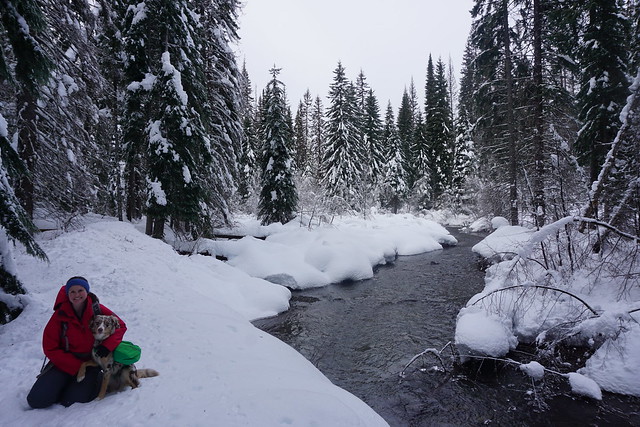
The pandemic has obviously been draining and awful for everyone, but it’s definitely given me an appreciation for all the trails that are still within close driving distance to the city. I love getting away from the city and out into the wilderness, but there’s still a lot of wilderness right at our doorstep.
Metro Vancouver is lucky to have so many regional parks scattered throughout the lower mainland. Minnekhada is one I’ve spent a fair bit of time in over the past year, so I decided to write about it because it has definitely become one of my favourite local parks.
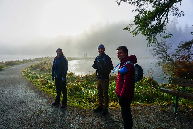
Minnekhada is wedged in the mountains between Coquitlam and PoCo and offers a nice escape from the city. It’s not that large of a park, but the reason I like it so much is for the diversity that you’ll find along the trails. The trail network consists of a figure 8 trail loop around two ponds that are just bursting with wildlife! There are several beaver lodges scattered throughout the ponds and it’s a great place for birdwatching. Metro Vancouver has a lodge at the south end of the park that used to run events pre-covid and has a bird-blind for watching the pond.
You can customize your trail length by either doing one or both of the pond loops. The trail crosses in the middle providing beautiful views of both ponds and the surrounding mountains (actually in reality this is one pond with a dam/causeway trail going across the middle). It seems like most people just do the southern loop, which is shorter, so we often take Sadie dog-walking around the northern loop because she’s still pretty nervous around dogs and strangers and we rarely see anyone there.
The highlight of the trail network though is the hike up to Low Knoll and High Knoll. Low knoll is a small branch off the southern loop to a forested viewpoint looking out over the ponds. High Knoll is known as the “Quarry Rock of Coquitlam” because it’s a steep hike to get up to the rocky outcrop that provides a scenic view of the tri-cities and Pitt-Addington Marsh. The view isn’t quite as stunning as Deep Cove, but in my opinion it’s a shorter and easier trail to the top.
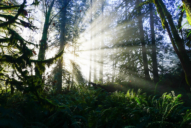
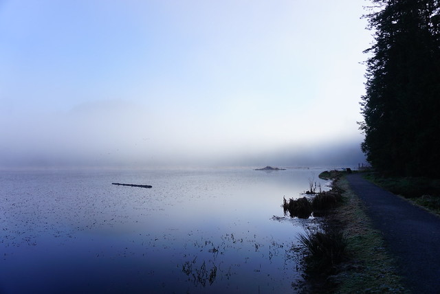
The first time I did High Knoll was a few years ago when I took my parents up there, but more recently I went up on a foggy morning in early December and stumbled upon some of the best views I’ve seen in the park. It was a sunny day, but the fog from the Fraser River was hanging low and had drifted into Coquitlam. It made for some stunning foggy views around the lake, with the sun streaming through the trees in sunbeams. But when we got up to High Knoll, we were treated to the most beautiful inversion. We’d hiked up above the clouds and could see the fog hanging over the city with the skyscrapers just poking up through. Steve treated us to some hot tea while we enjoyed the views.
The shorter loop trail clocks in at around 3.5km, while doing both loops with High and Low Knoll side trails clocks in at around 8km. So you can really customize the trip however you want. However, Minnekhada is also well known for bears, so you should always practice bear safety when walking in the area. We went on an unfortunate hike in October where we ran into either 2 bears, or the same bear twice (we’re not sure). We first encountered it near the Low Knoll trail and it wondered off when we started making noise, but as we continued around the north loop trail, we encountered it again, but this time it did not leave us alone. It didn’t seem like an aggressive bear, but it was definitely curious about us and did not move on when we started making noise (nor was it deterred by our pre-emptive bear calls, which we’d been doing since the first encounter). We ended up abandoning the loop and backtracking and it didn’t follow us, but it did make me really nervous and I’d been arming myself with rocks in case in pursued us. There are bears all throughout the park, but we felt more vulnerable on the North loop because there are less people.
Anyways, don’t be deterred by the bears, just hike with a friend and bring a horn with you, especially in late fall when the bears are bulking up for hibernation. That’s the only time I’ve ever seen them and I’ve been there a half dozen times. Overall, I think it’s a beautiful, under-rated park and I’d definitely recommend checking it out!
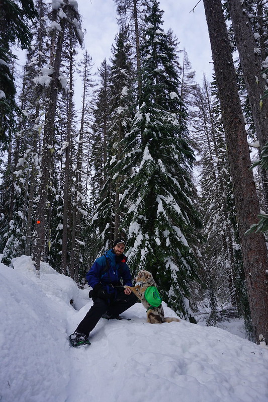
This will be the final post in my Manning Park snowshoe series (for now). To date I’ve only explored the beginner trails, but now that I have avalanche safety training I’m hoping to venture further out in upcoming years. I go out to Manning Park a lot, sometimes camping and sometimes just for the day, but on this occasion Seth and I decided to rent a little airbnb log cabin in the Sunshine Valley for a weekend. The cabin was really quaint – it had a woodstove, which made it feel really cozy, and no cell service or wifi, so it was truly a proper forest getaway.
We drove out on Friday night and then continued in to Manning Park on Saturday morning to go snowshoeing. We’d planned to do the Skagit River trail, but as it’s located right at the start of the park, and at a lower elevation, so it often won’t have fresh snow. On this occasion it didn’t, so we decided to save it for another day and continued on towards the resort to hike the Similkameen River Trail.
This trailhead starts just past the resort and is the same as the Windy Joe trail. You can park along the road just after the bridge and hike in along the river. Unfortunately we didn’t get the best conditions for it, the weather was good, but it was right after a wind storm, so there were a lot of fallen trees that we had to climb over and a lot of debris cluttering up the trail. Otherwise it was really nice though and I would love to go back and do it again.
We followed the trail along the river past the turn-off for Windy Joe. After that, there’s another trail branch and it looks like you can cross the river and loop back on the other side of the river. This is what we decided to do, but I’d advise you to just turn around and go back the same way because the trail on the other side of the river is the nordic ski trail and snowshoers aren’t permitted on this trail.
Before doing that though, we continued further along the river trail to extend the time (it’s pretty short if you just go to the branch and turn around). If you’re keen, you can hike it all the way to the Monument 78/83 trailhead, but this is a bit of a roundabout route that would leave you having to hike back the highway, so I recommend just turning around whenever you feel you’ve gone far enough. We probably continued on for about a kilometre before stopping for lunch by the river. The Windy Joe lookout would likely also make for a fun day, but I think you may need avalanche gear for this trail, so proceed with caution.
The Similkameen River also continues in the other direction from the trailhead and can be hiked in the resort snowshoe area as well, you just need to buy a trail pass for $10 at the resort to use that trail. There’s almost no elevation along the trail, so it’s great for beginners, and even with all the windfall, we still had a lot of fun exploring the trail! Definitely recommend!
I had one of the best backpacking trips to close out the season this year. I wanted to try and get one more overnight trip in the fall and planned a mid-September hike with Carolyn and our friend Tiiu, who is looking to get more into backpacking. We bounced around a few ideas for hikes and decided on the Rainbow Lake trail in Whistler. You can’t actually camp at Rainbow Lake because it’s the Whistler water supply, but you can camp a few kilometres further at Hanging Lake, so that was the plan.
This was one of those trips where nothing seemed to go right. It was super, don’t-go-outside-you’ll-kill-your-lungs, smoky in Vancouver the week before the hike from the fires in the States, so we decided not to go. Which we regretted a little because the smoke did end of clearing out the night before we were supposed to go, so we probably could have gone, but it was too late to change plans. So we rescheduled for the first weekend in October.
Again, the smoke started to come back the week before the hike, but it was much lower on the air quality index than the last time, so we decided to go for it anyways. Otherwise, the forecast was great and it was a cloudless sunny day when we left Vancouver. We got to the trailhead and there was a sign saying that the trail was closed because of a bear, but then underneath the sign it said “trails above flank closed, trails below open”. As non-Whistler locals this had absolutely no meaning to us and we spent forever studying the map trying to find the Flank trail and determine what “above” meant (North? physically above on the map? what?). Eventually we decided that Rainbow Lake was below what looked like a flank trail junction and decided to hike up to the junction and see if there was more clear info.
It was a bit less than a kilometre to the junction, where we found the same sign, which was no more clear than the first. However, in this case, there were two trail branches and it was located closer to the Rainbow branch, so we thought that likely meant it applied to Rainbow as well. We couldn’t get a hold of anyone at Whistler Municipality on the phone (they manage the area), so we decided not to risk it and go back. There was a conservation officer at the car park when we returned and it turns out the trail was closed, so we made the right decision and had a good conversation with her about how the sign could maybe be more clear, so hopefully they improve it for future users. She was very nice and gave us some alternative trails to consider instead.
It’s not mine and Carolyn’s first time having to make last minute adjustments to our plans (see our first snow camping adventure), so we decided to head south on the Sea to Sky highway while I looked up some other trails. We agreed Brew Lake sounded like a good alternative and made for the trailhead.
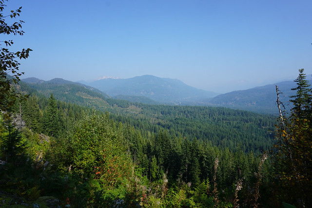
Brew Lake is a lower trafficked trail near Callaghan Valley, just across the highway from Brandywine Falls. Information on trail length is a bit confusing. According to AllTrails, it’s a 17km trail that’s partially on forestry road and partially on trail. According to my “105 Hikes” trailbook, it’s an 8km trail at the end of a 2WD service road. After doing a bit more research, I’ve seen it listed as several different lengths, so I think everyone just disagrees on what parts of the service road are really driveable.
The entrance to the forestry road is right next to the Whistler RV park, it’s so narrow we legitimately didn’t see it on our first drive by, so we decided to just park there and walk it. We figured we’d had enough setbacks for one day and didn’t want to get Carolyn’s SUV stuck down there. Having now walked it, I’d say that about 3km are drivable and after that you can make a decision about how far you’re willing to take your vehicle. We passed about 5 other cars at various intervals of the trail, so that seemed to be the common approach.
After an easy 5km along the road, we reached the forest trailhead. It was a very hot day, though still a little smoky. The only people we saw on the road were a family of ATVers, so it seemed that the trail wouldn’t be too busy. Since we’d had a late start from Rainbow Lake, we decided to have lunch soon after we reached the forest. We just picked a little rocky outcropping and settled in for a break.
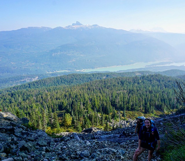
Because we’d followed the AllTrails route, we had about 17km of hiking and 1000 metres of elevation gain, however, our GPS clocked it at 18km and 950m, so somewhere around there. We’d done 5km in just over an hour, but only 200m in elevation gain, so we figured we had a pretty steep hike ahead of us. The next 2 kilometres meanders through some really interesting topography in the woods. It’s quite unlike any other hikes I’ve done in the area and reminded us a bit of hiking on Vancouver Island because it was all through the woods with lots of small hills and valleys. But it still wasn’t that steep and we were wondering when we would finally hit the major elevation gain.
Turns out most of the elevation gain is in the last 2 kilometres. You hit a giant boulder field that proved to be a bit confusing. The whole trail is pretty well marked, but you definitely have to watch for the markers because the trail itself is not super obvious. We got a little off course in the boulder field – we missed the marker that indicated the trail goes up the edge of the field and instead started hiking up into it. The boulders are REALLY large, so it’s not conducive to hiking over it. Eventually we found our way back to the trail along the edge and went from there.
Around this section we passed a few day hikers on their way down. They (mistakenly) told us once we finished the boulder field we were pretty much done, so we were very excited. It’s definitely steep though and after you finally get across it, there’s an even steeper rope section up a hill side that we had to take one at a time. After that we figured we should be almost there based on what the other hikers had said, but it really didn’t look that way on my GPS and we had to trundle along through several more uphill sections after that, much to our disappointment.
Because of the trail mix-up, it was turning into a pretty long day and we were all ready to get to the campsite. It was around 4pm and we thought we’d finally reached the last peak, only to crest it and see another peak we’d have to climb before maybe reaching the end. I was starting to get a little discouraged at this point, but the moment we finally crested the last peak and the view opened up, all the other thoughts melted away and I was super pumped to be there.
The trail is really all in the forest, so it’s a little weird when you finally pop out of the woods to this completely open alpine lake, surrounded by meadows and low mountain peaks. From the lake you can continue up to Brew Mountain, where there’s a hut, but fortunately our plan was to end at the lake.
I LOVE swimming and I’d really been hoping to go for a swim in the lake, but I didn’t dare voice the desire out loud for fear it would be too late or too cold when we arrived. But it had been a super hot day and the sun was still up over the lake when we arrived, so it took barely more than a look between me and Carolyn to agree we were going in the water (she loves swimming just as much). We could tell the sun was soon going to dip below the mountains, so we didn’t waste any time in setting up camp or anything first. When you swim so late in the season you really have to do it right away, before your body adjusts to the temperature and cools off. So we stripped down and were in the water within minutes. We had the real privilege of having the lake completely to ourselves, so we decided to enjoy it in our birthday suits, an rare opportunity in BC, where the backcountry is usually so busy.
After that we made camp pretty fast. Daylight is so much more limited in October, so we got the tents up and then I started making dinner while Carolyn and Tiiu got to work on a bear cache. We were alone in grizzly bear country, so it was pretty important, though a real challenge with not that many trees around. They were successful, but I am starting to think it may soon be time to invest in a bear canister.
We had my dehydrated chickpea curry for dinner and Tiiu had some chocolates and rye to share, while Carolyn had brought a little dessert surprise. It was a freeze dried ice cream sandwich! I’m not sure where she got it, but it was definitely one of the more bizarre treats I’d had on a camping trip. The whole thing becomes this kind of brittle, almost spongey-chalky type texture, but once you chew it, it really does have all the flavours of an ice-cream sandwich. I don’t know how astronauts stand eating so much of that stuff, but it made for a fun experiment for us.
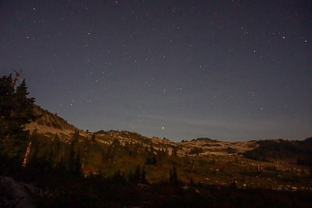
We didn’t stay up too late, but since the sun sets a lot earlier now I did stay up and take a few star photos, not my best photos, but still fun to play around with the camera. It was no where near as cold as I was anticipating and I was quite comfortable hanging around outside. I had hiked Frosty Mountain the week before and it had been FREEZING, so I’d come a little over prepared for Brew Lake since we were having much nicer weather. I never bothered with my sleeping bag liner that I’d brought and Carolyn had just bought a new -18 degree bag, so we were toasty warm in her tent. However we forgot to open the vents and I’ve never seen a tent so covered in dew in the morning. Although to be fair, everything was covered in a crazy amount of dew. Must be the season.
Unfortunately, it clouded over in the night and it did drizzle on us a little when we were making breakfast, but not enough to really cause any trouble and the sun did eventually poke through the clouds. It felt mystical with the fog clinging to the tops of the surrounding mountains, but it was clear near the lake.
We took down our tents and said goodbye to Brew Lake, which had been extremely good to us considering the circumstances. As soon as we left the lake though we descended straight into the fog and didn’t catch anymore views the rest of the trip. It was a cooler day than the previous day, but still super humid, so even though it was all downhill, we were sweating a lot. Brew Lake is definitely one of those trails that’s harder on the downhill, so we were pretty cautious as we came back down the boulder field. Always leave space between yourselves on scree as its easy to knock rocks down on your friends.
We finally popped back out of the woods and then had a long walk back along the forestry road. It drizzled on and off, but not enough to warrant digging out our rain coats. Finally we made it back to the car and as soon as we got back on the highway, the rain started for real, so we were pleased with our timing! We decided to finish off the weekend with a trip to the new cider place in Squamish, Geo Cider, where we each enjoyed a flight and some pizzas!
So overall, it was not at all the weekend we’d planned, but I wouldn’t change anything about it because we had such a great time!