In addition to my series on the East Coast Trail, I’ve also been writing about the Rockcut Trail, both located in Newfoundland. For those new to my blog, I grew up in Newfoundland and spent the first 23 years of my life there. I’ve explored most of the 300km long East Coast Trail by section hiking (I just have 3 left) from St. John’s, where my parents live. My Nan lives in Twillingate, which is a beautiful island on the central north part of the (big) island. It’s accessible by causeway and is popular among tourists for whale watching and iceberg hunting. They recently re-branded all the trails on Twillingate Island as the Rockcut Trail and have been improving them, so I’ve been trying to hike them all. See my other posts on Little Harbour and Top of Twillingate.
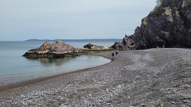
In Summer 2024, I visited with my sister, Emily, and my friend Brandon, who came all the way from BC to explore Newfoundland! Our biggest priority was to go fishing (which we were able to do twice) and visit with Nan, but we managed to find a bit of time to hike Codjacks Cove. This trail is located on the northeast side of the South Island and leaves out of Durrell. Drive down Horwood Lane to find a small parking lot. The road continues on from there, so if you take the left branch (the right branch goes to the dump), you can drive a bit further, but it was a nice day, so we just walked it.
Once you hit the coast, there’s a wooden staircase that heads down to Codjacks Cove and you can hang out on the beach. There is a single tent pad at the back of the beach that is newly installed if you feel like camping out! The trail is an out-and-back, so we skipped the beach on the way in and continued along the trail. The trail goes through the woods and along the rocky coastline of Gunning Head, with beautiful ocean views wherever you look! The trail supposedly continues all the way on the Little Harbour, as they’ve been working to connect all the trails into one longer thru-hike, but we just hiked for ~3km before turning around and heading back, since we only had one car.
We had a beautiful day for it, though it was windy of course! We stopped into the beach on the way back and I went for a little skinny dip by myself because Emily and Brandon were too chicken to participate! Well, Brandon was too chicken, Emily just didn’t want to. Like every trail on the island, it’s very beautiful. They’re all pretty similar, so you really can’t choose wrong. You can read more about the other sections of the Rockcut Trail on their website. I only have one section of trail left to explore in Purcell’s Harbour, but it’s been many years since I’ve done some of the other sections, so I plan to re-do them before writing about them. Twillingate is really special to my entire family and I feel lucky to call a little slice of this island home.
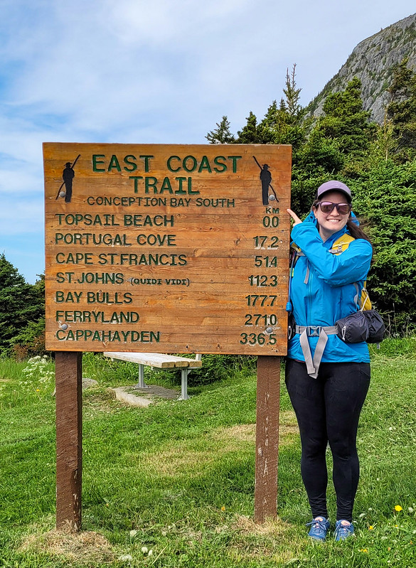
Long Shore Path is an interesting section to write about. There’s currently 3 trails on the northwest side of the Avalon peninsula between Topsail and St. Francis: Long Shore, Piccos Ridge, and White Horse. All 3 trails have been around for a while, but only officially opened in the Spring of 2022. I’ve already done Piccos Ridge, and White Horse has a reputation as a challenging trail, so I decided to tackle Long Shore Path while I was home in June.
It’s an interesting section of trail because it’s technically the start of the East Coast Trail. The trail is always changing and evolving, so it may not stay this way forever, but it currently runs north from Long Shore Trail to Cape St. Francis at the far north peak of the peninsula, where it then turns south all the way to Cappahayden.
The reason I say that Long Shore is interesting is because it’s marked as a 17km long section of trail, but there’s ~4km of road walking in the middle of it. Typically sections of road this long aren’t included in the trail sections (though I believe they are included in the overall length of the ECT, as you would have to walk all the road sections if you did it as a true thru-hike). I find it a bit odd that they decided to include so much road walking in Long Shore Path instead of just breaking it into 2 sections. I didn’t want to do 4km of walking along the road, so I opted to do the trail in 2 sections over 2 days. So I guess I technically haven’t done the entire thing, but I’m going to count it as close enough.
I did the first section in late afternoon with Emily after she got off work one day. We drove out to Topsail Beach and hiked the first 4km of coastline to St. Thomas and back for a total of 8km. The trail starts right at the beach in Topsail Rotary Park and is primarily through the woods the entire way. Generally I don’t love long wooded sections, but I didn’t mind this part because it’s pretty sparse forest and you can still see the coast through the trees. The trail is a little bit technical, with tree roots and rocks, and undulates up and down.
When you get to the end of the trail, you can take a left to walk down Lorry Road to the beach at St. Thomas. It’s a quiet and lovely beach that I’d never been to before and it makes for a nice end destination. It was overcast when we started the hike, but we sat on the beach for a while as the sun started to break up the clouds. It took us about an hour to hike the 4km and we had a few snacks before turning around to hike back. The sun properly came out on our return, which really brightened up the trail.
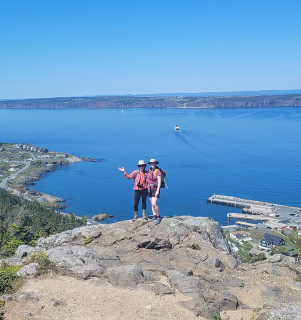
The following day I returned with Seth and his parents to hike the rest of the trail. After St. Thomas is the 4km of road walking to St. Philips Beach, followed by another 9km of hiking to Portugal Cove. We parked one car in St. Philips and then started from the trailhead in Portugal Cove to hike backwards. The first part of the trail out of Portugal Cove is another odd section because it doesn’t actually follow the coastline at all. Instead, you hike up behind Portugal Cove to a series of lookouts along the bluffs. It doesn’t feel very East-Coast-Trail-like, but it’s beautiful nonetheless.
It’s about 225m of elevation gain to the top – we didn’t find it too challenging, but if you don’t like climbing you may want to take your time. There are some excellent views of Bell Island from the top as you hike along the bare rock before descending to Beachy Cove. The descent isn’t very nice as you go through a huge section of blowdown, with tons of knocked over and destroyed trees. It’s not hard to follow the trail as the debris has been cleared, it’s just not very scenic. Once you reach the bottom, you hike out along an ATV road and then swing left on the road for a few hundred metres before turning right to go down to Beachy Cove.
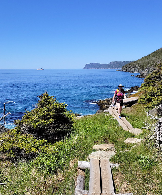
Beachy Cove is easily accessible from the road, but it’s another beach I’d never been to that is really lovely. There’s a big waterfall flowing down to the ocean and the river can be a bit challenging to cross when the flow is heavy, but if you’re able, there’s a picnic table on the other side where we stopped for lunch. To get to Beachy Cove was ~6km, then there’s another ~3km along the coast to get back to St. Philips. This section is very similar to the 4km between Topsail and St. Thomas in that it’s mostly in the trees and undulates up and down (though I’d say it’s more challenging than the Topsail section).
The only tricky part of this trail is when you reach Goat Cove. There’s a creek flowing down to a small pocket beach, so you have to descend down a sketchy rope section to the beach. From what I’ve heard, there used to be ropes on both sides of the beach, but there are stairs on one side now, so I wouldn’t be surprised if a second set of stairs is added in the near future, which would make this trail much more accessible. As it is now, it is a particularly long rope section that is manageable, but not easy. I’d recommend bringing gloves for the rope and taking your time.
We didn’t have quite enough water for the entire hike, but fortunately I’d brought my water filter, so we filled up with fresh cold water before continuing on. The rest of the trail isn’t particularly difficult and we enjoyed the glimpses of sun through the trees while still enjoying the shade.
So it’s a bit of a complicated trail with so many sections. I’d definitely recommend doing it in 2 sections to skip the road walk, but if you wanted, you could even do it in 3 sections as return hikes, which is what Emily ended up doing. I didn’t expect to like it as much as I did with so many forest sections, but it’s actually quite scenic (especially the views from the hill in Portugal Cove) and I loved hiking to all the little beaches along the way. Whether done as 1 long trail or several sections, it makes for a really nice hike.
I recently made my annual summer trip home to Newfoundland for 10 days in early June and had the best time exploring some new trails! I wasn’t thrilled about going home in June because it’s not the nicest weather in Newfoundland at that time, but I ended up having to eat my words because I had really good luck while I was home! I got such fine weather I ended up doing 55km worth of hikes in just 7 days – the first of which was Chance Cove Coastal Trail.
Chance Cove is located about an hour and half outside of St. John’s on the far end of the Avalon peninsula on the isthmus. Chance Cove has definitely been trending on Newfoundland social media throughout the pandemic and I was starting to feel like everyone I knew on the island had been there over the past year. It looks incredibly scenic in photos, so I admit to being drawn to this hike by Instagram and I was determined to check it out for myself.
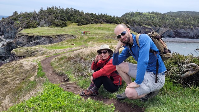
We got nice weather on our first weekend home and I convinced both mine and Seth’s families to do the hike with us. It’s only ~4km round trip and is fairly easy terrain, but it’s so scenic it ended up taking us 2.5 hours to do the whole thing!
What makes this hike especially nice is that it’s a double loop hike (kind of like a figure 8), so you get different topography along the entire hike. We started by climbing up into the woods until we reached Chance Cove Beach, which extends across the cove to the main road, then we switched back to the coastal route up towards Green Head. It was overcast and extremely windy when we started, with Green Head being the most blustery part of the trail. We hiked up to the head, but didn’t stay long because it was so cold, though it was cool to watch the wind swirl erratic patterns through the water.
From Green Head, you continue along the headland past Chance Cove Island to Island Cove Beach, where fortunately, the headland shelters you from the worst of the wind. There’s a newly constructed set of stairs going down to Island Cove Beach, so we took a long break on the beach to eat our snacks and enjoy the warmer (less windy) weather. As we continued on, the clouds started breaking up and pretty soon the sun was shining down on us!
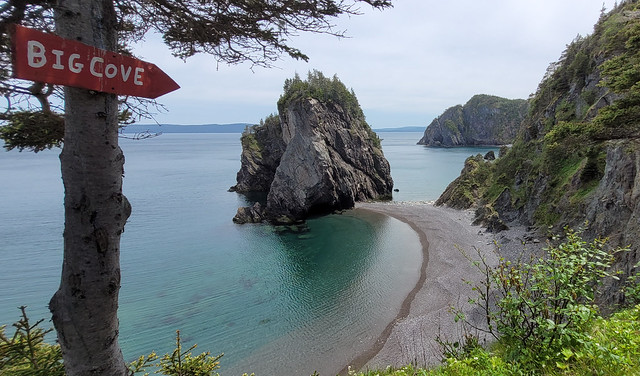
The next attraction is Patrick’s Cove (also known as Big Cove), but first you can hike up to a series of viewpoints between the two coves. With the sun shining, it completely transforms the landscape and the water turned the most vibrant shade of blue! You could almost be tricked into thinking you were somewhere tropical, if not for the wind.
You can also hike down to Big Cove, which has a huge sea stack that is centered in most of the photos I’ve seen on social media. Unfortunately, there are no stairs going to Big Cove, just a large rope guiding you down the bank. I really wanted to see it, so I climbed down, but it’s still really steep and not for the faint of heart. The rope is positioned pretty awkwardly and some of my family members had some trouble, so I wouldn’t go down there if you’re not confident in your abilities. Definitely use caution.
If you do decide to climb down to beach, it is very lovely and would make a great place for a swim. Me and Emily toyed briefly with the idea of going for a dip, but we didn’t have swimsuits and it was a bit too breezy to air dry. We opted instead to wade out up to our knees. It wasn’t quite as cold as I was expecting at first, but it quickly starts to numb your feet and I had to stumble back to the beach to defrost!
From there we hiked back up the bank to get what I’d call the “money shot” of the hike. A view from above of the curved beach and sea stack. It was no longer sunny when we got there, but no less scenic! After that it’s a pretty easy walk back to the parking lot. There’s a small climb and then you head back down towards Chance Cove. You can cross the beach if you prefer, but given the wind, we decided to just hike back along the water instead.
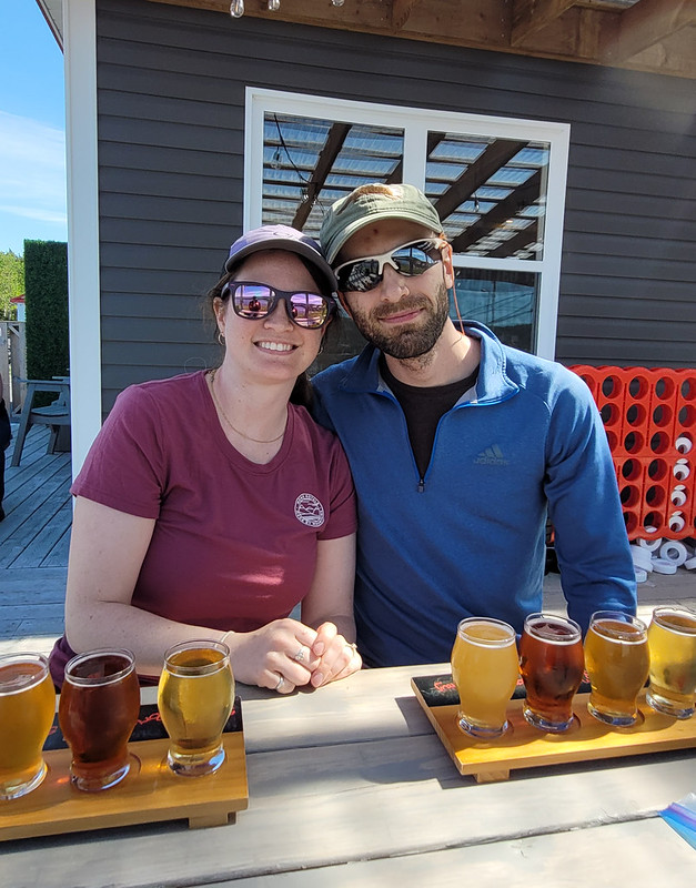
We concluded our day with a visit to Baccalieu Trail Brewing Co. in Bay Roberts to sample some of their beer and “legendary” cod chowder. The sun returned while we sipped our beers on the patio and we congratulated ourselves on a very successful day. Chance Cove Coastal Trail definitely lives up to the hype and I would recommend it to pretty much anyone. Use caution if climbing down to the beach, but otherwise it’s a fairly easy hike that’s great for beginners! We had a great time.