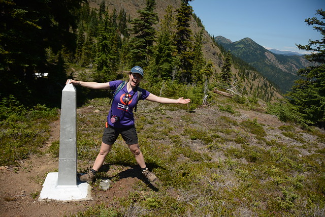
Now that I’ve finished my Manning Park mini-series, I decided to write about my first backpacking trip to Elfin Lakes. I’ve hiked to Elfin Lakes 4 times and camped there 3 times, but my first trip stands out as my favourite trip up to the lakes.
It was the Labour Day long weekend in 2017. I really wanted to do a fun backpacking trip for the whole weekend, but everyone seemed to have other weekend plans and no one would commit to hike up there with me for 3 days. To this day, I’m not really sure how I managed it, but somehow I convinced Brandon, Karen, and Grant to rotate up there with me. Karen is my oldest friend – she likes coming on day hikes with me and has done some backpacking in the past, but is a little more nervous about venturing into the backcountry. But Grant was enthusiastic about it, so I convinced the two of the them to hike up with me and stay for Saturday night. I have tons of extra gear, so Karen agreed to borrow some and give it a try. I still can’t quite believe I got them to come up with me, but they did and we had a great time!

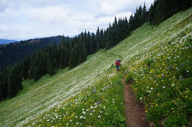
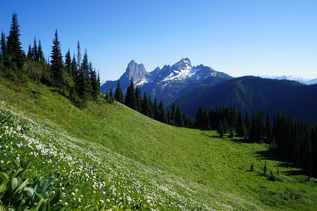
Before we left, I desperately wanted them to have a good time so they’d come out again with me in the future, so I loaded my pack up pretty heavy, gave Grant the pot and stove, and pretty much left Karen to just carry her personal gear. It’s an 11km hike up to Elfin Lakes, which is definitely a bit on the longer side for some hikes. The elevation gain is pretty reasonable spread over the 11km, but it is still a steady climb for most of the trail and it was a really hot day. The first part of the trail is 5km along an old service road. It’s not the most scenic, so it can be a bit of a slog to hike over. But everyone survived and we stopped for lunch at the Heather Hut.
From there things got fun. We continued on along the rest of the trail, which is incredibly scenic as it travels further into Garibaldi Park. Karen was pretty beat out towards the end, but she still did the whole hike no problem! So Karen, please remember, you are your own worst critic when it comes to outdoor activities and you are awesome. Pretty please come backpacking with me again some day!

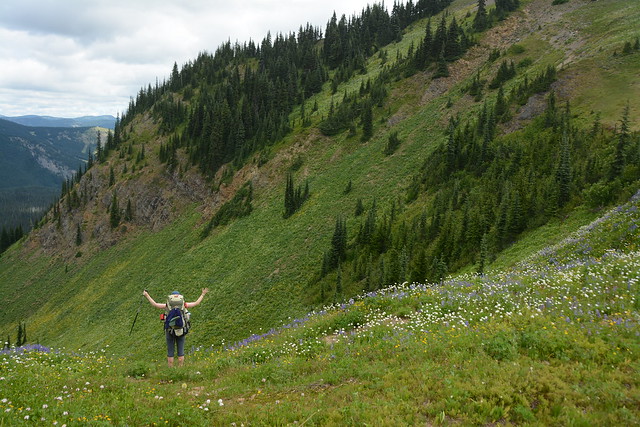
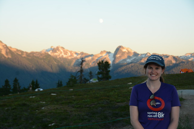
Elfin Lakes has one of my favourite campgrounds, which is probably why I keep going back. I’ve camped there 3 times, but I’ve still yet to sleep in the hut. There’s 50 tent pads running along the hillside meadow and they provide a truly epic view out towards the rest of the park and the surrounding mountains. We set up my 3 person tent, which was definitely cozy for 3 people, and dipped into Karen’s massive snack stash. She had every kind of snack you can imagine, so long as it had chocolate. Her trail mix was basically just a chocolate smorgasbord with the occasional nut thrown in – not a bad decision in my opinion!
We wasted away the afternoon lounging on the tent pad and went for a swim in the lake. Elfin Lakes is completely fed by snowmelt and rainwater, but it’s pretty shallow, so by the end of August, it was actually really warm. I made fettucine alfredo for dinner because it is Karen’s favourite meal – I had to use powdered milk, but it actually turned out surprisingly well! It’s the only time I’ve gotten to make it in the backcountry because Emily and Carolyn don’t like dairy and Brandon always makes thai curry chicken. We enjoyed watching the sun set over the mountains and looking at all the stars that came out on what was an awesome cloudless night. I tried to convince Karen that we should sleep with the fly off to look at the stars, but she was worried about getting cold, so we left it on and did our best to get some sleep with 3 people crammed in the tent.

The downside of leaving the fly on is that it creates a bit of a greenhouse effect when the sun does finally peak over the mountains in the morning. So it got pretty hot in the tent pretty fast, which was successful in getting us out of bed in the morning. The plan for Sunday was for Karen and Grant to pack up and head back down to the car and for Brandon to drive out early that morning and meet me at the lake for noon. Karen and Grant had an even easier hike out because Karen got to leave some of her borrowed sleeping gear behind for Brandon so that he could hike up faster and Grant got to leave the cookware behind. So with his sleeping pad, tent, and all the cooking supplies already at the campsite, Brandon had a pretty empty pack on the way up. I had just told him he had to bring up our supper.
Karen and Grant expected to see Brandon on the way down, but they must have missed him when they took a break in the Heather Hut, because they never did see each other. Brandon had a late start leaving Vancouver, but he somehow hiked up the entire trail in just 2 hours and still met me right at noon at the lake! I had a very lazy morning, went for another swim and did some reading while I waited for Brandon. I made lunch in time for his arrival and we quickly ate our wraps and hit the trail again for a day hike.
Brandon is truly a machine. He hiked 11km that morning just so he could meet me to continue hiking. We both really wanted to go to Mamquam Lake – admittedly, noon was a bit late to be leaving for Mamquam, which is another 22km round trip from Elfin lakes, but we decided to try it anyways and set off with a good spring in our step.
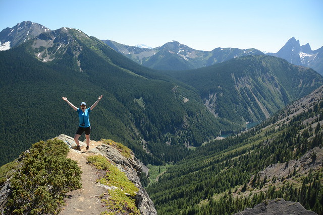
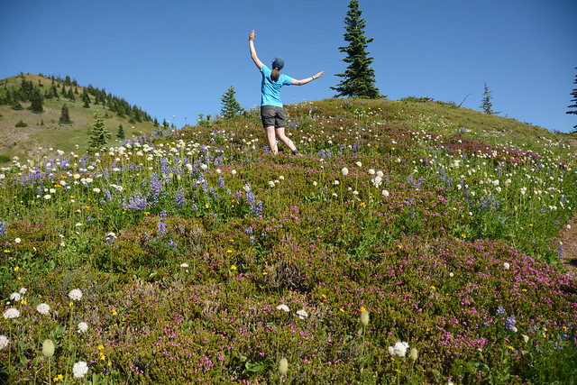
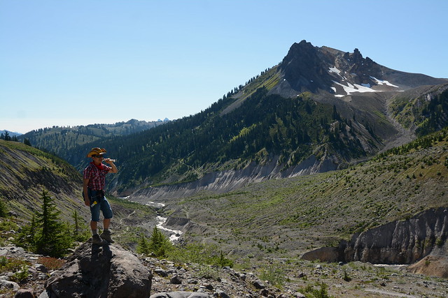
Unsurprisingly, we never made it to Mamquam. It’s usually cooler in the mountains and it was the first weekend in September, so we weren’t expecting such hot weather. It ended up being somewhere between 30-35 degrees during the afternoon. That’s too hot for hiking on any day, but it felt even worse on the trail to Mamquam, which is extremely dry and dusty and is completely open. There’s no shade to be found anywhere on the trail and as we started to climb up the switchbacks on our way up Opal Cone, it was pretty exhausting. It’s still a beautiful hike, but we felt pretty small as we crawled our way up and around the cone.

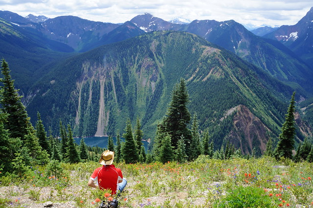
After Opal Cone, you descend down into a bit of a crater. There’s a small lake from melting snow, but it feels a bit other worldly as you walk across all that barreness. We continued walking across the sweltering alpine desert, but when we reached a sign that said it was still 4km to Mamquam Lake, we finally decided to admit defeat. I’m sure Brandon would have continued on – lots of times he encourages me to push myself further on the hikes we do – but sometimes he also needs for me to be the voice of reason. 4km didn’t sound like that much more, but with the round trip it would be another 8km. If we turned around now, it would still be a 27km hiking day for Brandon and 16km for me. At the time I was breaking in a new pair of backpacking boots and I feared we’d just be getting ourselves into trouble to push forward in the blinding heat. Plus I really wanted to swim in the lakes once more and if we kept going it would be too late by the time we got back – though in retrospect, I could also have swam in Mamquam.

Anyways, we decided to call it there, took a break to have some snacks, and then turned back. My only regret is that we went straight back and never finished Opal Cone by going up the short side trail to the summit. So I definitely still need to go back some day and go the whole way to Mamquam.
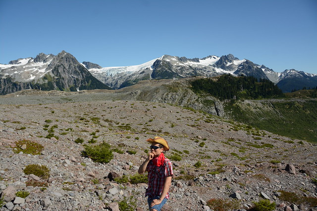
We had a bit of a debacle on the way back though. We were hiking around the edge of the cone heading back towards the switchbacks when Brandon decided it was time for a pee break. I continued on along the trail to give him some privacy, but when I reached the end of the first switchback, I decided to wait for him. It was still a pretty busy day on the trail, so I waited at the end of the switchback while people passed me. After a while I started to wonder what was taking so long and where Brandon was. I’d been waiting around for the better part of 15-20 minutes and he hadn’t shown up. Brandon always hikes in a cowboy hat and bandana, so he’s pretty easy to recognize on the trail. So I started asking everyone coming down if they’d passed an Asian cowboy at any point in the last 10 minutes and consistently got the answer no. I’m a bit high strung on a good day, so this was when I started to panic a little bit.
It’s a pretty steep trail, so I was worried that with so many people on the trail, Brandon had tried to go too far into the trees and had fallen. I headed back the direction I’d just come, calling for him and trying to listen for his whistle. I walked all the way back to where he’d stopped to pee and there was no sign of him, which was when I really started to panic. At this point we were like 18km into the wilderness and I had no way to call for help. I started heading back towards the switchbacks again and as I passed people coming up, I finally got some answers.
Turns out when he was trying to catch up with me, Brandon found a little shortcut past the first switchback and while I’d been waiting for him at the first switchback, he’d been further down waiting for me at the second switchback. When the people I’d talked to saw him as they continued down, they immediately recognized his cowboy hat and told him I was further back looking for him. He started climbing back up to me at the same time I turned back to go look for him and when I finally switched directions again, I had someone stop me and reassure me that my “cowboy” was fine and he was coming back up for me. We were soon reunited, but it ended up being about a half hour that we were separated and it really struck home how easy it is to get in trouble in the backcountry. One little misunderstanding resulted in a lot of confusion for both of us. So we agreed no more shortcuts in the future unless we attempt them together.
We made it back to the campsite shortly before 5pm and had just enough time to go for a dip in the lake before it started to cool off again. It felt great to wash all the dust and sweat off after a long day of hiking in the dry sun. Brandon made his infamous thai chicken curry and we ate while watching the sun set over the mountain. We were a bit giddy after our long day of hiking, so we decided to stay up and take star photos. I’ve mentioned before that I prefer taking photos on my camera to my cell phone and since 2012 I’ve been using a Sony compact system camera. When I bought it in 2012, there weren’t very few mirrorless cameras on the market, but I picked it because it was kind of like owning a lightweight DSLR camera. Now Brandon actually has a DSLR and I would never debate that his takes better photos than my mirrorless, but I’ve generally been satisfied with my Sony.
At the time though, I’d broken my camera just a few weeks earlier when I was hiking in Newfoundland (banged it off one too many rocks), so I didn’t have any camera (hence the dicey quality of the first few pictures in this post – the rest are credited to Brandon). But I was anxious to learn about star photos, so we messed around for a few hours with Brandon’s camera. It was another cloudless night of course, so it wasn’t hard to convince Brandon to sleep with the fly off. That was my first time sleeping with the fly off – I’ve done it several times since then, but Elfin Lakes is still my favourite. So we fell asleep gazing at the stars and ended up sleeping quite late in the morning without the ‘fly sauna’ to wake us up when the sun came up.

By the time we did crawl out of our tent, half of the tent pads had emptied and people had already packed up and left. We took our time over breakfast and packing up our gear before finally leaving to hike back down. We split the gear evenly on the way back, so it was a much easier hike than on the way up. We hiked down pretty fast and were relieved when we could finally jump in Brandon’s 4Runner and blast the AC for the rest of the car ride home!