ECT Series: Long Shore Path

Long Shore Path is an interesting section to write about. There’s currently 3 trails on the northwest side of the Avalon peninsula between Topsail and St. Francis: Long Shore, Piccos Ridge, and White Horse. All 3 trails have been around for a while, but only officially opened in the Spring of 2022. I’ve already done Piccos Ridge, and White Horse has a reputation as a challenging trail, so I decided to tackle Long Shore Path while I was home in June.

It’s an interesting section of trail because it’s technically the start of the East Coast Trail. The trail is always changing and evolving, so it may not stay this way forever, but it currently runs north from Long Shore Trail to Cape St. Francis at the far north peak of the peninsula, where it then turns south all the way to Cappahayden.

PSX_20220622_081000

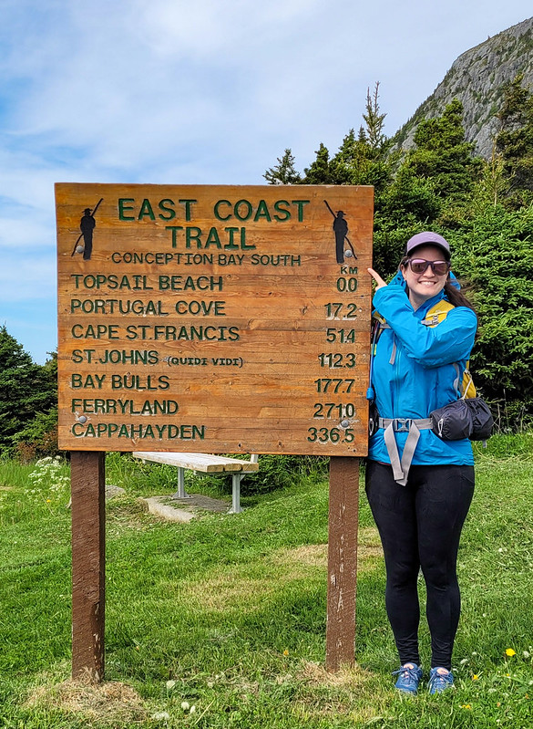
The reason I say that Long Shore is interesting is because it’s marked as a 17km long section of trail, but there’s ~4km of road walking in the middle of it. Typically sections of road this long aren’t included in the trail sections (though I believe they are included in the overall length of the ECT, as you would have to walk all the road sections if you did it as a true thru-hike). I find it a bit odd that they decided to include so much road walking in Long Shore Path instead of just breaking it into 2 sections. I didn’t want to do 4km of walking along the road, so I opted to do the trail in 2 sections over 2 days. So I guess I technically haven’t done the entire thing, but I’m going to count it as close enough.

I did the first section in late afternoon with Emily after she got off work one day. We drove out to Topsail Beach and hiked the first 4km of coastline to St. Thomas and back for a total of 8km. The trail starts right at the beach in Topsail Rotary Park and is primarily through the woods the entire way. Generally I don’t love long wooded sections, but I didn’t mind this part because it’s pretty sparse forest and you can still see the coast through the trees. The trail is a little bit technical, with tree roots and rocks, and undulates up and down.

PSX_20220623_223021

When you get to the end of the trail, you can take a left to walk down Lorry Road to the beach at St. Thomas. It’s a quiet and lovely beach that I’d never been to before and it makes for a nice end destination. It was overcast when we started the hike, but we sat on the beach for a while as the sun started to break up the clouds. It took us about an hour to hike the 4km and we had a few snacks before turning around to hike back. The sun properly came out on our return, which really brightened up the trail.

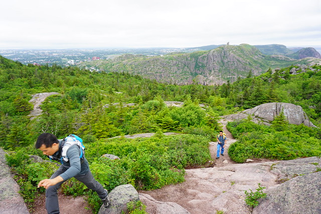
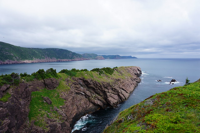
The following day I returned with Seth and his parents to hike the rest of the trail. After St. Thomas is the 4km of road walking to St. Philips Beach, followed by another 9km of hiking to Portugal Cove. We parked one car in St. Philips and then started from the trailhead in Portugal Cove to hike backwards. The first part of the trail out of Portugal Cove is another odd section because it doesn’t actually follow the coastline at all. Instead, you hike up behind Portugal Cove to a series of lookouts along the bluffs. It doesn’t feel very East-Coast-Trail-like, but it’s beautiful nonetheless.

20220616_110637

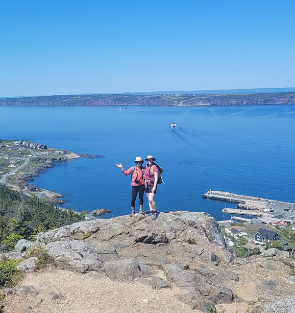
It’s about 225m of elevation gain to the top – we didn’t find it too challenging, but if you don’t like climbing you may want to take your time. There are some excellent views of Bell Island from the top as you hike along the bare rock before descending to Beachy Cove. The descent isn’t very nice as you go through a huge section of blowdown, with tons of knocked over and destroyed trees. It’s not hard to follow the trail as the debris has been cleared, it’s just not very scenic. Once you reach the bottom, you hike out along an ATV road and then swing left on the road for a few hundred metres before turning right to go down to Beachy Cove.

20220616_125433

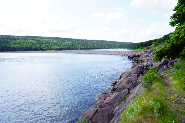
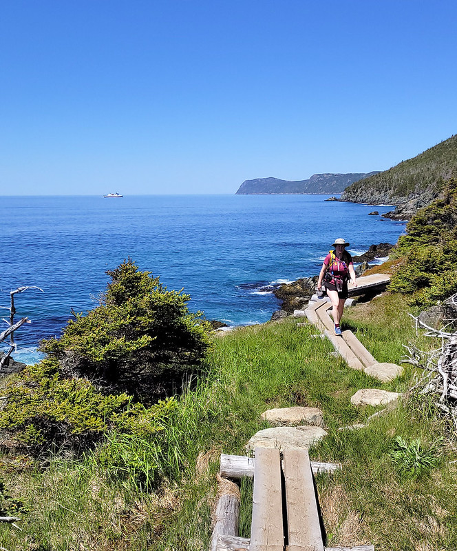
Beachy Cove is easily accessible from the road, but it’s another beach I’d never been to that is really lovely. There’s a big waterfall flowing down to the ocean and the river can be a bit challenging to cross when the flow is heavy, but if you’re able, there’s a picnic table on the other side where we stopped for lunch. To get to Beachy Cove was ~6km, then there’s another  ~3km along the coast to get back to St. Philips. This section is very similar to the 4km between Topsail and St. Thomas in that it’s mostly in the trees and undulates up and down (though I’d say it’s more challenging than the Topsail section).

The only tricky part of this trail is when you reach Goat Cove. There’s a creek flowing down to a small pocket beach, so you have to descend down a sketchy rope section to the beach. From what I’ve heard, there used to be ropes on both sides of the beach, but there are stairs on one side now, so I wouldn’t be surprised if a second set of stairs is added in the near future, which would make this trail much more accessible. As it is now, it is a particularly long rope section that is manageable, but not easy. I’d recommend bringing gloves for the rope and taking your time.

PSX_20220627_221816

We didn’t have quite enough water for the entire hike, but fortunately I’d brought my water filter, so we filled up with fresh cold water before continuing on. The rest of the trail isn’t particularly difficult and we enjoyed the glimpses of sun through the trees while still enjoying the shade.

So it’s a bit of a complicated trail with so many sections. I’d definitely recommend doing it in 2 sections to skip the road walk, but if you wanted, you could even do it in 3 sections as return hikes, which is what Emily ended up doing. I didn’t expect to like it as much as I did with so many forest sections, but it’s actually quite scenic (especially the views from the hill in Portugal Cove) and I loved hiking to all the little beaches along the way. Whether done as 1 long trail or several sections, it makes for a really nice hike.

20220616_143757

Hiking ECT: Deadman’s Bay Path

I haven’t hiked Deadman’s Bay Path since 2019, but it is one of my favourite trail sections on the ECT and I’ve done it 3 times. Most recently I did it with Lien and Brandon when they visited Newfoundland for my wedding, but I’ve also solo hiked it in the past. This section of the trail runs from Fort Amherst to Blackhead and is approximately 10.5km in length. I feel like it has a bit of a bad rep because of the steep climb out of Fort Amherst, but I think it’s unjustified because it’s only a steep climb and the views from the top and along most of the trail are really unparalleled.

DSC09488

You can hike the trail in either direction, but I’ve always done it from Fort Amherst to Blackhead. If you try to logic that the other direction will avoid the steep climb, you’ll just have to do it out of Freshwater Bay instead, so either option is basically the same. I definitely recommend 2 vehicles for this trail since you won’t want to have to turn around and go back the entire trail, but given the proximity to St. John’s, it’s easy to get dropped off or picked up on one end. If you’re looking for a shorter day, you could also exit at Freshwater Bay or just turn around at Freshwater Bay and only do half the trail. I haven’t done the Freshwater Bay access trail in years, but I believe it’s about a 45 minute walk.

DSC09501

If you start in Fort Amherst, you can visit the lighthouse and get the climb out of the way early. It only takes me about 15 minutes to climb up to the top of the bluff and once there, you’ll have an amazing view of Signal Hill and downtown St. John’s. One time I started the trail around noon and ate my lunch once I reached the top so I could enjoy the view a bit longer. If you don’t want to do the whole trail and are just looking for an hour long walk to get some exercise, I suggest doing the climb up to the top and just enjoying the view before turning around. It’s a great workout and will help build up your stamina.

DSC09503

After that, the trail meanders along the top of the cliff without too much up or down. It goes in and out of the trees and past a few water holes, all with fantastic views of the coastline. Right around the 4.5km mark you start the downhill section into Freshwater Bay (which is the worst uphill part if you go the opposite direction). Freshwater Bay is another lovely short hike on it’s own if you want to park off Blackhead Road on the way to Signal Hill and hike in. It’s marked by the long strip of beach that separates Freshwater Bay Pond from Freshwater Bay – I’ve never swam in the pond myself, but Emily has and it makes for a good cool down on a nice day.

DSC09505

I had a minor breakdown at Freshwater Bay when I hiked it with Lien and Brandon because I forgot sunscreen and was petrified of getting a sunburn or awful tan lines before the wedding, but fortunately a kind stranger happened upon us at the exact right moment and lent me some! Freshwater Bay is located at ~5.5km, so it makes for a good halfway point to stop and have lunch if you’re doing the whole trail.

DSC09523

After crossing the beach, you head back up into the woods and traverse along the edge of the bay. The trail comes out of the woods at the end and I recommend following the trail out to the viewpoint on Small Point for amazing views back to St. John’s and out to Cape Spear. After Small Point the views are more about Cape Spear than St. John’s and the trail winds it’s way around Deadman’s Bay before finally heading into Blackhead. The trail is pretty exposed walking into Blackhead, so gets pretty windy and you can get hit with ocean spray on a particularly blustery day.

DSC09528

If you’re feeling particularly adventurous, you can continue for another 4-5km to Cape Spear on Blackhead Path. I did this once when I was hiking solo and I was ahead of schedule for when my Dad was going to pick me up. It’s not a difficult trail, but it will significantly lengthen the hike, so most often I just end at Blackhead. I’m about 60% through the East Coast Trail to date, but Deadman’s Bay Path remains one of my favourite trails, and given it’s proximity to the city, I definitely recommend!

DSC09547

ECT Series: Silver Mine Head Path

This is going to be a short post for a short trail. Silver Mine Head Path runs from Middle Cove Beach to Motion Drive on the edge of Torbay. If you want to take 2 cars, it’s approximately 2km one way, but given the short distance, it’s still only 4km to walk there and back, which is what I did.

DSC09858

Silver Mine Head Path was never really a priority for me because it was so short (funny how that happens), but it was the only section of trail I hadn’t done on between St. John’s and St. Francis, so I decided to fit it in one morning when I was home in August 2021. I parked at Middle Cove Beach and walked towards Torbay – it only took me an hour and a half and it was a gorgeous sunny day, so I finished it off with a dip in the ocean! Not something I normally do, but I’ve been getting more into cold water swimming in the last few years. I always thought North Atlantic Ocean was the coldest place to swim, but it turns out in the middle of the summer, the glacier fed lakes in BC are a fair bit colder!

PSX_20210819_093611

For such a short walk, Silver Mine Head Path gives you a really good bang for your buck. It starts with a short climb up to the top of the bluff and then you continue along the scenic coast all the way to Torbay and back. There’s not too much going on since it’s a short trail, but there aren’t many trees either, so I enjoyed the beautiful ocean views. Plus I really liked the grassy meadows on the Torbay side of the hike – I imagine it would be a great place for lupins at the right time of year (or at the very least, fireweed).

DSC09869

So in conclusion, this is the hike to do if you’re looking for a short walk after work or on a Sunday morning. Along with hiking out to Torbay Point and back (on Cobbler’s Path), I think both trails make for great evening walks when you only have an hour or two and are craving that fresh salty air. I’ve always gone to Signal Hill, but I’ll be hitting up these trails instead in the future!

DSC09852