10 Paddling Trips near Vancouver

A few weeks ago I shared a list of 10 Easy Day Paddles near Vancouver. In keeping with the paddling theme, I’d like to highlight 10 Paddling Trips near Vancouver! We’re lucky to have easy access to excellent paddling routes in Southwest BC and these are a few of my favourite overnight and multi-day trips. Please be aware that overnight tripping does add complexity to the activity and you should make sure that your skills and experience match that complexity. I highly recommend taking a paddling course from Paddle Canada before attempting any of these trips as you want to ensure you know how to self-rescue and are familiar with the basic paddle strokes. Despite canoeing being very popular in Canada, I do think it is more challenging than kayaking.
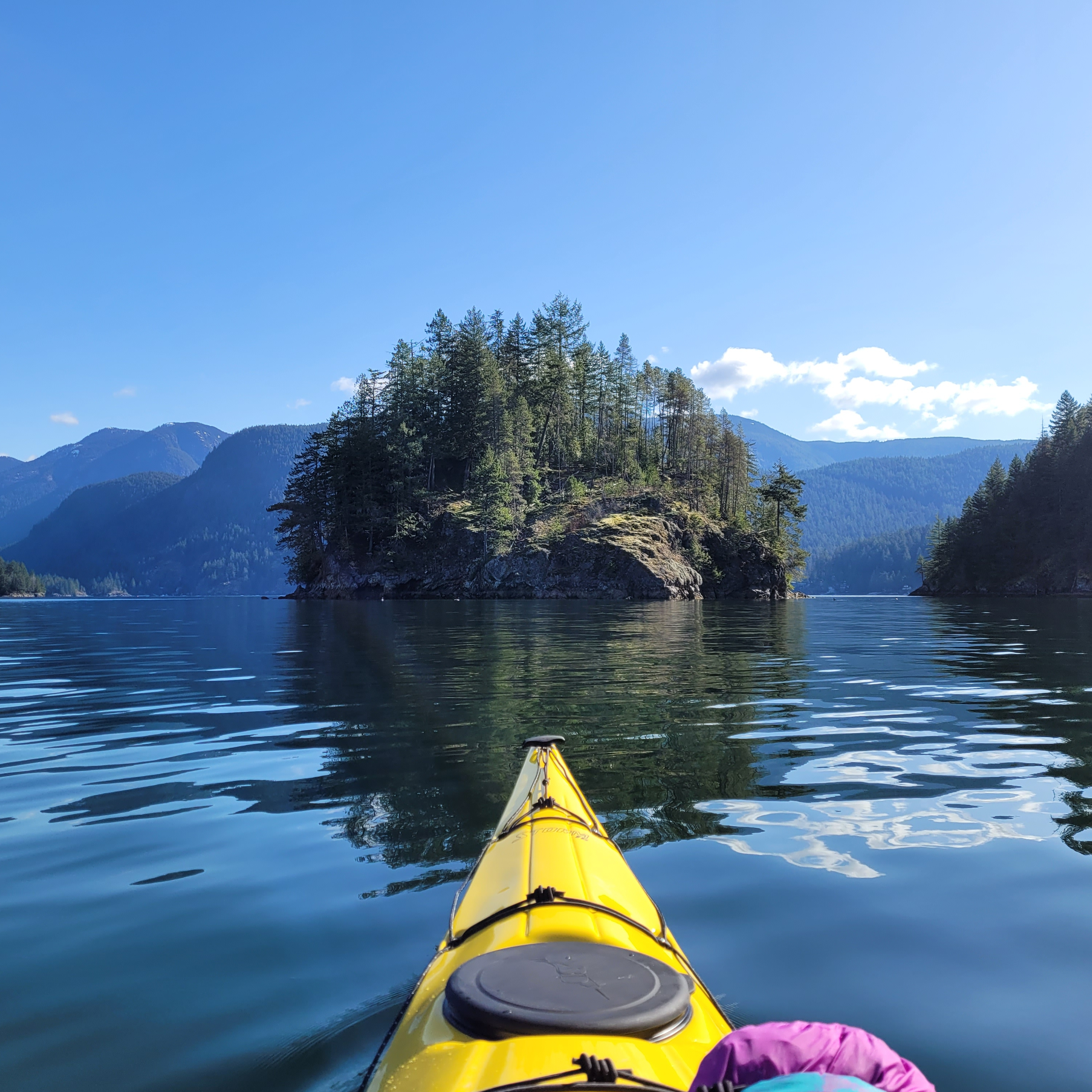
Twin Islands

A kayaker paddles towards Jug Island on a sunny day with calm waters in Indian Arm. Jug Island is located near Belcarra Regional Park in Vancouver, BC.

Twin Islands also made my list of day trips and it’s a popular overnight location for a reason. It’s only a 5km paddle from Deep Cove to Twin Islands and there are several tent pads located on the north island (camping is not permitted on the south island). While you can access Twin Islands from either Belcarra or Deep Cove, there is no overnight parking at Belcarra. Kayak rentals are available from Deep Cove and Cates Park and there is no overnight camping fee. Due to the proximity to the lower mainland, this campsite can get extremely busy. If you’re going on a weekend, I recommend leaving early, or avoid altogether by going on a week day. There is an outhouse on the island and please make sure to back out all your garbage and be respectful of other paddlers.
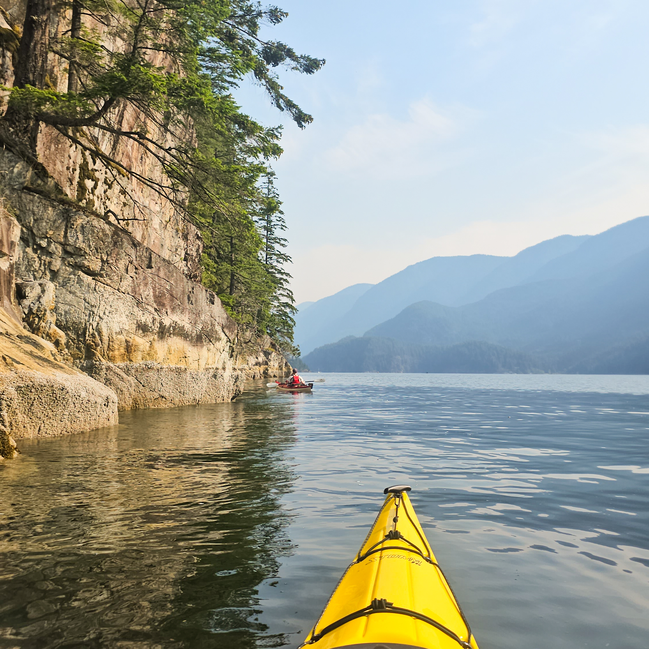
Granite Falls

Two kayakers paddle up the still waters of Indian Arm, with the mountains in the background and a steep cliff extending into the water near Vancouver, BC.

If you want a more ambitious trip than Twin Islands, continue north up Indian Arm to Bishop Creek or Granite Falls, where there are two more free campsites. Bishop Creek is approximately 14km from Deep Cove, while Granite Falls is 18km. Granite Falls is beautiful, with a large cascading waterfall, but it’s extremely popular among both paddlers and power boaters. I think this is a great trip, but honestly, the atmosphere on a busy weekend is not great. It attracts more of a party scene, meaning that it’s very crowded, noisy, and very few people practice bear safety. There are outhouses and bear caches, but the caches are undersized for the amount of people that visit the site. I recommend doing this trip on a week day, or consider staying at Bishop Creek instead. Some people like to do this as a multi-night trip, staying at Twin Islands on the way there or back. Leave early to return to Deep Cove as the wind gets high in the afternoon. Kayak rentals are available from Deep Cove and Cates Park.
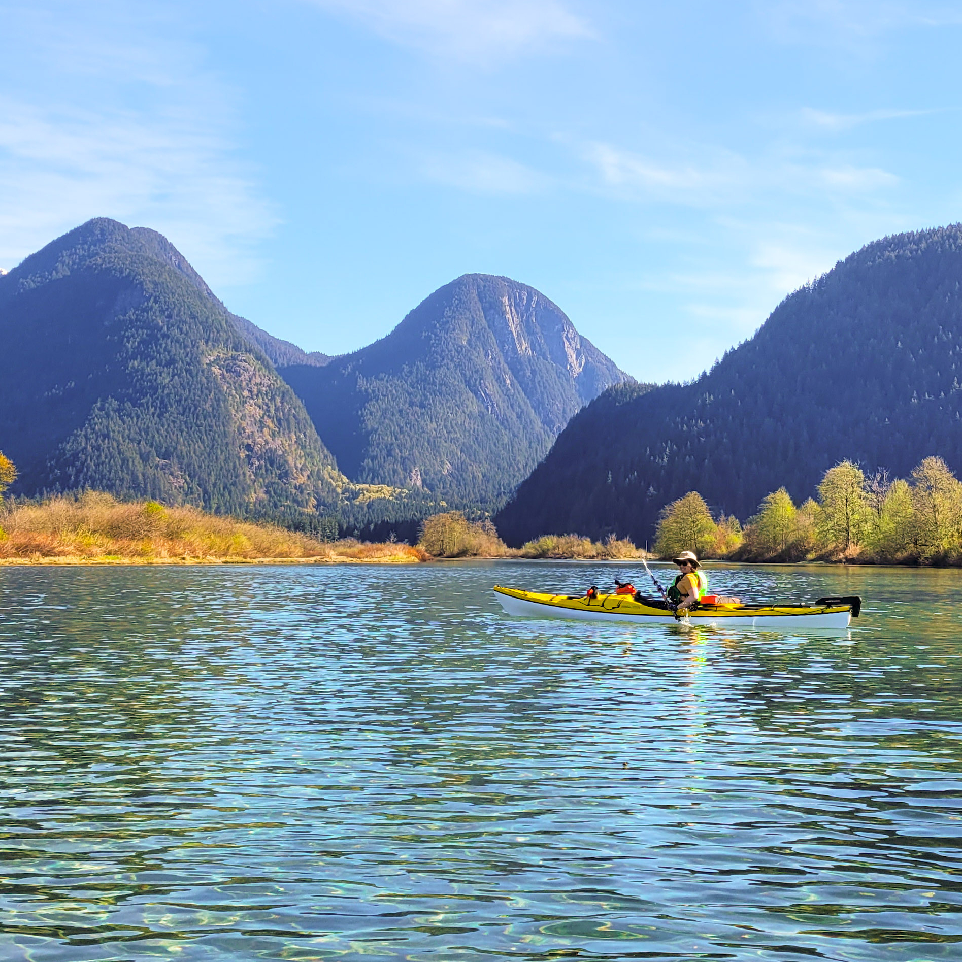
Widgeon Creek

A woman in a yellow kayak paddles in crystal clear blue water on a sunny day with mountains in the background and a blue sky in Widgeon Creek by Widgeon Marsh in British Columbia, Canada.

Widgeon Creek is a very popular summer paddling destination in Pitt Meadows. It was also on my list of day trips and it is a great option for an overnight trip for beginners. Park at the main lot on Pitt Lake and paddle across the Pitt River to Widgeon Creek, which is a leisurely 6km paddle to the campsite. From there you can do a day hike to Widgeon Falls. This area is very busy in the summer, but head out in April or May to avoid the crowds. Be careful crossing the Pitt River, which can have strong currents, and leave early to avoid the wind. Flows in the creek can be very low later in the summer, meaning you may have to walk your boat in some sections, especially at low tide. You can rent boats from Katzie in the summer, or through independent operators that deliver the boats to the lot. There is a bear cache and outhouse at the campsite and there is no fee to camp, but you do have to pay for parking at Pitt Lake in the summer.
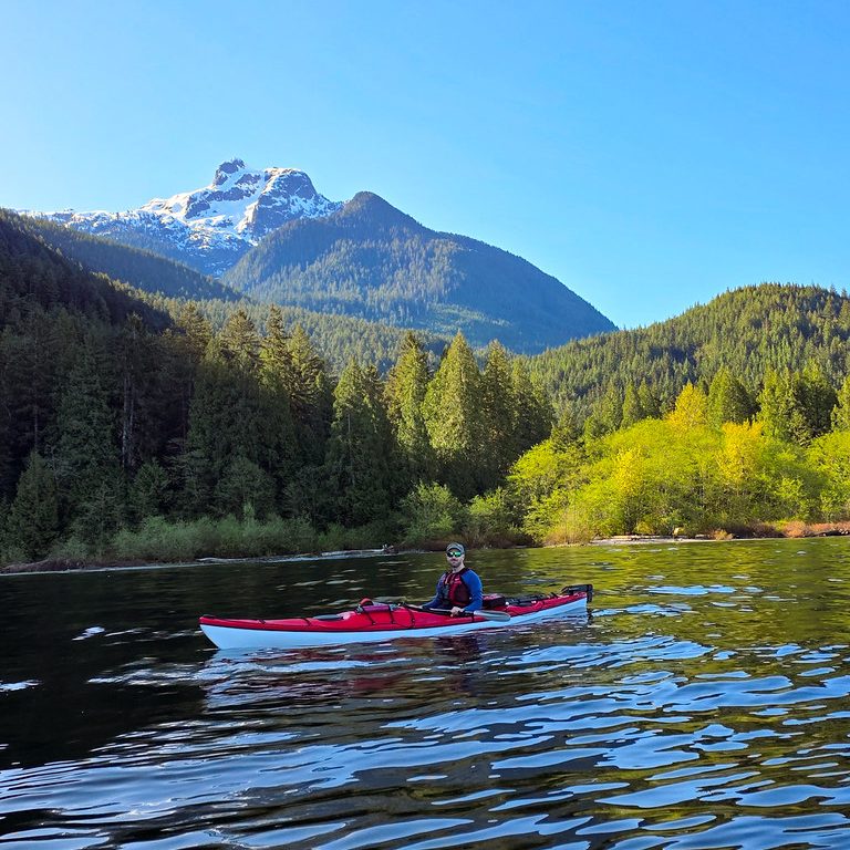
Pitt Lake

A kayaker paddles up Pitt Lake with Raven Creek Campsite and Golden Ears Peak in the background on a sunny day in Pitt Meadows, BC.

Pitt Lake is located in Pitt Meadows and is a trip I recommend for slightly more experienced paddlers, only because it can get very windy on the lake. There are two BC Parks campsites located on the east side of the lake, in Golden Ears Park. Raven Campground is located approximately 9km from the boat launch and Osprey Campground is another 8km from Raven. Paddle to the far east side of the lake along the dike before following the coastline up to the campsite. There are some shallow areas along the edge of the lake that may require you to paddle out into the lake to avoid getting stuck in the mud flats. This is a tidally influenced lake, so make sure you set up camp above the high tide line. A permit is required to camp at these sites, it’s $5 per person, per night, from camping.bcparks.ca. There is an outhouse, but no bear cache.
Alouette Lake

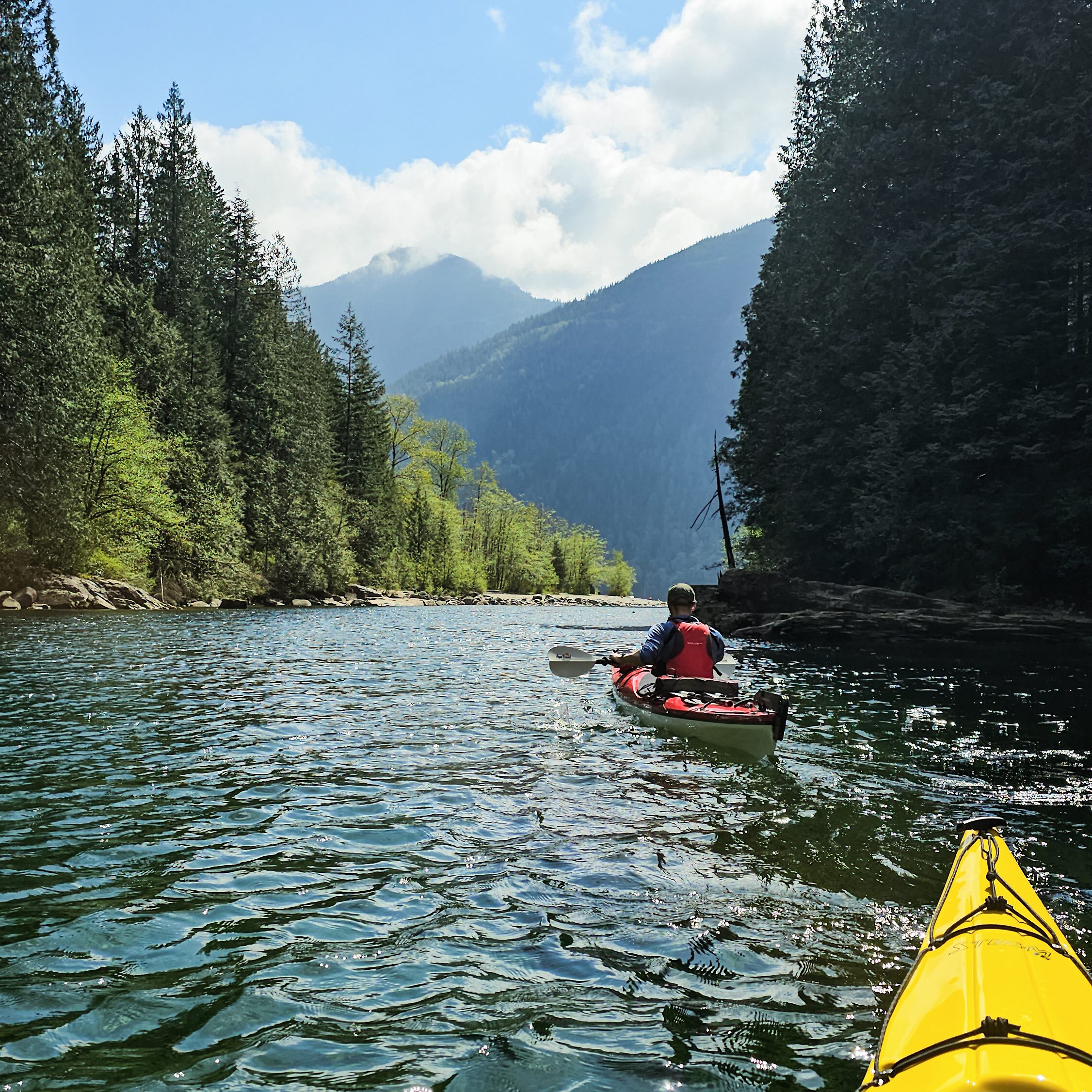
Two kayakers paddle up Gold Creek on a sunny day on Alouette Lake in Golden Ears Provincial Park. BC, with the forests and mountains in the background.

Alouette Lake in Golden Ears Park is a popular location for day trippers in the summer, with lots of people exploring Gold Creek. However, there are also 3 BC Parks campsites on this long lake, two are located approximately 10km from South Beach, Moyer Creek and The Narrows, and a third, Alouette River, is located at the far north end of the lake, another 8km from Moyer Creek. Similar to other lakes, Alouette can get very windy in the afternoon. A permit is required to camp at these sites, it’s $5 per person, per night, from camping.bcparks.ca. There is an outhouse and bear cache at Moyer Creek, I’m not sure about the other campsites. You can usually rent canoes from South Beach in the summer.

Plumper Cove

Two tents set up at the campsite on a sunny, blue sky day near the ocean at Plumper Cove Marine Park on Keats Island, BC.

Plumper Cove also made my list of day trips under the title of Keats Island. It’s the shortest paddle on this list and a great option for beginners because it’s only 3km from Gibsons. You can rent kayaks from Alpha Adventures at the marina and paddle across the channel to Keats Island, following the coastline north until you reach Plumper Cove Provincial Park. This park is primarily marine access and attracts a lot of power boaters. It’s a huge site with lots of space for camping. It is first-come-first-serve, and you’ll need to bring cash to pay the on-site ranger. Since there is a water crossing from Gibsons to Keats, pay close attention to the wind and do not attempt to cross if it is a windy day.
Sechelt Inlet

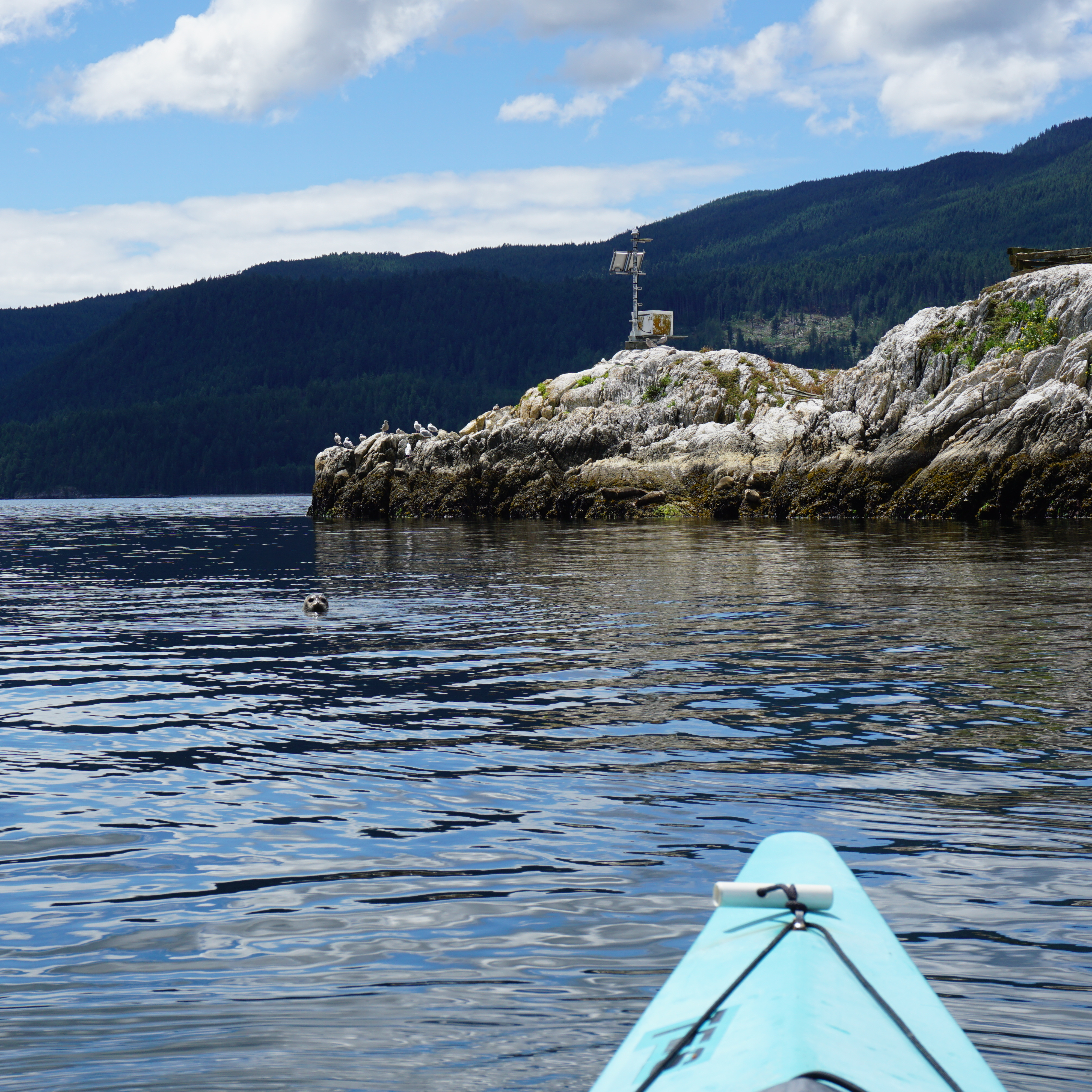
A photo of a seal looking at the camera from the water in Sechelt Inlet on a kayaking trip, with the water and mountains in the background on the Sunshine Coast in BC.

Sechelt Inlet is located just north of Sechelt on the Sunshine Coast. It’s a great option for multi-day trips and offers a more remote experience than some of the other trips on this list. There are more than a half dozen campsites located throughout the inlet, with some of my favourites at Nine Mile Beach, Kunechin Point, and Halfway Beach. The boat launch is located at Lamb’s Bay and you can rent boats from Pedals and Paddles. The campsites are all free and most of them have outhouses, though I’m not sure if they have bear caches. I recommend staying for at least two nights on this trip. As usual, beware of wind in the afternoon.

Gulf Islands

Two kayakers paddle on the Pacific Ocean in the Gulf Islands Marine Reserve National Park between Run Island and Sidney Spit on a sunny day with bright blue sky.

There are lots of options available for paddling in the Gulf Islands National Park Reserve, located just east of Vancouver Island (Salt Spring, Pender, Saturna, Mayne Island, etc). Plan your trip around where you want to visit. I’ve done trips out of both Pender Island and Sidney. Pender is a safe option because you don’t have to do any open water crossings, whereas some of the other sites require water crossings out of Sidney, which are more appropriate for experienced paddlers. There’s a great first-come-first-serve campsite at Rum Island and another at D’arcy Island. Beaumont Campground on Pender Island has closed, but you can still make reservations at Shingle Bay. In addition, there’s a frontcountry site at Sidney Spit. Some sites require reservations from reservation.pc.gc.ca, but the others are pay on site, so bring cash. You can rent boats from Blue Dog Kayaking in Sidney or Pender Island Adventures on Pender Island.

Copeland Islands

A female kayaker smiles at the camera from her yellow Boreal Storm kayak while the sun sets over the water and leaves a pink glow over everything in the Copeland Islands Provincial Park on the Sunshine Coast in British Columbia, Canada.

The Copeland Islands are located north of Powell River on the Sunshine Coast and can be accessed from Lund. There are several campsites located throughout the collection of islands and it’s approximately 10km from Lund to the North Campground. I believe the campsites can get pretty busy in the summer, but the water is super warm in this area, so it’s a great option to visit in May or September. It’s free to camp and there is an outhouse. This is a great 1-night trip, or you could extend it to paddle into Desolation Sound for a few more nights. I’m not aware of any boat rentals in Lund.
Desolation Sound

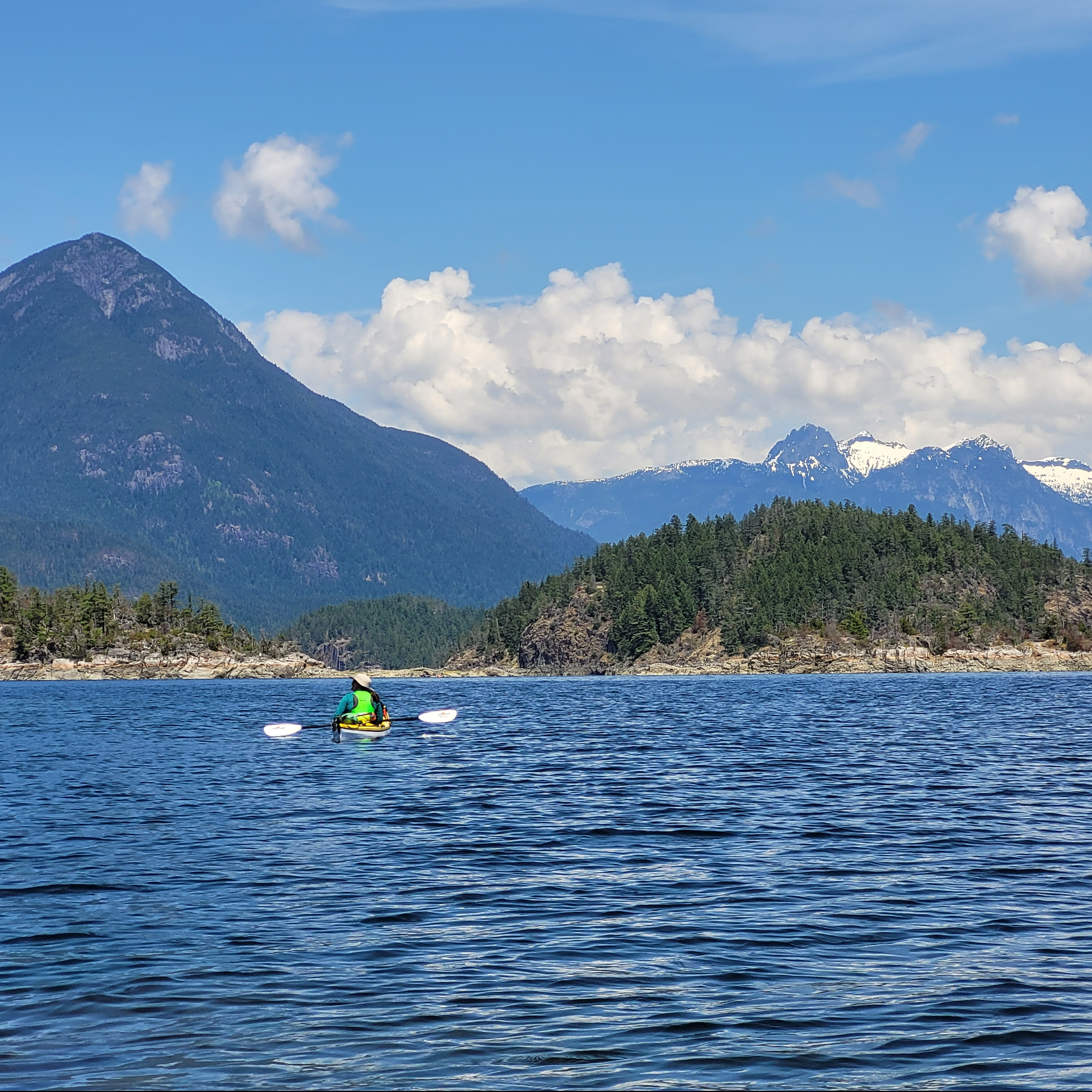
A female kayaker in a yellow kayak admires the view on the water with the mountains in the background in Desolation Sound Provincial Park on the Sunshine Coast in British Columbia, Canada.

Finally, Desolation Sound is a beautiful provincial park reserve north of Powell River on the Sunshine Coast. You can access it from either Lund (via the Copeland Islands) or Okeover Arm. It’s a large area that warrants at least a few days to properly explore. The most popular campsites are on the Curme Islands, but these can get very busy in the summer with both paddlers and power boaters, so the campsites at Bold Head and Tenedos Bay are good alternatives. You do have to do an open water crossing to access the Curme Islands, so it’s not recommended for beginners. There is no freshwater, so make sure you bring enough for your entire trip. Permits are required from camping.bcparks.ca and cost $5 per person, per night. All campgrounds have outhouses and some of the mainland sites have bear caches. You can rent boats from Powell River Sea Kayak near Okeover.

Desolation Sound Kayak Trip Part III

On day 3 of our paddling trip to Desolation Sound Marine Park, we got up at 6am to get ahead of the wind (as I explained in Part II). We packed up our campsite on East Curme Island and were on the water around 8am. It was flat water at this time, so we had a very leisurely paddle over to Otter Island and along the coast to Bold Head Campground.

I was really curious about Bold Head because I’d read it was a nice site. It’s backed right again the cliffside and there are several tent pads up at the head, but it was empty. I could understand why – as nice as it is, I’d still pick the Curme Islands when given the choice, so I suspect it may act primarily as overflow for the islands.

20230521_091954(0)

The campsites in the Park are all first-come-first-serve and according to BC Parks, if the tent pads are all taken, you should move on to another site. Though they do state that if moving on isn’t safe, find the least impactful spot (somewhere with no vegetation that looks like people have camped there before). Fortunately we didn’t have any issues with availability on the May Long weekend, but I could see it being an issue in the height of summer. The problem is, the islands are all very small, and while there’s 3 of them, there’s limited options for overflow camping since most of the sites are set on bedrock. Fortunately there are a lot of tent pads, and I assume that’s why.

But if you do find the islands full, head over to Bold Head – it’s not far and it is nice. The toilet situation is quite different though. The other campsites I visited all had an outhouse (sometimes two), but Bold Head just has a throne toilet and at the time of our visit, it had a wasp nest inside! There are bear caches at all the mainland sites, but none on the island sites. It is also a tricky landing on Bold Head, but manageable.

20230521_131900

Unfortunately our simple paddling was short lived as the wind came up suddenly while we were touring around Bold Head. It wasn’t too bad at first, but as soon as we started paddling across Tenedos Bay, it really caught us unaware and started hitting us broadside. It was still manageable, but definitely veering into uncomfortable territory for me as I could see some small white caps forming. It’s ~1km to cross, so we really powered it to the bay on the other side. I had put on my spray skirt, so I had no issue, but Seth didn’t have his on. This wouldn’t have been a problem, but I accidentally bumped him and almost put him in the water… oops! This was the closest anyone came to a capsize on the trip though, so all in all, it was fine.

20230521_121649

We continued up through Call Bight to Portage Cove. Seth took a quick break along the rocks to get his skirt on and we powered up to Portage. This turned out to be the most challenging part of the entire trip. It was definitely windy and while the waves weren’t bad along the shore, it was slow moving through the headwind. I was very excited to pull into Portage Cove and take a proper break, but we were disappointed to learn that Portage Cove is private property and not actually in the park (as we were informed by the numerous trespassing signs).

I know these properties long pre-date the park, but it was a low moment for me. There’s not a lot of pull-outs between Bold Head and Hare Point when you’re taking the southern route and I needed a proper break. Fortunately, the tide was coming down, so we pulled out on a tidal beach for a reset. This proved to be a good idea because I was getting a bit upset and stopping to have a snack and talk things through helped a lot.

20230521_154749

We decided to get properly suited up in our wetsuits and come up with a plan for the rest of the day. There’s a longer stretch between Portage Cove and Galley Bay with no beaches, so our plan was for me to lead (as the weaker paddler) and Seth to come right behind. This worked really well for us and we stayed close together throughout the paddle.

It was a bit rough coming out of Portage Cove, but then the wind either dropped down or was sheltered by Zephine Head. I think it was actually the former as it was gusting pretty strong at times, but overall, the sustained wind speed wasn’t too bad. We ended up actually having a nice paddle along the cliffside before stopping in Galley Bay for lunch.

Once we hit Galley Bay I felt much better because we would have the wind at our backs when we turned down Okeover Inlet. We’d started the trip from Lund, but we were planning to finish at the public wharf in Okeover instead to switch up the trip. In fact, we ended up not actually repeating any coastline, which made for a more diverse trip.

20230521_184506

As soon as we got around Zephine Head, the wind pretty much died and we had a simple paddle down the inlet to Hare Point. There’s a huge campsite at Hare Point and we landed at the main beach to assess. There’s two key areas to the site, with a bunch of tent pads at the back of the beach and a bunch more along Hare Point. We were the only people there, so we decided on a site along the Point and then paddled back to land on the rocks instead. We kept the same strategy of tying the boats on and letting the tide bring them up for us.

We were joined later in the afternoon by another family of kayakers who camped in the other section of the tent pads, otherwise we didn’t see anyone else. I really liked our site at Hare Point, but the wind was unquestionably getting worse. To be fair, we were on a pretty exposed tent pad, but I ended up guy-lining the tent to the rock for peace of mind and it was the only night we used the fly.

20230521_194220

The wind was supposed to be even worse the next day, so we had to do a bit of risk management. I was reassured by the fact that it’s a lot calmer in Okeover Inlet than in the Sound, and that the wind would be at our backs. In case you’re wondering, I use both the Windy App and the weather network for wind information. I usually find Windy to be good, but on this trip the Weather Network was more reliable for wind speed (though the Windy app was still accurate for direction). We’d been planning to get weather updates on our marine radio and via inreach message from Carolyn (who had our trip plan), but there was cell service in pretty much the entire park, so I ended up just using my phone.

What arose as more of a concern as we watched the inlet from our campsite, was the currents. Okeover Inlet is huge, with lots of other inlets branching off it, so with up to 5m of difference between high and low tide, that’s a huge amount of water coming up and down the inlet twice daily. We arrived at Hare Point at slack tide, so we had no trouble getting there, but as the tide changed, the current got quicker and quicker, until it was really clipping down the inlet at a fast pace.

20230521_194716
20230521_180629

We’d already decided to get up at dawn the following morning to try and get ahead of the wind, and this decision became much more important when we realized that the tide would be switching again at 7:30am. It would be working with us until then and we didn’t want to have to battle it the whole morning.

It ended up working out really well. It was hard crawling out of bed so early, but we were on the water by 6:45am and with the wind at our backs and the current with us, we absolutely flew down the inlet! It was super fun! It’s 10km of paddling back to the public wharf, which would usually take us around 3 hours with breaks, but we ended up doing the whole thing in about 90 minutes. The wind looked pretty intense later in the morning when we returned to Powell River, but we managed to get ahead of it and actually had a very enjoyable paddle.

20230522_073103

Our ferry reservation out of Langdale wasn’t until 8pm, but since we’d finished so early, we decided to power back to try and get on an earlier ferry. Unfortunately this didn’t really pan out. BC Ferries was so busy over the long weekend that it actually crashed the website, so we couldn’t check the ferry times and ended up being way out of sync with them. We waited for the ferry at Saltery Bay for the better part of 2 hours. Then we rushed down to Langdale for 2pm, only to be told to keep our 8pm reservation because we probably wouldn’t get on any earlier than that anyways. So we ended up burning 6 hours in Gibsons instead. In hindsight, I would have preferred to spend some more time in Powell River, but you can never know that at the start of the day.

We had a nice time in Gibsons. We explored some shops and enjoyed a pint at Tapworks and a really nice meal at Buono Osteria. We finished with a nice walk along the waterfront. Overall it was a fantastic trip. Seth and I used to do a 3 day paddling trip every year, but we missed 2021 and 2022, so this one was long overdue and a good reminder of how much we enjoy the trips. We do lots of day paddles, but overnight trips definitely have a very different feel. I don’t think we’ll have time to do a second trip this summer (mostly because it’s hard finding someone to watch our dog), but I’m really desperate to do another trip, so we’ve already started brainstorming for next year!

There are lots of things to consider when visiting Desolation Sound, but May turned out to be good timing for us. We’re so lucky to live in a place with so many epic places to explore and I can’t wait until the next trip!

20230522_183628

Desolation Sound Kayak Trip Part II

Despite the name change in the blog title, this post is a continuation of my last post about Copeland Islands Marine Park, as I visited both parks in the same trip. Read Part 1 here.

I will admit that the wind gave me a lot of anxiety on this trip. I’m definitely a fair weather paddler, and while I’ve been out in less-than-favourable conditions, I’ve never paddled in outright dangerous conditions. It was surprisingly windy overnight, which made me a bit nervous for our second day of paddling, but the wind forecast wasn’t that high and it did calm down throughout the day. I’m used to the wind being calm in the morning and coming up in the afternoon, so that was an interesting change to have it reversed.

20230520_103252

We still got up reasonably early (7am) because we wanted to launch the boats while the tide was still high. Once the tide starts to go down, you lose the channel exit from our campsite and it adds a bit of extra paddling, plus you have to load the boats and gear further down the beach.

Fortunately, our timing was right on and we paddled out through the channel around 9am with just enough clearance to get over the newly forming beach. We crossed back over to the Malaspina Peninsula and said good-bye to the Copeland Islands as we made our way to Desolation Sound. There were some cool cliff features along the way, just past Bliss Landing, and we quickly arrived at Sarah Point, which marks the beginning of both Desolation Sound Marine Park and the Sunshine Coast Trail. It was a bit of a bittersweet moment for me as I have very fond memories of hiking the SCT last year and I loved seeing the Sarah Point hut again.

20230520_093410
20230520_095516

We had a quick break further along the beach at Sarah Point before continuing around the headland to Feather Cove, which is also on the SCT. It got a little windier as we rounded Sarah Point, but nothing to be concerned about. We spotted our second sea lion and then took in our first glimpse of the jaw-dropping beauty of Desolation Sound. I wasn’t able to successfully identify the mountains, but there are some gorgeous snow capped peaks in the distance as you first enter the Sound.

20230520_135657

We took another short break at Feather Cove before crossing Okeover Inlet to Zephine Head. The Inlet crossing was fine and the tide was rapidly dropping, so we were able to pull out at a beach just around the Head. At high tide, you might have to continue into Galley Bay for a pull-out though. We had our lunch there and since the conditions were favourable, we decided to do a direct crossing to Mink Island.

It’s about a 3km paddle from Zephine Head to Mink Island in open water. We tried to stay close to one another on the crossing, but the wind definitely picks up the further out you get, so I finally dropped my rudder and that helped me maintain my course a lot easier. Seth is pretty opposed to his rudder and never uses it, so he had some trouble staying on track. We managed to correct this the following day (which was windier), by both dropping our rudders and having Seth paddle directly behind me (since I’m the slower paddler) instead of trying to paddle side by side. Whenever we go side by side we tend to get separated, so this system worked better for us.

20230520_100200
20230520_130756

That said, it was still a pretty good crossing. The wind was low and we didn’t have any trouble making it over to Mink Island. Once we got to Mink Island, we had the wind working with us, so that was nice. Unfortunately, there weren’t a lot of good looking places to stop along the island, so we powered around the corner of the little arm on Mink Island (sorry I don’t know the name) and had a nice rest in the sheltered bay.

From there it’s not much further to the Curme Islands, which are the most popular attraction in the park, at least as far as I can tell. At the end of Mink Island, there are 3 small islands: South Curme, East Curme, and West Curme. The water was super calm at the end of Mink and around the Curme Islands, so we did a little paddle around each island. It was Seth’s turn to pick our site and he opted for East Curme Island, which I think was an excellent choice!

20230520_101046
20230520_134603

West Curme Island was really busy when we arrived, so I think that one might be the most popular. There was just one group on both East and South Curme, though a lot of people showed up to South Curme by motor boat later in the evening. But no one else joined us on East Curme, so it was just us and the other group (which is surprising considering it is the biggest of the 3 islands). We had a lovely site looking out to South Curme and Bold Head, and climbing up to the top of the island, another nice view looking down at West Curme.

The tide was very low when we arrived again, but in contrast to North Copeland Island, it was a more challenging landing. It wasn’t hard at low tide, but it’s a bit of a climb up to the island and at high tide, there’s no beach at all. There was just enough room for 4 kayaks between us and the other group, so I’m not sure where everyone stores their boats when the campsite is full.

20230521_064232

Instead of dragging the boats up the rocks, we opted to tie them on and let the tide slowly float them up to the landing. It worked really well and when the water reached high tide around sunset, we popped them up on the bank.

After unloading the boats, we were really warm, so we opted to go for a swim almost immediately. Like Copeland, the water was incredibly warm, though there was a lot of seaweed floating around with the low tide. Even Seth went for a swim and we were in the water for the better part of a half hour. We had landed on the island around 2:30pm, and after our swim, I spent the rest of the day doing absolutely nothing. Seth had a nap and I just enjoyed drinking my ice tea and watching the seals play while the tide came up.

20230520_154453
20230520_205122

Seth wasn’t as excited about a sunset paddle on this day, but I convinced him to go out for a half hour since you can’t really see the sunset from East Curme. The water was calm again and it was approaching high tide, so we paddled in and around all the islands before calling it a night. We slept with the fly off again and set our alarms for 6am to get an earlier start on the following day.

This was on account of those winds I mentioned earlier that were making me anxious. The wind was supposed to come up a lot on our 3rd day and I was nervous about the big open water crossing. We discussed it in the evening and decided we would take the long route back to our next campsite. There’s two benefits to this. The first is that you get to explore new terrain by circling Desolation Sound from the other side instead of doing the same crossing back along Mink Island. The second is that you avoid the big 3km open crossing, instead doing a 0.5km crossing from East Curme to Otter Island, and then a second 1km crossing across Tenedos Bay. The other benefit is that these two crossings are done at the start of your paddle, which would be early morning for us, resulting in less wind.

Here’s a screenshot of our 2 paddling routes for some context. I’ll cover the rest of the trip in the Part III!

Desolation Sound screen