I spent a few days visiting my friend, Kristine, in Calgary in August and we spent the weekend traveling around Banff National Park. Kristine is very familiar with Banff and wanted to do a few day hikes that she hasn’t gotten around to visiting over the years. We took off from Calgary early on Saturday morning to spend two days road tripping around the park, our first stop of which was Parker Ridge on the far north end of the park.
This was a fun trip for me because, in the 12 years I lived in BC, I’ve never driven highway 93 past Lake Louise, also known as the Icefields Parkway. I drove it once as a teenager on a family trip, when my parents took us to visit Jasper and the Columbia Icefield, but I’d yet to return. I still haven’t made it back to Jasper National Park, but hopefully one day soon! On this trip, we drove past all the hot spots – Bow Lake, Peyto Lake, and the Waterfowl Lakes – until we hit the parking lot for Parker Ridge, right on the edge of the Columbia Icefield.
Parker Ridge is a 5km hike with 300 metres of elevation gain in mostly exposed alpine terrain. The entire hike is a climb, but you are rewarded with gorgeous views at the top. From the parking lot, you hike along switchbacks through the trees. If you’re thinking this means you’ll get a bit of shade, think again. It’s a sub-alpine environment and the trees are pretty low and sparse, so they don’t provide much protection against the sun. Eventually you exit the trees altogether and continue following switchbacks up to the ridge.
Once you hit the ridge, the view really opens up and there’s a couple of large plateaus. It’s easy to think you can walk wherever you want once you hit the ridge, but please stick to the trails. It’s a very sensitive alpine environment and while it’s easy to walk anywhere, avoid damaging the alpine shrubs, they take a long time to recover. There are the main trails and a couple of side trails that go to views, please try and stick to those.
Once you’ve done most of the elevation gain, you hit a small saddle. From there, you can walk up to a small summit, or you can walk down the other side of the ridge for a view of the Saskatchewan Glacier, which connects to the Columbia Icefield. We did the summit first, which I recommend doing as there is a really nice panoramic view up there, but you can’t see the glacier from the summit, so it’s also worth heading down the ridge a little bit to see the glacier. We didn’t go the whole way down, so potentially there are better views than what we saw, we just walked until we found a nice little viewpoint and then hung out there for a break. As you can see from the photos, it was quite windy and cold, despite being mid-August.
It’s a quick walk back to the car from the top since it’s all downhill. In total, the hike took us 2.5 hours, with a half hour break at the viewpoint. It’s not a longer hike and even though it’s steep, it has a really good payoff for a relatively short distance. I was recovering from a cold when we did the hike, so I did struggle, but I still had a great time and would absolutely recommend this hike. It was fairly busy when we were there as this is a popular hike. We were still able to find a spot in the parking lot, though it was much busier by the time we finished.
It’s that awkward time of year when there’s still a lot of snow in the mountains, but we’ve finally reached the time when lower elevation hikes are becoming accessible again! I always play it really safe in the Spring because there are a lot of hazards that accompany the snow melting, but Brandon, Seth, and I went out the last week of May to do some exploring outside of Squamish.
Last Fall Brandon and I hiked High Falls Creek, which was my first time exploring in this area. We did some driving around to see what else was out there and added the Crooked Falls hike to our list – May seemed like the perfect time! Crooked Falls is located on the Sigurd Trail, which is accessible by 2WD and is just across the Squamish River when you pass the rec site.
It was really busy when we arrived around 10am, but a lot of the traffic appeared to be people camping and fishing on the river. We didn’t actually pass that many people on the way up to Crooked Falls. The hike starts out on an old forestry road that heads up into the woods. It meanders around the side of the mountain before seemingly heading straight up it. It’s only 3km to Crooked Falls and 500m of elevation gain, so it’s definitely steep!
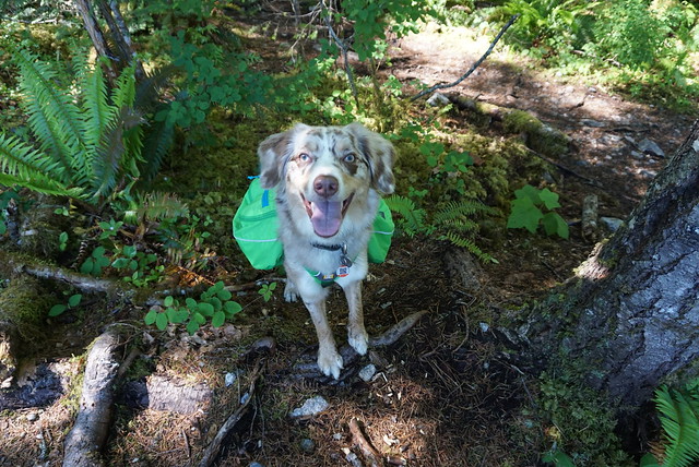
We took Sadie with us on this trip, which was a bit of a challenge because she’s not friendly with other dogs. She did well passing other people, but the trail is pretty narrow and everyone lets their dogs off leash, so we had to pull her into the woods whenever we would encounter another dog to try and avoid a reaction. Overall, it only happened a few times and she mostly was able to handle herself, but she did have one bad reaction to a dog that ran up in her face because it was off-leash. It’s a pet peeve for me – I have no problem with off-leash dogs (we do let Sadie off leash when there’s no one around and it’s permitted), I just wish people would ask consent before letting their dog approach you.
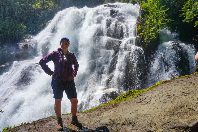
Anyways, back to the trail. Like I said, for the most part we didn’t encounter many people. After 3km there’s a branch off the left side of the trail that heads in towards Crooked Falls. Spring is a great time to visit because the falls are giant with all the run-off. There’s two small viewpoints and you do get a lot of spray off the water (as you can see in the photo), so I wore my rain coat while taking photos. We had a our lunch in the woods where we could stay dry, but still see the falls, before heading back to the main trail. Several other hiking groups came into the falls after us, so it did look like it was getting busier.
It was only shortly after noon, so we decided to continue up the trail to Sigurd Creek. My guidebook indicated that hiking another 1.5km would take you to a lookout off the Sigurd Trail. While the falls are reasonably popular, we spent 3 hours on the Sigurd Trail and only saw 1 other person the whole time. It’s not the most well maintained trail and it’s steep and muddy, so I don’t really blame people.
Shortly after you leave the junction from Crooked Falls, there’s a steep 100m side trail that goes up into the woods to a viewpoint. We decided to save it for the way back, but it wasn’t the best viewpoint. It’s a bit crowded in by trees, but you can see the river down below. We continued on the trail until we came to a second junction. To the left is the Sigurd Trail to Ossa and Pelion Mountain, to the right is the Rose Trail to Sigurd Peak. My guide book pre-dated the Rose Trail, so I was a little bit confused where to go at first, but Brandon figured out that what we wanted was to follow Sigurd Creek on the Sigurd Trail and we continued that way.
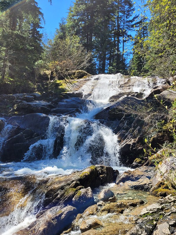
Unfortunately our distance tracking was a bit off because the guide book doesn’t include the Crooked Falls side trail, so after 1.5km of hiking we hadn’t reached anything that looked like a viewpoint. We did however stumble upon a second waterfall cascading down from Sigurd Creek. It was lovely and this time we had it all to ourselves, so we had a quick break and Seth refilled his water bladder. Sadie had chilled out a lot and was having the time of her time exploring around the woods.
We decided to push on a little further, but after the waterfall the trail becomes extremely steep and it was slow going. It’s another 400m in elevation gain between Crooked Falls and the viewpoint (on top of the 500m you’ve already done), so it’s definitely no walk in the park. The viewpoint indicated in my guidebook wasn’t shown on my GPS, but I made a guess about where it would be based on the topography. From the trail it really didn’t look like we were close, so Seth was ready to turn around because we were all tired from the uphill. But I persuaded him to push for another 10 minutes to the point on my GPS, because we were really close and I was convinced it was the viewpoint.
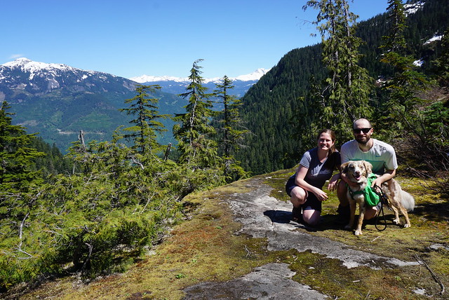
Fortunately I was right and a few minutes later we finally crested the mountain and could see a small knoll branching off the trail with a bare top. We climbed up to it and then collapsed while enjoying the view. We stayed up there about half an hour, snacking and guessing what mountains we were looking out at. We could see up the snowy side of Pelion Mountain and out to Cloudburst Mountain. Behind that we could see Black Tusk from a new angle and could see most of Mount Garibaldi peaking around the corner.
It was hot at the summit, so we gulped down lots of water and Brandon shared macarons for a summit snack. Sadie had her summit snack at the waterfall, so we gave her half of her emergency meal to give her a boost after so much climbing. She wasn’t showing any signs of being tired though and was still bounding along the trails when we started to make our way back down again.
Once we got close to the junction again, we heard a lot of people at the falls, so I guess it does still get pretty busy during the day. There were still a few groups of people making their way up, but it was 4pm, so most people were on the way down. Because of the topography, you’re on the back of the mountain, so we lost the sun around 4pm and it was surprisingly dark along the trail, even though the sun doesn’t set until like 9:30pm. Sadie was finally starting to look a little tired and nothing seemed to bother her on the way down.
All together we ended up hiking about 12km. My book has Sigurd Creek round trip listed as a 9km hike, so it is a bit off. Like I said, I don’t think it accounts for the 300m branch to Crooked Falls, but even so, it’s definitely closer to 10 or 11km round trip and has a whopping 900m of elevation gain in total. So be prepared if you attempt this trail. We had a great time, but we ended up being on the trail for 7 hours and had been anticipating it would be more like 5 hours. Overall this is a great area and I’ve had a lot of fun exploring there over the last year.
I’ve been saying this for ages now, but I want to start writing more about the outdoor adventure experiences I’ve been having in BC over the last 5 years. I haven’t done a lot with this blog over the past few years, except for writing about my occasional vacations, but I’ve been writing a lot on my second blog, which is a book blog (check it out here). I’ve developed some better writing habits, so I’d like to try and focus on writing more on this blog and perhaps reorganizing some of my content to make it a bit more of an adventure blog. I’m sure I’ll still post about travel when I get the opportunity, but those trips just aren’t as frequent as they were when I was in University and hopping off somewhere new every 4 months.
I’ve hiked over 100 trails in the past 5 years and would love to write about some of those trails. Since it’s winter, I’ve decided to write a few posts on some of my snowshoeing adventures and do a little ski series to motivate myself to write more. I’ve skied most of the local mountains in Vancouver and have made a ton of trips to Whistler, but I also go on an annual ski trip to the Interior every year. This tradition was born in 2016 because the Easter holidays that year were in March and I wanted to make use of the extra vacation days. My original plan was to spend the weekend at Big White Ski Resort with Seth and my best friend and her boyfriend, but I ended up getting an awesome deal on a condo that could sleep 10 people and we decided to fill it with some of our other friends.
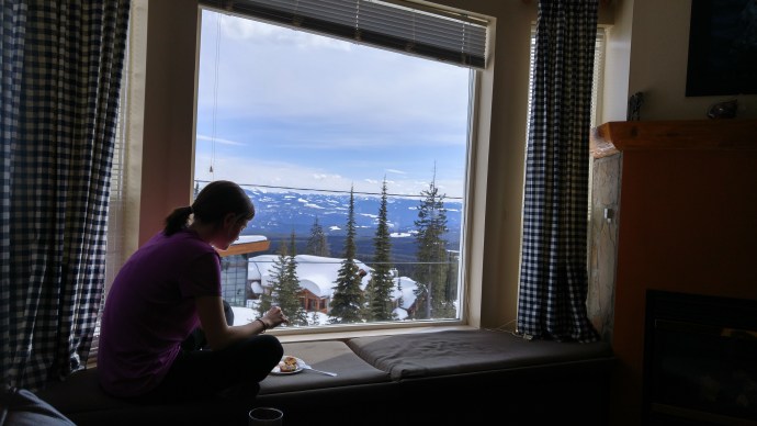
Since then, we’ve gone to a different ski resort every year, but Big White still sticks out as being one of my favourites. It’s located just past Kelowna and is about a 5 hour drive out of Vancouver. Because of Easter holidays, we left on Good Friday morning and arrived mid-afternoon, but every year since we’ve left after lunch or after work. Our condo was located right on the mountain with ski out access and we had this huge window seat in the living room looking out onto the ski slopes and surrounding mountains. The resort also had a huge group hot tub and we spent a lot of time chilling in the evenings.
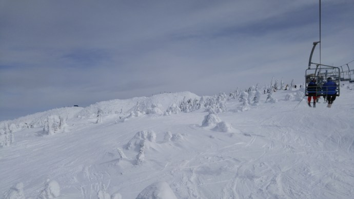
On top of the awesome accommodation, we also had excellent conditions. It was sunny the first day and we had some amazing views. It clouded over in the afternoon and snowed all night and into the next day, so even though we didn’t get the views on the second day, we got some really awesome powder. Big White’s tagline is “It’s the Snow”, and I would have to agree because it had some of the best snow conditions and is the latest in the season that we’ve ever gone skiing.
One of the things I liked most about Big White, which I don’t think has been replicated at any of the other resorts I’ve been to, is that the slopes go right through the ski village. Until I started exploring some of the resorts outside Vancouver, I didn’t realize just how many ski hills there actually are in BC and was surprised to learn that not all of them have villages. This has made it a bit of a struggle when planning our trip in later years because we really want to go somewhere with group accommodations and a fun atmosphere, but sadly some of the resorts just don’t seem to offer much on-mountain accommodation.
But we were located right in the village at Big White and there were several fun places to explore around. We had dinner in the village one evening and made our own meals other nights. It’s always so surreal driving out to the Interior (and really to any of the mountains in the lower mainland) because the conditions change so much on the way out. It was late March, so we didn’t really see any snow on the drive out to Kelowna (except on the Coquihalla) and it was pretty bare most of the drive up to Big White. But it was a huge contrast because the mountain ended up getting so much snow on our second day skiing and overnight, that the drive was totally transformed on the way out. We ended up having to shovel our vehicles out after a pretty heavy dump overnight and the plows were busy running the mountain road down to Kelowna all morning on our way out.
Big White is a huge mountain and has a ton of trails. I took a look at the ski map to jog my memory and I don’t remember it being quite as large as it actually is. I’ve definitely become a better skier since 2016 and I’m wishing I could go back and try out some of their glade runs. Overall the mountain has a nice mix because there are several big chairs running the whole length of the mountain, as well as several smaller chairs just running to the peaks. The Gem Lake Express Chair is quite separate from the rest of the mountain and this is where we spent almost our entire second day doing powder run after powder run.
Overall, we had such a great time at Big White that it inspired us to check out a different mountain every year, and we have our 4th annual trip coming up in a few weeks! Our group has grown and we’ve worked out a lot of the details of the trip down to a pretty precise science and have developed a lot of traditions that we keep going every year. It’s always one of the highlights of my winter season.