Cape Scott and North Coast Trail: Part I

Prior to the pandemic, my friends and I had already decided we were going to take a week off to do a road trip to the Rockies to hike Mount Assiniboine. I booked the sites back in early March and we were all set to go. Then Covid-19 happened and we weren’t sure what would become of the trip. BC Parks re-opened in June and we were thrilled that the trip would still be going ahead, until about 2 weeks before when BC Parks cancelled our reservation with no explanation. I suspect it was cancelled because they weren’t operating the park at full capacity, but we could never track down anyone to get an explanation and we were frustrated that they waited until mid June to cancel the reservation, meaning that we missed out on any opportunity to try and book something different because everything was booked up. So overall, really not impressed with BC Parks, but that seems to be the general consensus with their new booking system this year.

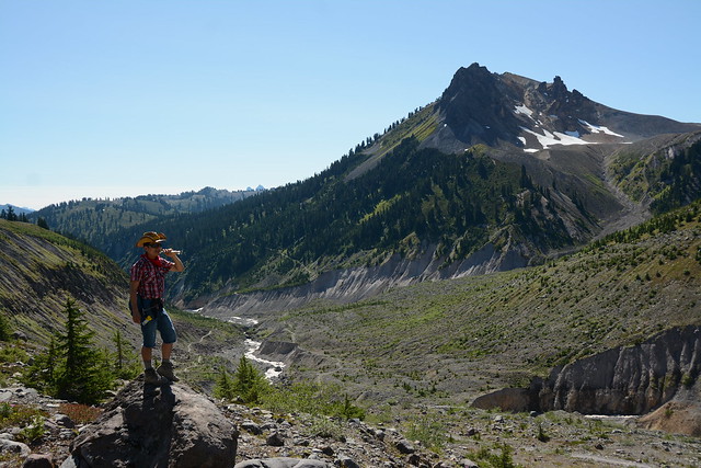
Anyways, we were determined to do something else instead and we landed on the North Coast Trail. Brandon had already done it once and was trying to convince me to do it again with him at the end of the summer, so we decided to move it up to replace our Assiniboine Trip. We managed to work out all the details and spent the first week of July hiking through Cape Scott Provincial Park.

HOP_3754

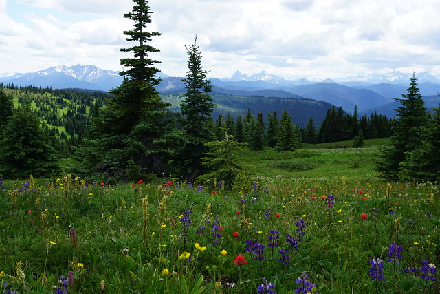
Cape Scott is a super well known and popular park, but the North Coast Trail is a relatively new addition that was added to the park in 2008. It was extended as an extension to the Cape Scott Trail and continues up along the entire North Coast of Vancouver Island. The two trail entrances are at San Josef Bay, which is the main entrance for Cape Scott and lies at the end of a 65km gravel road, and at Shushartie Bay, which is only accessible by water taxi from Port Hardy. Most people hiking the NCT start with the water taxi from Shushartie Bay and hike west, but in our case, the water taxi wasn’t re-opening until July 1 and we wanted to start hiking earlier then that, so we decided to do the trail backwards. There were some benefits to this in that the North Coast Trail is much harder than the Cape Scott Trail and so your pack is lighter by the time you reach the NCT, but overall I would definitely recommend you do it the traditional way. It gives you more time to enjoy the less crowded and more technical NCT. We didn’t realize just how slow we would be on the NCT and slightly underestimated how much time we would need to complete the trail, resulting in a pretty rushed final two days.

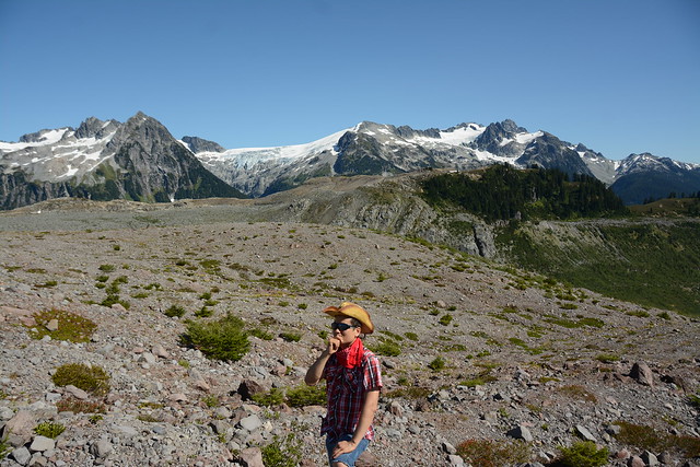
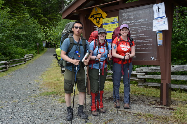
But let’s start from the beginning. My hiking companions on this trip would be Brandon, Emily, and Lien. Me and Brandon have done lots of backpacking together and he has done lots of multi-day trails, including the North Coast Trail. Likewise me and Emily have done lots of backpacking together, including the Juan de Fuca Trail, which was our reference trail for what to expect on the NCT. Lien was our rookie wildcard. We’ve done lots of day hiking together, but the North Coast Trail was a big jump for him and he was super stoked about it!

DSC05941

We spent a lot of time working on our kit list for the trail and me and Emily were determined to keep our pack weight down. I’ve never done a trail longer than 3 nights and this one was going to be 6 nights, so food was a major consideration. We planned to share dinners, but plan our own breakfasts and lunches. Oatmeal and instant mash potato are my go-to’s for breakfast because they’re already dried, so we spent a lot of time dehydrating food for our dinners, lunches, and snacks – I’ll include our meal plan below for anyone interested in what we brought on our 6 day trip. Food is really one of the most important considerations because it will be the heaviest thing in your pack. My food bag weighed in at about 11-12 lbs, resulting in a total pack weight of ~43lbs with water. This was a lot heavier then I wanted (was hoping to ring in around 36-38lbs), but we really only brought the bare minimum and after having completed the trip, there’s not a whole lot I would have changed. The only way I can figure to reduce my pack weight would be with a lighter tent and that costs a lot of money.

We had a packing party at my house before the trip and then took off bright and early on a saturday morning to catch the ferry to Nanaimo. It was the first weekend after the Phase 3 re-opening, so it was pretty bumping at the ferry terminal. We spent the boat ride napping in the cars and then hit the road for the 4 hour drive to Port Hardy. It went by relatively quickly and we met up with some of Brandon’s friends in Port Hardy for an early dinner. By the time we hit the road again, it was around 4:30pm, which left 90 mins for the drive to the trailhead and enough time to hike an hour in to San Josef Bay to camp for the first night.

It was an admirable plan, but unfortunately it was quickly derailed. The road to San Jo is all dirt and gravel. As far as gravel roads go, I didn’t think it was that bad and have definitely driven on a lot worse. But it seems that the road had recently been graded and the grader had not been back out to remove all the larger rocks from the road. About 30km in Brandon’s tire pressure dropped all of sudden and we got out to discover we had a very flat tire. We didn’t feel any bumps and didn’t seem to have hit a pothole, so all we can figure is a very sharp rock must have punctured the tire. It was a bad flat, but no problem for Brandon who lives for off-roading and has a full spare tire in his 4runner.

DSC05918

Over the past few years I’ve had quite a lot of bad luck with flat tires. Me and Carolyn went out to Sloquet hot spring one year and the guy we were driving with got a flat on the way back and didn’t have the lug nut key for his tires – so we ended up having to abandon the truck on the service road for a tow. I joked when we got out that Brandon better have the right lug nut key for his tires and he reassured me he wasn’t so fool-hardy. But wouldn’t you know, while Brandon’s a pro, his mechanic is not. He had the car serviced just before the trip and the mechanic had put a very slightly different version of Brandon’s lug nuts on the tires. They were the same shape, but Brandon’s key had a curved edge, while the lug nuts had a pointed edge. The key didn’t work and for the second time I found myself stranded on a forestry road with a flat tire that should have been an easy fix.

Brandon really beat himself up about it, though none of the rest of us found any fault with him since it should have been an easy fix. Fortunately another car drove by just as we were having this realization and we asked them to call a mechanic or a tow for us (there was no cell service on the road). They took some notes before offering to take one of us back to Port Hardy with them, which was very kind, especially during Covid, so I jumped in the back with them. They dropped me at Lien’s car, which we had left at the end point, and I got on the phone to BCAA immediately to try and find a solution. Ideally we just needed someone with the master set of lug nut keys, but it was 6pm on a saturday night in a tiny town, so our options were pretty limited. Almost everything was closed and it was an hour and a half before BCAA finally found a tow truck that was willing to come get the car the next morning. The only problem of course was that it was going to cost an arm and a leg to get a tow truck up the service road. Either way, the car wasn’t going anywhere that night, so I headed back up the road in Lien’s car to pick everyone up.

DSC05929

Just before this trip I invested in an InReach so that I could get emergency assistance on the trail if needed, and I have to say that as expensive as it was, it was worth every penny. I left the inreach with Emily when I went back to Port Hardy, so I was at least able to communicate with them while I was away. They ended up sitting on the service road for 4 hours before I finally returned, so I can only imagine how bored they all were. Apparently they tried flagging down every car that passed in an attempt to find a matching lug key! The ride back to them was the most intense part for me though because it was dusk and if I broke down, I really had no way to communicate with anyone. So I took my time and fortunately made it back to them without incident. There happened to be a rec site about 2 kms down the road, so we ended up just crashing there for the night since there wasn’t anything else we could do for Brandon’s car.

The next morning we got up early and went straight back to Port Hardy. Everything was still listed as closed until Monday, but we decided to try our chances. The tow truck said it could go out later that morning, but in the meantime we called around to any mechanic we could find. Eventually one mechanic told us to drive over to the OK Tire, which has an emergency number listed on the door. We had gathered OK Tire was our best bet at getting the tire off, but they weren’t open until Tuesday, so our original plan had been to get it towed to the OK Tire and leave it there and drive Lien’s car out. Fortunately, the emergency line came through and the nicest mechanic came and met us to save our asses. He found a bunch of similar keys and then drove back out to the car with Brandon where they finally got the nuts off and replaced the tire. In the meantime, the rest of us chilled in Port Hardy and spent some time soaking in the sun along the waterfront. It wasn’t quite what we pictured for our first day, but the weather was gorgeous, so we made the best of it.

IMG_0330

Brandon made it back in no time and by noon, he had a full spare tire replaced and we were back on the road to San Jo. This time we made it the full hour and a half without incident. The trailhead was absolutely hopping when we finally rolled in. There were a ton of people day tripping to San Josef Bay, as well as a bunch of people backpacking to Cape Scott. There were a few people doing the whole NCT like us, but they were few and far between and we didn’t meet any of them until later in the trip. The way the trail is, there’s a 2km off-shoot to San Jo Bay. We were sad to have to skip it, but we planned to stay there at the end when we returned for Brandon’s car. We had a quick lunch in the parking lot and then started the trail around 2pm, skiping San Jo and heading up towards Cape Scott.

Had we starting hiking in the morning, we probably would have been aiming to make it to Nel’s Bight, a super popular beach about 17km in. Brandon was still super optimistic we could make it to Nel’s Bight, but me and Emily were a little more realistic. The mud started almost as soon as we started hiking (as expected), but otherwise the trail wasn’t too bad. It was a little technical, but there was limited elevation gain and we made a pretty good pace along the trail. The first campsite is Eric Lake at 3km. We had lots of jokes about Eric Lake because Lien had tried to hike to Cape Scott about 10 years ago and had never made it past Eric Lake because his party was so unprepared. So we kept joking that we were going to leave him there and that he was the reason we’d never made it to San Jo Bay, because he was cursed.

DSC05962

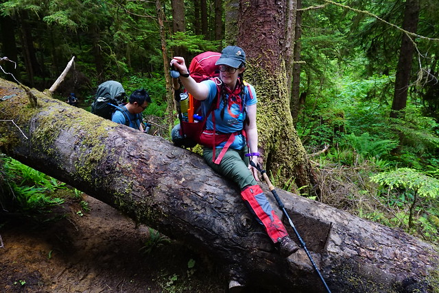
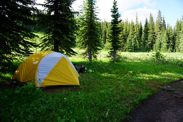
Eric Lake sounds like a nice place, but there was really no lake access and the whole campsite was in the trees and very buggy. I was glad we weren’t staying there and we continued on. Eventually we rolled into Fisherman River around 6pm. The whole first part of the trail is straight north and inland towards the coast. So we didn’t see any coastline on our first day. I’m not sure if Fisherman River is an official campsite, it has an outhouse and bear cache, but only has 2 tent pads. We were about 9km in (of the desired 17km) and we all knew it was unrealistic to try and go any further, so we were thrilled to find both tent pads empty. There’s really not much room to camp outside of the tent pads and we were concerned about there being room for us. 2 other groups did show up afterwards and managed to squeeze in along the river and on the side of the bushes. It wasn’t a beautiful beach, but we had an enjoyable evening cooking along the river. Brandon made his infamous thai chicken curry and we had a lazy evening recovering from the first day.

I think that’s enough for one blog post, more to come in Part II!


Maria’s Meal Plan

.             Breakfast                            Lunch                                      Supper
Day 1     Potato and bacon bits       Egg salad wrap                       Brandon’s thai chicken curry
Day 2     Oatmeal and trail mix        Egg salad wrap                       Lien’s dehydrated chili
Day 3     Potato and bacon bits       Salami and cheese wrap         Emily’s dehydrated veggie pasta
Day 4     Oatmeal and trail mix        Salami and cheese wrap         Maria’s dehydrated chickpea curry
Day 5     Potato and bacon bits       Salami and cheese wrap         Emily’s thai PB pasta and Brandon’s Paella
Day 6     Oatmeal and trail mix        PB and jam wrap

Snacks: Fig bars, kind bars, apple chips, banana chips, energy bites, fruit leather, granola, trail mix, chocolate

IMG_0347

Elfin Lakes Backpacking Trip

Now that I’ve finished my Manning Park mini-series, I decided to write about my first backpacking trip to Elfin Lakes. I’ve hiked to Elfin Lakes 4 times and camped there 3 times, but my first trip stands out as my favourite trip up to the lakes.

It was the Labour Day long weekend in 2017. I really wanted to do a fun backpacking trip for the whole weekend, but everyone seemed to have other weekend plans and no one would commit to hike up there with me for 3 days. To this day, I’m not really sure how I managed it, but somehow I convinced Brandon, Karen, and Grant to rotate up there with me. Karen is my oldest friend – she likes coming on day hikes with me and has done some backpacking in the past, but is a little more nervous about venturing into the backcountry. But Grant was enthusiastic about it, so I convinced the two of the them to hike up with me and stay for Saturday night. I have tons of extra gear, so Karen agreed to borrow some and give it a try. I still can’t quite believe I got them to come up with me, but they did and we had a great time!

20170902_130115

Before we left, I desperately wanted them to have a good time so they’d come out again with me in the future, so I loaded my pack up pretty heavy, gave Grant the pot and stove, and pretty much left Karen to just carry her personal gear. It’s an 11km hike up to Elfin Lakes, which is definitely a bit on the longer side for some hikes. The elevation gain is pretty reasonable spread over the 11km, but it is still a steady climb for most of the trail and it was a really hot day. The first part of the trail is 5km along an old service road. It’s not the most scenic, so it can be a bit of a slog to hike over. But everyone survived and we stopped for lunch at the Heather Hut.

From there things got fun. We continued on along the rest of the trail, which is incredibly scenic as it travels further into Garibaldi Park. Karen was pretty beat out towards the end, but she still did the whole hike no problem! So Karen, please remember, you are your own worst critic when it comes to outdoor activities and you are awesome. Pretty please come backpacking with me again some day!

20170903_091157

Elfin Lakes has one of my favourite campgrounds, which is probably why I keep going back. I’ve camped there 3 times, but I’ve still yet to sleep in the hut. There’s 50 tent pads running along the hillside meadow and they provide a truly epic view out towards the rest of the park and the surrounding mountains. We set up my 3 person tent, which was definitely cozy for 3 people, and dipped into Karen’s massive snack stash. She had every kind of snack you can imagine, so long as it had chocolate. Her trail mix was basically just a chocolate smorgasbord with the occasional nut thrown in – not a bad decision in my opinion!

We wasted away the afternoon lounging on the tent pad and went for a swim in the lake. Elfin Lakes is completely fed by snowmelt and rainwater, but it’s pretty shallow, so by the end of August, it was actually really warm. I made fettucine alfredo for dinner because it is Karen’s favourite meal – I had to use powdered milk, but it actually turned out surprisingly well! It’s the only time I’ve gotten to make it in the backcountry because Emily and Carolyn don’t like dairy and Brandon always makes thai curry chicken. We enjoyed watching the sun set over the mountains and looking at all the stars that came out on what was an awesome cloudless night. I tried to convince Karen that we should sleep with the fly off to look at the stars, but she was worried about getting cold, so we left it on and did our best to get some sleep with 3 people crammed in the tent.

20170902_191143_HDR

The downside of leaving the fly on is that it creates a bit of a greenhouse effect when the sun does finally peak over the mountains in the morning. So it got pretty hot in the tent pretty fast, which was successful in getting us out of bed in the morning. The plan for Sunday was for Karen and Grant to pack up and head back down to the car and for Brandon to drive out early that morning and meet me at the lake for noon. Karen and Grant had an even easier hike out because Karen got to leave some of her borrowed sleeping gear behind for Brandon so that he could hike up faster and Grant got to leave the cookware behind. So with his sleeping pad, tent, and all the cooking supplies already at the campsite, Brandon had a pretty empty pack on the way up. I had just told him he had to bring up our supper.

Karen and Grant expected to see Brandon on the way down, but they must have missed him when they took a break in the Heather Hut, because they never did see each other. Brandon had a late start leaving Vancouver, but he somehow hiked up the entire trail in just 2 hours and still met me right at noon at the lake! I had a very lazy morning, went for another swim and did some reading while I waited for Brandon. I made lunch in time for his arrival and we quickly ate our wraps and hit the trail again for a day hike.

HOP_6335

Brandon is truly a machine. He hiked 11km that morning just so he could meet me to continue hiking. We both really wanted to go to Mamquam Lake – admittedly, noon was a bit late to be leaving for Mamquam, which is another 22km round trip from Elfin lakes, but we decided to try it anyways and set off with a good spring in our step.

Unsurprisingly, we never made it to Mamquam. It’s usually cooler in the mountains and it was the first weekend in September, so we weren’t expecting such hot weather. It ended up being somewhere between 30-35 degrees during the afternoon. That’s too hot for hiking on any day, but it felt even worse on the trail to Mamquam, which is extremely dry and dusty and is completely open. There’s no shade to be found anywhere on the trail and as we started to climb up the switchbacks on our way up Opal Cone, it was pretty exhausting. It’s still a beautiful hike, but we felt pretty small as we crawled our way up and around the cone.

HOP_6327

After Opal Cone, you descend down into a bit of a crater. There’s a small lake from melting snow, but it feels a bit other worldly as you walk across all that barreness. We continued walking across the sweltering alpine desert, but when we reached a sign that said it was still 4km to Mamquam Lake, we finally decided to admit defeat. I’m sure Brandon would have continued on – lots of times he encourages me to push myself further on the hikes we do – but sometimes he also needs for me to be the voice of reason. 4km didn’t sound like that much more, but with the round trip it would be another 8km. If we turned around now, it would still be a 27km hiking day for Brandon and 16km for me. At the time I was breaking in a new pair of backpacking boots and I feared we’d just be getting ourselves into trouble to push forward in the blinding heat. Plus I really wanted to swim in the lakes once more and if we kept going it would be too late by the time we got back – though in retrospect, I could also have swam in Mamquam.

HOP_6345

Anyways, we decided to call it there, took a break to have some snacks, and then turned back. My only regret is that we went straight back and never finished Opal Cone by going up the short side trail to the summit. So I definitely still need to go back some day and go the whole way to Mamquam.

We had a bit of a debacle on the way back though. We were hiking around the edge of the cone heading back towards the switchbacks when Brandon decided it was time for a pee break. I continued on along the trail to give him some privacy, but when I reached the end of the first switchback, I decided to wait for him. It was still a pretty busy day on the trail, so I waited at the end of the switchback while people passed me. After a while I started to wonder what was taking so long and where Brandon was. I’d been waiting around for the better part of 15-20 minutes and he hadn’t shown up. Brandon always hikes in a cowboy hat and bandana, so he’s pretty easy to recognize on the trail. So I started asking everyone coming down if they’d passed an Asian cowboy at any point in the last 10 minutes and consistently got the answer no. I’m a bit high strung on a good day, so this was when I started to panic a little bit.

HOP_6362

It’s a pretty steep trail, so I was worried that with so many people on the trail, Brandon had tried to go too far into the trees and had fallen. I headed back the direction I’d just come, calling for him and trying to listen for his whistle. I walked all the way back to where he’d stopped to pee and there was no sign of him, which was when I really started to panic. At this point we were like 18km into the wilderness and I had no way to call for help. I started heading back towards the switchbacks again and as I passed people coming up, I finally got some answers.

Turns out when he was trying to catch up with me, Brandon found a little shortcut past the first switchback and while I’d been waiting for him at the first switchback, he’d been further down waiting for me at the second switchback. When the people I’d talked to saw him as they continued down, they immediately recognized his cowboy hat and told him I was further back looking for him. He started climbing back up to me at the same time I turned back to go look for him and when I finally switched directions again, I had someone stop me and reassure me that my “cowboy” was fine and he was coming back up for me. We were soon reunited, but it ended up being about a half hour that we were separated and it really struck home how easy it is to get in trouble in the backcountry. One little misunderstanding resulted in a lot of confusion for both of us. So we agreed no more shortcuts in the future unless we attempt them together.

HOP_6418

We made it back to the campsite shortly before 5pm and had just enough time to go for a dip in the lake before it started to cool off again. It felt great to wash all the dust and sweat off after a long day of hiking in the dry sun. Brandon made his infamous thai chicken curry and we ate while watching the sun set over the mountain. We were a bit giddy after our long day of hiking, so we decided to stay up and take star photos. I’ve mentioned before that I prefer taking photos on my camera to my cell phone and since 2012 I’ve been using a Sony compact system camera. When I bought it in 2012, there weren’t very few mirrorless cameras on the market, but I picked it because it was kind of like owning a lightweight DSLR camera. Now Brandon actually has a DSLR and I would never debate that his takes better photos than my mirrorless, but I’ve generally been satisfied with my Sony.

At the time though, I’d broken my camera just a few weeks earlier when I was hiking in Newfoundland (banged it off one too many rocks), so I didn’t have any camera (hence the dicey quality of the first few pictures in this post – the rest are credited to Brandon). But I was anxious to learn about star photos, so we messed around for a few hours with Brandon’s camera. It was another cloudless night of course, so it wasn’t hard to convince Brandon to sleep with the fly off. That was my first time sleeping with the fly off – I’ve done it several times since then, but Elfin Lakes is still my favourite. So we fell asleep gazing at the stars and ended up sleeping quite late in the morning without the ‘fly sauna’ to wake us up when the sun came up.

HOP_6458

By the time we did crawl out of our tent, half of the tent pads had emptied and people had already packed up and left. We took our time over breakfast and packing up our gear before finally leaving to hike back down. We split the gear evenly on the way back, so it was a much easier hike than on the way up. We hiked down pretty fast and were relieved when we could finally jump in Brandon’s 4Runner and blast the AC for the rest of the car ride home!

Backpacking the Heather Trail

Continuing on with my mini-series on Manning Park, in 2018, 2 years after first being inspired by 3 Brothers Mountain, I returned to hike the full Heather Trail. Manning Park is filled with dozens of awesome mountain trails, but (dare I say) the Heather Trail is one of the most popular. It’s a 21km trail the starts at the top of Blackwell Road, runs past 1st, 2nd, 3rd, and 4th Brother Mountains, and continues through many kilometers of scenic alpine meadows to Kicking Horse Camp and Nicomen Lake. In the height of the summer, you can find every colour imaginable of alpine wildflower scattered along this trail.

DSC05780

In 2018, I finally took 3 days to hike the Heather Trail with my good hiking buddy, Carolyn. One of the reasons the hike is so popular (I imagine) is because it starts at the top of Blackwell Road, which is one of the few public roads going right up into the alpine, so it saves you from having to hike much elevation gain. I believe most people hike the 21km in to Nicomen Lake and then hike all the way back, but me and Carolyn decided to drive 2 cars out and added an extra 17.5km onto our hike to make it a through hike down to the highway and Cayuse Flats parking lot.

We took Friday off and dropped my car at Cayuse Flats and then started our hike from the Blackwall parking lot shortly after noon. I was dogsitting my friends black retriever, Alfie, at the time, so we had the added excitement of taking a dog with us along the trail. The view from the parking lot is already beautiful and showcases the surrounding mountains, so from the parking lot, we started hiking down into the woods for about 4 kilometres before arriving at the first backcountry campsite, Buckhorn Camp. We skipped this one and continued on towards our destination, which was Kicking Horse Campsite, located at kilometre 12.

DSC05809

From Buckhorn Camp, the trail gets super scenic. You hike back up into the alpine meadows and from there, you continue along the ridge to First Brother Mountain. There are incredible views of all the surrounding mountains, and though the wildflowers were a little late this year, we did spot a few starting to bloom. The nice thing about the trail is that once you hike back up from the first campsite, there’s very little elevation gain or loss for the rest of the trail (with the exception of First Brother Mountain).

Me and Carolyn aren’t ones for too many breaks, so we pretty much powered through the first 9km to the base of the First Brother Peak. From there we abandoned our packs for a little side hike up the First Brother. Like I said, I’ve done this one before, but it was no less breathtaking the second time. It starts with a steep ascent up the side of the mountain before flattening off again along the ridge to the peak. The mountain drops out from under you on both sides, so it makes for a narrow, but scenic walk up to the peak.

DSC05851

It’s a little steep, so we tried to tie Alfie to a tree for the last couple hundred metres, but he’s part retriever, part border collie, so his herding instinct started to go bananas as soon as we started to walk away from him. We were honestly worried he was going to pull off his leash in his anxiety to stay close to us. I told Carolyn to go ahead without me, but even that was too stressful for Alfie, so he did accompany us (slowly) to the top of the mountain. Honestly, he was totally fine with the rocks, it was me that was the nervous one.

We all survived the hike to the top, so after that we continued our hike to Kicking Horse Campsite. This was all new terrain for me and it was rolling meadows as far as we could see. We weren’t particularly worried about the campsite being busy because we had taken Friday off work, but a group of about 8 boys caught up to us mid-hike, so we kept just ahead of them for the last few kilometres to beat them to the campsite.

DSC05849

Our haste was wasted though, because even though we had barely seen anyone on the trail, everyone had apparently beaten us to the campsite and all the tent pads were taken when we arrived. So I can only imagine what this campsite must be like on a weekend, especially when the wildflowers are in bloom. But no fear, we don’t like tent pads anyways (they’re hard and uncomfortable), so we found a nice empty patch away from the crowds to set up our tent.

It was probably around 6 or 6:30pm by the time we rolled into camp, so we mostly just set up camp and had our supper before hitting the sack. We weren’t sure how many people were heading to Nicomen Lake in the morning, so we wanted to get a head start nice and early. It was also pretty cold, so we layered up and cocooned into our sleeping bags for the night. It actually dropped below zero in the night because when I got up to pee Alfie’s water bowl had completely frozen solid and everything had frost on it when we got up in the morning.

DSC05874 (2)

We’d picked a stellar spot though because as soon as the sun made it up over the mountains, it was shining directly on our tent. There’s nothing I love more than being able to pack up a dry tent! We had a quick breakfast, took down camp, and then started on our way to tackle the 9km to Nicomen Lake.

The hike to Nicomen Lake is just as scenic as the rest of the trail. We hiked through meadow after meadow until we finally hit the ridge before Nicomen Lake. From the top of the ridge, we could see Nicomen Lake and started our descent towards it. We were momentarily distracted by a helicopter transporting a supply load via cable down to the campsite and a couple we passed in the opposite direction informed us they were doing some campsite maintenance at the trail.

DSC05818

We had no worries about campsites this time. We were the first people to make it to the lake and arrived around 12:30pm. This time, the tent pads were all taken up by the maintenance crew, but we found an awesome sandy spot right next to the lake to pitch our tent. Nicomen Lake is incredible beautiful, the only problem is the bugs…

We’ve never arrived at a campsite as early as noon before, so we were honestly at a bit of a loss for what to do. It would have been lovely to lie next to the lake all day, but the amount of mosquitoes made it a bit torturous. We had lunch, took a little nap, went for a swim, and played fetch with Alfie. Eventually we decided to go for a little mini hike to explore the area to keep moving to avoid the flies. It was a really lazy afternoon and I got in a fair bit of reading, but by nighttime the campsite had completely changed and gotten very busy. Some of the people from Kicking Horse showed up, along with a huge crowd of others who had hiked the entire 21km that day.

DSC06019

We had supper and then made it a pretty early night. We got hit with a small bit of rain in the evening, but it only lasted about 15-20 minutes and the clouds cleared out again pretty quickly. We had a beautiful view of the lake and I wanted to try my hand at some night photography, so I turned my midnight pee break into a bit of a photo shoot and got some really awesome shots of the stars and the milky way!

We kind of forgot that our last day was going to involve a whopping 17.5km, so we decided to get up really early again because we really had no idea how long it would take and neither of us wanted to be too late getting home on Sunday. We also knew the last day wasn’t going to be scenic (all forest trails), but it was actually a bit of a relief because it was scorching hot on Sunday and the trees provided a nice buffer from the sun.

DSC06030

We totally killed the last 17.5km and exited the trail ~5 hours after we left the campsite. The trail out comprises of 2 hiking trails, the Grainger Creek Tail and the Hope Pass Trail. The Grainger Creek Trail was mostly switchbacks (although very gentle ones) that undid most of the elevation we had driven up. It ended at Grainger Creek horse camp, where we stopped for our only break, before rejoining the Hope Pass Trail to Cayuse Flats. The Hope Pass Trail has a lot of history because it was originally used as a wagon trail during the gold rush in the mid 1800’s. So it was a very nice wide trail the rest of the way down.

DSC06048

There was one challenging spot about 100m before the parking lot. There was a pretty high flowing river with two trees down over it that were the only way to cross. I’m not really afraid of heights, but I hate crossing on narrow trees with my backpack, so we had to butt-scootch our way along the tree. The real problem was getting Alfie across. I was worried about letting him go over the tree, so we spent forever trying to find somewhere for him to ford the river, but another guy and his dog eventually caught up with us and his dog had no problem crossing the fallen tree, so I let Alfie go across it too and he totally had no problem. So again, it was just me being a worry wart.

And that pretty much concluded our adventures on the Heather Trail. From the river it was a short walk back to the parking lot. It’s a pain having to drive all the way back into the park to pick up the second car at Blackwell peak (easy way to kill 2 hours). But the trail was just a scenic as expected and I had a great time exploring it!

DSC05863
DSC05918
IMG-20180731-WA0004