A Beginner’s Guide to Backpacking

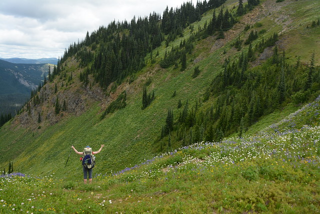
Would you like to get into backpacking, but don’t know where to start? Whether you’re new to hiking or an avid hiker, it can be challenging to make the transition to backpacking. It can be hard to know where to go, what to bring, and how to stay safe. This Guide is meant to be a high level support to link you to other resources, help you assess your skills, and safely plan for your first overnight hike.

The backcountry can be a dangerous place. It can be easy to become lost, injured, or susceptible to adverse weather, and without the proper preparedness, sometimes one mistake can unfortunately prove to be fatal. I don’t think we need to be afraid of the backcountry, but I do advocate for smart planning to mitigate as many risks as possible up front.

I am not an expert on backpacking. I have done a lot of backpacking near the lower mainland and I am a Outdoor Adventure Trip Lead with Girl Guides Canada, so I focus a lot of risk management and preparedness in the backcountry.

IMG_4814

Assessing Your Skills

Before heading into the backcountry, I think it’s important to understand what skills you have and what skills you may need to supplement. Are you an experienced hiker? Are you comfortable on more challenging terrain? Do you have any special training such as first aid or avalanche safety? Do you have access to all the essentials? Are you good at map and GPS reading? Do you know what to do if you run into trouble?

It’s important to have a good sense of awareness of your own body and to listen to it. It’s easy to get into trouble if you push your body too far or don’t recognize signs of stress. If you haven’t done much hiking, always start small to understand your limitations. Stop when you need a break, you are tired, the terrain looks dangerous, it’s too hot, etc. One of the most challenging decisions is accepting that you should turn around and not expose yourself to additional risk. Once you’ve started something, the inclination is always to push forward, because you’ve sunk time and energy into getting this far. But if the weather conditions are not right or your body is not feeling it, you should always feel empowered to stop for any reason.

Picking a Trail

Deciding where you want to go will help you plan appropriately for the rest of your trip. Once you’ve assessed your skills, you should have a better idea of what kind of trail you may want to do. Here’s some questions to ask yourself:

  • How far a distance do I want to hike?
  • Am I okay with hiking uphill, or do I prefer a flatter hike?
  • Do I want access to facilities like an outhouse, bear cache, tent pads, cooking shelter, etc?
  • How far am I willing to drive?
  • Can my vehicle safely access the trail?

For new backpackers, I recommend starting with shorter trails that aren’t too steep. AllTrails is a great resource to research hikes, so look for trails under ~6-10km and with elevation gain of no more than 200-400 metres. The shorter the hike and the greater the elevation gain, the steeper it will be. As a rule of thumb, keep the elevation gain under 10% grade (100m of gain over 1km). I also recommend selecting campgrounds that have outhouses and bear caches. Unless you already know how to dig a proper cathole, or you have a bear cannister, it’s much less stressful if you have access to these facilities. A cooking shelter can also be a great resource if the weather is not good because it will help you to stay dry without needing to set up a tarp. Do as much as possible to make your first trip easy because it can be overwhelming trying to learn too many new skills as once. Next week I’ll be posting some of my recommended hikes for beginners near Vancouver.

PSX_20220818_214003

Packing the Essentials

Backpacking is a balancing act between making sure you have everything you need to survive and trying to keep your pack light for physical comfort. It’s likely you will have a pretty heavy pack on your first trip because lightweight gear is expensive and you won’t have a good sense of what you really need versus what you can manage without. First time backpackers often bring way too much clothes, make sure you have warm and waterproof layers, but leave the extras at home. Embrace being smelly and just wear the same clothes for multiple days.

While there’s some things you can do without, you can’t compromise on your 10 essentials. I have a whole other blog post on Personal Safety and the 10 essentials and you can get more information from North Shore Rescue. Make sure you have all the essentials with you.
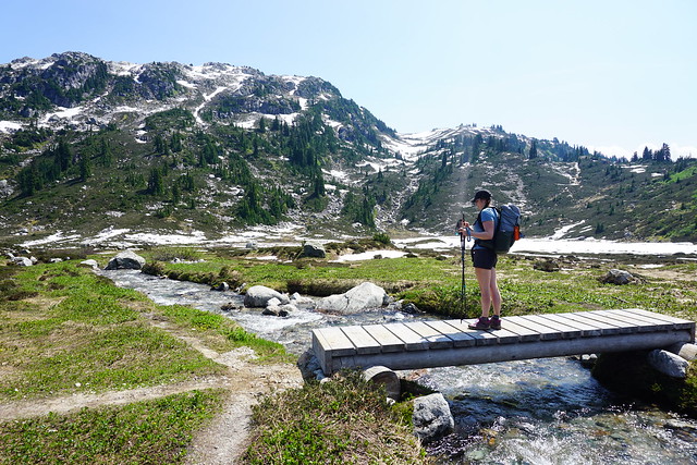
Safety

One of the most important things to do before heading into the wilderness is to leave a trip plan and have a plan for how you will manage problems on the trail. Your trip plan should include details on where you are going and when you are expected to return, and should be left with someone you trust to call 911 if you do not return. AdventureSmart is a great resource for creating a trip plan. Some other things to consider for safety:

  • Assess your first aid knowledge. Are you carrying a first aid kit and do you know what to do if you become injured?
  • Assess your navigation skills. Are you confident reading maps and GPS? Are you carrying an extra battery for your phone/GPS? Will your GPS app work offline?
  • Assess the ease of communication. Do you know if you will have service on this hike? Do you have a satellite device in case of emergency? If not, are you traveling with other people who can help in an emergency, or on a crowded trail where you can seek help from others?

If you become lost or injured, always stop right away and call 911. Don’t call a friend, partner, or parent. 911 calls will go through on any network available and are traceable. If cell service is unreliable, don’t waste what might be your only call on someone who can’t trace you or meaningfully help you. I have written extensively about trip plans, navigation, and communication in my blog post on Personal Safety, as well as I have a blog post dedicated to First Aid and preparation.

DSC09647

Camping Permits and Reservations

Now that we’ve talked about the scary safety preparedness implications, let’s talk about some of the more practical preparation you can do. Camping permits and reservations can be really confusing, but are necessary for most campsites. There is a lot of camping you can do on crown land, but I recommend parks where possible because they have more infrastructure dedicated to visitors. It’s important to respect the natural landscape in which we’re recreating. Everyone makes mistakes starting out, so it’s easier to limit your impact when camping in parks with access to toilets, grey water disposal, bear caches, etc.

If you’re camping in a provincial park, you will need a permit or reservation. Both can be booked online at camping.bcparks.ca. Reservations are only required in popular parks where they are trying to manage overcrowding. A reservation guarantees you a campsite, but not a specific site. For example, Elfin Lakes has 50 tent pads, so they release 50 reservations and you can pick any available tent pad when you arrive. Reservations are available for Garibaldi Park, Joffre Lakes, Manning Park, Berg Lake, and Assiniboine. They release 4 months in advance of your desired date, so if you want to camp on Aug. 15, you must reserve your campsite at 7am on Apr. 15. These typically cost $10 per person, per night, with a $6 reservation fee.

All other parks require only a backcountry permit. Permits are available 2 weeks before your desired date, but there is no limit on the number of permits sold, so you can wait until the evening before your trip to purchase it. There is no guarantee of a site with a backcountry permit, it’s simply first-come-first-serve at the campground when selecting a site. These typically cost $5 per person, per night.

Camping Equipment

Your essentials likely will only account for a portion of what you actually want to bring in your pack. Equipment can be really overwhelming when you first start backpacking because gear is really expensive. On your first trip, borrow as much as you can and accept that you’re not going to have all the best gear and that you will likely have a heavy pack. I have a gear guide dedicated to talking about camping equipment. My piece of advice would be to start with investing in a quality sleeping bag, something both warm and lightweight, and then move on to other gear later. I have also shared a packing list from the 10-day trip I did on the Sunshine Coast Trail.

HOP_6458

Food Planning

Food planning can be very stressful or very easy. If you want it to be easy on your first trip, just purchase backpacking meals at any outdoor store. They are expensive, but they are simple because they only require boiling water.

If you want to save money, I have written a 3-part series on cheap and easy meals to eat in the backcountry (no dehydration required):

If you want to get into the exciting world of dehydrating your own meals, of which I am a huge fan, I’ve written another 3-part series on easy dehydrated meals:

DSC08950

Leave No Trace

If you are recreating in the backcountry, you have a responsibility to leave it the same or better than you found it. This means, take all your garbage, including your toilet paper; stay on trails, even if it means walking through mud; filter your grey water to keep food waste out of the streams and lakes; don’t harm the natural environment scavenging for firewood or take anything natural back with you; respect wildlife and be considerate of other people. Check out Leave No Trace Canada for more information.

Other Considerations

A few other things to be aware of:

  • Practice bear safety. Cook away from your tent; keep everything that smells in a bear cache, including sunscreen and toiletries; pick up all crumbs; and make noise while hiking.
  • Protect your water sources. Filter or treat your drinking water and get water from moving sources, upstream of where people are swimming or washing dishes.
  • Always prepare for the weather. Mountain weather is unpredictable, always be prepared for rain and cold conditions. Turn back if necessary.

Check back next week for a list of recommended overnight hikes for beginners!

HOP_6069

Torres del Paine Backpacking Trip Part IV

Continued from Part I, II, and III. The O-trek can only be hiked in the counterclockwise direction. I thought this was the case for the W-trek as well, but I learned that lots of people hike it clockwise, meaning they start their trip with the towers. I’m really glad we started from Paine Grande, because it meant that we reached the towers on our last day, which is a high note on which to end the trip!

Hiking to the Towers for sunrise requires a very early rise. I wanted to be hiking by 4am, so we got up at 3:30am and the campsite was already bustling with other campers and day hikers. I know a lot of hikers weren’t able to get a reservation for Chileno, so it’s not uncommon for people to hike all the way from the Campsite at Centrale to see the sunrise. Many of the day hikers were taking a break at the picnic table before continuing up to the towers.

Seth is definitely not a sunrise hiker, but I was pretty much buzzing with excitement all night about how fortunate we were to experience the towers on a cloudless day. It was pitch dark when we set out; I carried our shared pack and thanks to our early start, we were able to move at a leisurely place. It’s not the most fun to hike in the dark, but I honestly have some really fond memories from this hike. The night sky was incredible and it felt really special and romantic to hike up a mountain by starlight.

20240304_065344
20240304_074737

The first two kilometres are mostly in the trees and aren’t too steep. Eventually you reach a junction where the ranger station and outhouse are located, and from there, it’s all uphill. It was steep, but honestly, I found it easier than at Lago de los Tres. The main downside is that the trail is incredibly busy. It kind of felt like we were on a pilgrimage with hundreds of other hikers all following the same route (like the many hikers who had come before us).

The trail gets a little confusing just before the towers. You reach a certain point where you can start to see the peaks rising out of the darkness (it’s magical!), and I think people get overexcited and start climbing the rocks directly towards them. It’s a big boulder field, but you’re supposed to follow the trail, as some sections are roped off for safety reasons. I had to focus on following the trail markers rather than the people and we made it to the top with lots of time to spare.

PSX_20240316_194531
PSX_20240408_100139

It was very busy at the lake, but there is a lot of room to spread out. Unfortunately, a lot of people were ignoring the roped sections, but we stuck to the sanctioned area. We found a nice place near the water and sat in the dark to wait for sunrise.

Similar to Lago de los Tres, once you start hiking, it’s freezing! I took off my sweaty clothes and put on every other layer I’d brought with me. You’re not allowed to cook in the park, so we couldn’t bring our pot to make breakfast and ate some protein bars instead. I was so cold I decided to finally test out my emergency bivvy, which I’ve never used. It definitely helped trap a lot of heat, but it has its limitations, so it was a good reminder that it would be a long cold night if I ever have to survive outside with only a bivvy.

Finally, the sun started rising on the other horizon. At first, the daylight only illuminates the towers, but once the sun comes up, they turn a very vibrant orange. It lasts for around 30 minutes and it was every bit as magical as I hoped it would be! I felt so content sitting there watching it. I feel like there’s always one thing you miss on a big hike – either you skip a summit, or the weather is bad – but I felt like I got to experience everything that I wanted in Torres del Paine, and I left the park feeling very content.

20240304_073822
PSX_20240408_095825

Once the sun fully came up, most people left the lake and it was pretty empty. We hung around for a while longer, taking more photos and warming up. The sun makes a huge difference in the temperature and we layered down before starting our hike back. I didn’t want to feel rushed at the towers on our last day, so I had booked the last bus on the day, which didn’t leave until 8pm. This was definitely a mistake as we ended up spending 4 hours at the visitor centre, but it made for a more leisurely day.

We hiked back down to Chileno, past a steady stream of hikers still coming up, and had our breakfast at the campsite. We hung out for a bit, chatting with some other hikers, before starting our hike out of the park around noon. From Chileno, you do have to hike back up the canyon to Windy Pass, but it’s only ~1km and then it’s all downhill for the rest of the day. At this point, most people who were doing the towers were already beyond Windy Pass, so it was a pretty empty trail down to the base.

20240304_090025
20240304_124016

It was the hottest day on the trek and we switched out to shorts and t-shirts for the first time! The hike to Centrale is gorgeous as you continue back down the valley. The trail is completely exposed, so you have views the entire way. From Chileno to the towers and back to the base is ~15km, but we were fast on the last section.

There’s a huge hotel at the trailhead and then you walk another kilometer parallel to the road to get to Centrale Campground and the Visitor Centre. From there, you take a shuttle bus to the Park Entrance, where you can catch your bus back to Puerto Natales. We debated trying to get an earlier bus, but apparently they only leave at like 3pm and 8pm. We just missed the 3pm shuttle, so we decided to stick around the Visitor Centre and got beer and empanadas to pass the time.

It was a long time to hang around, but we befriended some other hikers who were also killing time before starting their hike the following morning. They were quite young and I found it very entertaining listening to stories about their adventures and missteps. The one thing I didn’t love about Torres del Paine, or Sendero al Fitz Roy, is that I felt we didn’t really befriend that many people.

20240304_133915
20240304_133001

I love meeting people hiking and I’m pretty good at making friends. When I hiked the Milford Track in New Zealand, and Mount Assiniboine and Lake O’Hara in Canada, I felt like I met so many interesting people on the trail. It’s definitely possible at Torres del Paine, but I think our combination of staying in refugios and cooking our own meals (plus the fact that Seth was quite sick for the first 2-3 days), didn’t lend itself that well to connecting with people. This was exacerbated by the fact that you can pay for wifi, so a lot of people were just hanging around on their phones in the refugio. I’m sure many people have a different experience, but this was my particular experience. It may have just been a timing thing.

But overall, it was an incredible experience. Like I said, I felt very content when I left the park. I feel that we made lots of good decisions in how we structured our trip and we got incredibly lucky with the weather. I’m sure I’ll be back to Patagonia again someday, but at this time, I feel more of a draw to return to Los Glaciares over Torres del Paine. I think I need to return for the Huemel Circuit, and one day, Antarctica!

20240302_111932
20240304_133952

Torres del Paine Backpacking Trip Part III

Following up from Part I and Part II. The weather forecast for Day 3 was our worst while on the trail. There wasn’t any heavy rain in the forecast, but more concerning was the alert for 80km/h winds. It was only 11km to our next campsite, but we wanted to attempt the day hike up to Mirador Britannico, which is another 11km round trip, so overall, it was our longest day of hiking in Torres del Paine.

PSX_20240408_101139

The clouds looked pretty foreboding when we left Paine Grande, and as anticipated, it was incredibly windy. But the moody weather produced some of the most striking photos of the stunning landscape! The dark clouds hung around the mountains, without always obstructing them, and occasionally the sun would break through, splintering rays of sunshine across the hillside. It was really pretty and we both loved the hike from Paine Grande to the ranger station at Italiano, which is where the day hike starts.

We arrived around lunch time, so we ate at the picnic tables as it started to rain. There’s a washroom with a big overhang for bag storage, so everyone leaves their backpacks while hiking up to the mirador. We re-packed our bags, putting everything we didn’t need in Seth’s, and everything we might want in mine. A lot of people just do the hike with a water bottle, but conditions were marginal and it is a remote trail, so I’m glad we brought all our essentials, as we did use them.

20240302_105053
PSX_20240408_100815

I struggled with the hike to Mirador Britannico. I think my biggest problem was that I’d heard from other hikers that it was an easier-than-expected trail. Even though there is 600 metres of elevation gain, I heard that it was pretty gradual and I didn’t properly manage my expectations. A large portion of the hike is a gradual incline, but it’s not the full story. The first kilometer of the trail is pretty flat, but then it gets quite steep very quickly and is surprisingly technical, with lots of tree roots and boulders. It was raining throughout the entire climb and I started overheating in my rain pants, so I got pretty cranky, despite gorgeous views of the surrounding glaciers.

20240303_122956
PSX_20240408_121306

After a while, the hike definitely flattens out, with one steep push to the top at the very end. About halfway to the summit, the rain transitioned to snow, so the visibility was pretty poor. I definitely questioned turning around, but couldn’t quite bring myself to do it. I picked up a lot of the slack for Seth on day 1 (giving him my hiking poles and carrying a bunch of his gear), and he came through for me on day 3. He ended up really liking this section and carried our shared pack most of the way there. On day 5, we transitioned again and I carried the pack for our sunrise hike when he was struggling, so overall, I guess we do make a good team!

20240302_172900
20240302_152046

We were pretty slow, but eventually we made it to the top! We didn’t get much of a view, but it was still a pretty cool experience. My new problem was that it was very cold and my pants were soaked through from the lack of breathability in my rain pants. This was definitely a flaw in my set-up, so I’m glad we had brought lots of extra emergency layers in our backpack and we layered up and enjoyed our snacks. Fortunately, my pants are quick dry, so they dried out really fast on the way down, which was helped by the fact that it finally stopped raining.

There were a lot of day hikers doing the mirador when we were hiking up, but somehow we got passed by almost all of them. We only passed a handful of people on our descent and by the time we got back to Italiano, there were less than a dozen bags remaining. So this wasn’t our swiftest hiking trip, but we stopped to take more photos and videos on the way down and my mood improved a lot.

PSX_20240415_221054

We hiked the last 2km to Frances Campground, where we’d be staying for the night. There’s no big refugio at Frances, just some small dome structures, but they are expensive, so we opted to stay in one of the permanent tents instead. Both Frances and Chileno Campgrounds have elevated tents that you can book. They’re basically those platform tents that people set up on top of their cars, but in this case, they were elevated platforms in the woods. They were massive inside, so it was pretty cool, but a bit annoying to climb in and out of. We were later arriving to the campground than other days, so we quickly ate supper and went to bed!

Lucky for us, the weather started to shift on Day 4. There was still some wind and rain in the forecast, but it tapered off throughout the day. We had to hike 16km from Frances Campground to Chileno Campground. Chileno is a smaller site, but it’s one of the most popular because it’s the closest campsite to the Towers. We left Frances and had a pretty easy walk to Los Cuernos Campground, which is a bigger and nicer site than Frances. It has a proper refugio, unlike Frances, but it’s still smaller than Grey or Paine Grande.

20240303_084303
20240302_111802

The morning hike was mostly in the trees, with a short walk along the lakeside beach. It sprinkled rain for an hour or so, but it cleared up after that and we didn’t get any more rain on the trip. Most of the day was a slow ascent along the mountainside, which looks out over Lago Nordenskjold, an absolutely massive lake. The trail peaks after ~7km at Mirador Cuernos, and we decided to stop for lunch, it has a gorgeous lakeview, but it’s still pretty windy.

The weather improved in the afternoon and the clouds started to disperse as we continued meandering along the mountainside. Eventually you come to a branch and you can either continue back towards the park entrance, or take a connector trail up towards Chileno. It’s a great shortcut when you’re hiking the W-trek and it’s an absolutely beautiful section of trail. It’s mostly meadows as the trail ascends through the foothills towards the pass to the Towers, but the real benefit was that it was almost completely empty (we only saw 4 people)!

20240303_132045

The sun finally showed its face in the late afternoon and it was the first time on the trail where we could hike in shorts and t-shirt. We took another break to enjoy the view, before continuing our trek up to the main trail. The trail merges just before Windy Pass, which is a high point along this section. It was surprisingly not windy in the pass and there’s a gorgeous view looking down over a canyon to the Rio Ascencio. The trail was much busier, but it was mid-afternoon, so not as busy as it would be in the early morning when everyone is starting their climb to the Towers.

From Windy Pass, you descend along the open canyon trail to Chileno Campground. It’s a really cool campsite in that it overlooks the river and has a nice bar where you can enjoy a drink after hiking the Towers. But it was the least accommodating campsite we’d visited. The refugio at Chileno is tiny, so most people who stay there, stay in the platform tents (which is what we did).

20240303_142931
20240303_141042

The problem is that this refugio is highly focused on profits – if you’re not staying in the campground, they charge you to use the bathrooms (which are NOT well maintained), and they want everyone to pay for meals in the dining hall, so they only provide one single 4-person table for everyone who wants to cook. It was extremely annoying considering we did pay a lot of money for a tent. Plus, you’re only actually permitted to use this table when they’re not actively serving dinner, which means there’s a blackout between 5:30 and 8:30pm. So we ate very early and then hung out before going to bed.

An early night was required because we were planning to hike up to the Towers for sunrise. We got some experience sunrise hiking on the Sendero al Fitz Roy, but the hike to the Towers is double the length of what we did in Argentina, so we planned for a very early rise. However, we got incredibly lucky with the weather. The clouds continued to clear all evening and when I woke up in the middle of the night to pee, I almost lost my mind over the star-speckled sky that greeted me. We were incredibly remote, so it was easy to see the milky way and I stumbled around in the dark enjoying the night sky before heading back to bed. Check back for the final story in Part IV.

20240303_150653
20240303_174457