Last winter I set myself a goal of visiting more huts, planning 3 separate trips across the season. As is often the case in winter, the avalanche conditions didn’t align with my trips and I ended up bailing on two of three huts. Fortunately, I had a fantastic time at the Elfin Hut, but was left feeling a bit disappointed about the other trips.
This winter I planned 4 hut trips! The first trip was a bust again, due to weather, and one trip has yet to happen, but I was successful in visiting two of the ACC huts in mid February! The ACC is the Alpine Club of Canada, which is a great organization if you’re looking to grow your mountaineering skills. It has an annual membership, but one of the unique features of being a member is access to a large network of huts throughout BC and Alberta, as well as the ability to participate in trainings, trips, and events. You can still stay in the huts if you are not a member, but you get priority booking as a member (and a small discount on the cost), so it can be hard to book some of the huts without having the advance booking privileges.


I’m no stranger to snow camping and have spent many trips sleeping in the snow in a tent. But since I’ve taken up ski touring, I have to admit, there’s a certain advantage to staying in huts and being able to travel with a smaller pack. It’s much harder to ski with a full pack that includes a -30 degree sleeping bag and a winter tent, so we’ve largely switched to hut camping in the winter.
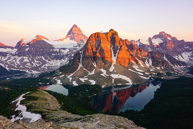
Since most of the ACC huts are located in the Rocky Mountains, this year I decided to plan a whole trip around skiing in the Rockies. I took one week off work and planned to do a few days resort skiing at Revelstoke with friends, before doing some ski touring with Brandon to the A.O. Wheeler Hut in Glacier National Park and the Elizabeth Parker Hut in Yoho National Park. We planned to finish with a day of resort skiing at Kicking Horse, but I ended up bailing on that day to rest and watch some of the Olympic finals.
After 3 days in Revelstoke, Brandon and I overpacked his 4runner to drive an hour to the Wheeler trailhead in Glacier National Park. I am, of course, talking about the Glacier Park located in BC, and not the one located in Montana. I feel like this park is hugely underrated and I’ve been wanting to explore more of it, so we booked one night at the Wheeler Hut to check it out.


The Wheeler Hut is one of the ACC’s most accessible huts and it’s a great option in the winter especially. In the summer, it’s basically located at the parking lot next to Illecillewaet Campground, but in the winter, you have to use the winter lot, so it’s a flat 1.5km hike to the hut instead. There’s a small picnic shelter and outhouse located at the trailhead. It’s a short walk up through the trees, and then it’s dead flat for 1.5km on a wide winter road. There’s no avalanche risk along the road, so you can feel pretty confident in visiting it at any time of year, regardless of your skill level.
When we visited, literally everyone in the cabin was on touring skis, most of which were planning to ski some bigger terrain nearby, but this would still be a good hut to visit on snowshoes or cross country skis. It was the middle of the week, so I think the hut likely attracts more families on weekends. I didn’t have any trouble booking the hut for a weeknight, and it wasn’t full, but I believe it’s very popular on the weekends. Booking through the ACC, you get access to bookings 6 months ahead of your travel date if you are a member, or 3 months ahead of your travel date if you are not a member.
In addition to the hut booking, there are several permits that are required from Parks Canada. You will need the standard Parks Canada Pass to leave in your vehicle, which is currently free in the summer, but still comes for a fee in the winter. You can buy it as an annual pass for your party, which we already had, or you can buy a day pass for each person on the trip. If you’re going to spend more than a week with 2 people in National Parks, I recommend the annual pass.


In addition to the Parks Pass, you are also required to obtain a free Winter Permit from Parks Canada if you are recreating in Glacier National Park. It’s a really interesting park because the Trans Canada Highway runs through the middle, which is extremely mountainous and potentially dangerous in the winter. The road passes through Rogers Pass, which has a bit of a reputation locally. Because the highway runs straight through the mountains, there is considerable avalanche risk, which is managed using explosives. In fact, Glacier National Park is home to the world’s largest mobile avalanche control program.
As a result, sections of the park are regularly shut down for avalanche control and it is completely illegal and extremely dangerous to be in those sections of the park when they are closed (as they will be setting off explosives and triggering avalanches). In order to manage the risk and ensure that people know how to check where they should and shouldn’t be, Parks Canada requires every single visitor recreating in the park to obtain a free Winter Permit every winter. In order to get the permit, you have to learn about the avalanche control program and complete a 30 minute quiz. It’s not difficult, but at the end you will receive a winter permit and parking pass.
If you’re staying at the Wheeler Hut, you’ll require a hut booking, the standard National Park Pass, the Winter Permit, the Winter Pemit Parking Pass, and an Overnight Parking Pass, which you can obtain from emailing Parks Canada (instructions are included as part of the Winter Permit process). It does sound quite complicated, but once you complete the Winter Permit quiz, the requirements will become much more obvious.


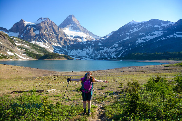
Once you’ve obtained all the appropriate permits, you’re ready for a fun trip to the hut. I was on touring skis and Brandon was on a splitboard, so it didn’t take us too long to get to the hut. The trail looks flat, but I think it might be ever so slightly uphill on the way there, because we were a lot faster on the way out. We arrived at the hut around 12:30pm and it was completely empty because all the current residents were out ski touring for the day. We had lunch and set up our beds before getting ready to go out and do a little exploring of our own.
I’m not super knowledgeable on the terrain around the Wheeler Hut, so I’ll just give a quick overview. If you don’t have Avalanche Safety Training, you’ll want to stick pretty close to the hut when exploring, but there are a few relatively safe options to check out. There are two trails from the hut, which includes the Perley Rock/Sir Donald Trail and the Asulkan Valley Trail. I didn’t do the Perley Rock Trail, which is closest to the hut, but you can follow it along the river in simple terrain for 1-2km. Stick to flat terrain – once the trail starts to get steeper or exposed to open mountain slopes, it’s time to turn around.
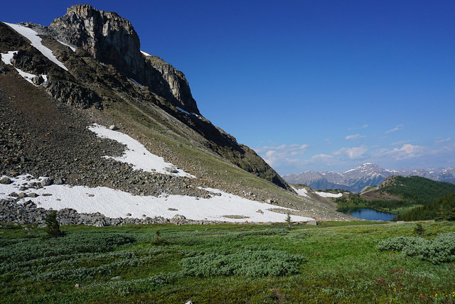
We opted to take the Asulkan Valley Trail, which starts in a meadow as opposed to the trees. We followed the trail until we hit a branch, where we took the left fork onto the Great Glacier Trail. We followed that trail for ~1km, until we hit the Illecelliwaet River, where there is a great view of some really big mountain terrain. That’s where we opted to turn around because we didn’t want to expose ourselves to any risk and the avalanche forecast was considerable.

Another option is to continue further up the Asulkan Valley Trail, from what I understand, you can go another half a kilometre up that trail until you hit a bridge, after which point it’s time to turn around. So overall, there are 3 potential routes, which are all ~3km round trip from the hut. When we visited the hut, we were the only people visiting for just 1 night. Everyone else was staying for multiple nights to go ski touring, with the most popular route being to tour the whole way up the Asulkan Valley Trail, where there is a second ACC hut, the Asulkan Cabin. I hadn’t done enough research to be comfortable with this route at the time, so we played it safe. I talked to a few skiers that did the trail and I think with a bit more background, this would be a good option for me in the future.
In spite of the higher avalanche conditions, the weather was quite nice. It was overcast all day, but it also snowed all day, leaving a nice layer of fresh powder to ski. We seemed to be the only people to take the Great Glacier Trail on that day, so there was several cms of fresh snow, which was nice. We returned to the hut for supper and the atmosphere was much livelier as people rolled in from their day of exploring. There was a large group staying at the hut, which is often annoying, but I will credit this group with being really respectful of hut norms. They took care of most of the hut chores, chopping a ton of firewood, keeping the woodstoves going, and making sure there was always a steady rotation of drinking water available in the large pots. So Brandon and I had it quite easy!


There is a creek near the hut where you can get drinking water. I’m not sure if the creek is normally open year round, but it was when we visited, which made water supply a lot easier. It’s so much faster than having to melt snow and a much nicer quality for drinking as well. Overall, the Wheeler hut is pretty swanky and exceeded all my expectations. It’s a large hut and it did feel busy, but it was under capacity on the night we stayed there, with lots of empty beds.
You enter from the back of the hut and there’s a small room to take off your boots, followed by the first of 3 main rooms. The first room has a woodstove and a table, but I would consider it to primarily be the gear drying room. There’s a bunch of racks for boots and lots of places to hang gear. The middle room is a large kitchen and cooking area. You don’t need to bring a stove or fuel, as there are several propane burners. You also don’t need to bring any dishes or utensils. We opted to bring our own small pot because we were just cooking dehydrated food and the provided pots tend to be quite large, but we didn’t need any other kitchen equipment, aside from some camp suds and a hand towel.
The last room is the main eating and hang out room and has a large fireplace. This is where we spent the rest of the evening. The large group was at one table, and most of the other smaller groups were at the other table. We had a nice chat with 2 brothers who were visiting from Ontario in order to go touring, and a group of 3 from Calgary. They saw me teaching Brandon how to play crib and recognized a fellow card lover, so I ended up joining them for several rounds of cards. I’ve already forgotten the name of the game. I only planned to play a few rounds before going to bed, but got sucked in when I couldn’t win a single hand. I ended up losing spectacularly, but I had a great time!


In addition to the three rooms on the main floor, there are 3 rooms of bunks upstairs, so it’s a very large capacity hut. Sleeping mats are provided, but I opted to bring my thermarest anyways because my quilt and thermarest together weigh less than my full size sleeping bag (and I didn’t want to lay directly on the mats in my quilt). Brandon brought his thermarest too because he was concerned about being cold on the mats, but it’s plenty warm in the hut with 2 woodstoves, so that wasn’t a concern.
It’s a nice set-up for sleeping, but I didn’t get much sleep because as soon as everyone went to bed, the symphony of snores started. This is to be expected at a hut and I did have earplugs, but it was so loud even that couldn’t drown them out. In future I would probably bring earbuds so that I could put on some music, I think that would have been more effective.
We were up early because we had to ski out, drive to Field, and then ski 12km up to Lake O’Hara on the same day. We were the first people to get up and the fire had gone out completely, so we got it re-started and then had a quick breakfast before heading out again. It was a beautiful day and we saw lots of blue sky on our early morning hike out. One night at the hut did seem a bit short, but it was a good length for what we planned to do, especially since we arrived early on the first day. In any case, Elizabeth Parker Hut was the real highlight of our trip, so tune back in next week to learn about that hut!