Blanca Lake Backpacking Trip

I hiked to Blanca Lake around the third week in July and it was the first weekend where it really started to feel like summer. The snow melt was very late in the mountains and I’d been tracking the hike via satellite all week. 5 days before we went, the entire lake was still frozen, but it was melting fast and by the time we hiked up there, it was almost entirely gone. 

Blanca Lake is not a well known hike, but it is starting to get more popular. It’s located pretty far up Squamish Valley Road and it does require 4×4 to get to the trailhead. The hike is only 4.5km, but the road to the trailhead is long and exposed, so I wouldn’t recommend hiking the extra distance on a hot day. We ended up picking up a few hikers along the road and they were about to give up and turn around before we drove by because it was so hot. 

IMG_4755

We had a great crew for this trip. Seth and Sadie both joined me for their second hike of the summer, and of course Brandon was ready with his 4runner. We were also joined by our friend Adriana, who we hiked Tetrahedron with last year, and a new friend, Victoria, who we met when hiking Hozomeen Lake several weeks earlier. I downed a lot of gatorade along the drive as we convoyed up to the trailhead in two cars. It’s a pretty long drive on Squamish Valley Road, as well as on the FSR. The road isn’t in that bad shape, but there are several water bars along the way and a sketchy washout before the top. A few cars parked before the washout as it’s not a long walk from that section.

To make the occasion more special, it was Brandon’s birthday! We ate sandwiches at the car and then started the hike up to the lake. The trail is flat for a short distance, but then you immediately do a big climb up through the trees. It was challenging because it was so hot, but at least we were in the shade. After the climb, the trail stays in the trees and is pretty flat again. You traverse through some small meadows and eventually come to a stream crossing before starting to climb again.

PSX_20240723_212149
20240720_154816

Some of the group was able to get across the stream crossing with their boots on, but I opted to just put on my sandals and wade through it. It was much easier and we all did it on the return trip. We encountered a few groups who were day hiking on their way down, but otherwise we didn’t see a lot of people. You continue through the trees again and then eventually come out on a boulder field that follows the river to the top. Seth really struggled from the heat on this section and the hike took longer than we expected it would, but eventually we all made it to the beautiful wide open view at the top.

20240720_162604

The final section of the trail and the lake are all in the alpine. Blanca Lake is really at the start of the alpine and if you have 2 nights to spare, it’s definitely worth it to stay up there for an extra day and explore around on your own. There aren’t any trails, but the terrain is easy to navigate and you can do a scramble to some of the other lakes and peaks.

Blanca Lake is the biggest lake, but there are several other lakes nearby, as well as a lot of tarns. I decided to swim in Blanca as soon as we arrived and it was so hot even Seth joined me! It was freezing cold (it had literally only finished melting 2 days ago), but it was refreshing. Adriana and Victoria opted to swim in the small lake just below Blanca, which was warmer, and Brandon scoped out a secluded place to pitch our tents by an even smaller tarn. 

PSX_20240722_184903
IMG_4680

There were quite a few people camping on Saturday night. Most of them camped right next to Blanca Lake, but there’s lots of room to spread out. I liked our spot over by the tarn because then Sadie wasn’t distracted by or a nuisance to the other campers. I swam in the smaller lake and 2 tarns, but not the other 2 large lakes. I can’t see any names for them on Gaia, but there’s a big circular lake west of Blanca, and another lake to the South. I hiked over to view both, but they were a bit farther away, so I didn’t swim in either.

We sent up the tents and proceeded to have an excellent evening hanging out in the alpine! We brought party hats for Brandon and celebrated his birthday with some cherry liqueur that I’d brought home from Portugal. We had Brandon’s infamous thai chicken curry for dinner and had a great time hanging out and enjoying the view during golden hour. 

20240720_184458
20240720_200051

There’s no facilities at Blanca Lake, so be prepared to dig catholes for your bathroom. There are some trees around, but it’s pretty barren, so we brought bear vaults and bear bags rather than hanging our food. It should be possible to find somewhere to hang your food, but it was definitely a lot easier using Carolyn’s bear vault, which I borrowed for the trip.

It was an absolutely gorgeous evening and we spent most of the night taking photos of each other. The sunset turned everything orange around us and we shared snacks to celebrate Brandon’s birthday. I made everyone worms and dirt (a girl guide classic!), but I guess our sugar tolerance is lower than my girl guides because we all ate way too much!

PSX_20240809_232610
PSX_1721796972974

I was the first one up in the morning thanks to Sadie. It gets bright so early and she wants out of the tent, so I decided to let everyone else sleep in and take her for a walk. She was my little dog sherpa and carried our essentials in her bag. Like I said, there’s a lot to explore, so we did a short hike up to some of the ridges to view the other lakes and have our breakfast. Blanca is cool, but in my opinion, the lake to the west has the most beautiful view. I wish we’d had more time to explore, but I’ll have to add it to my long list for a return trip.

20240721_074347

We took our time having breakfast and packing up and as a result, we were the last to leave. The campsite was completely empty, so I think it’s really only busy on the weekends. The hike back down the valley was nice and there were a lot of wildflowers around. We stopped for lunch shortly after crossing the river and then continued back to the cars. We stopped at the Water Shed in Squamish for dinner and then closed the books on a really nice weekend in the mountains! I took way too many photos on this trip, so here’s a few more!

PSX_20240809_233207
20240720_192804
20240720_203652
PSX_20240721_210601
20240720_191252(0)
PSX_20240723_071614

Hozomeen Lake Backpacking Trip

Disclaimer: I’ve heard that this border crossing is now closed and I don’t believe it’s possible to do this hike from the Canadian side anymore. Below recounts my experience doing the hike in 2024, I wouldn’t advise doing this hike at this time.

The thing I love about BC is that there’s something to do in every season. I love skiing and snowshoeing in the Winter, and kayaking in the Spring, but there’s no question that backpacking season is my favourite. As soon as the warm weather hits, I always get the itch to go to the mountains. But it takes the snow a lot longer to melt in the mountains than in the city, so I always have to impatiently wait until almost July for alpine hiking (though there are still opportunities at lower elevations). 

It was a very poor ski season last winter, so I was expecting an early alpine season this year. Unfortunately, we ended up getting a lot of late season snow, and it’s been a cooler and rainier Spring than normal, so by the time July hit, there was still a lot of snow in the mountains. In the long run, I know this is a good thing for wildfire season, but it left me scrambling to find a trip for the Canada Day long weekend.

PSX_20240704_180704
PSX_20240704_181919

I monitor the snow in the mountains in several ways. First, I always check Sentinel Playground/Copernicus Browser, which has satellite imagery that allows you to check the snow levels. Availability of data depends on having a cloudless day when the satellite rolls over your area of interest, but generally you can get data on the conditions within the last 2 weeks. Second, I check AllTrails for trail reviews from other users, and finally, I search the location on instagram for recent photos. All this effort confirmed that most of the trails on my hiking list were still inundated with snow.

I spent weeks scouring the internet and maps, looking for an alternative that I hadn’t already done, wouldn’t have permits, and would be appropriate for my husband, Seth, and our dog, Sadie. After much searching, I stumbled upon a very interesting option – the Hozomeen Lake Trail.

PSX_20240703_210130
20240630_152059

Hozomeen Lake is located in North Cascades National Park in Washington State. It’s just south of Skagit Valley Provincial Park and east of Ross Lake. What makes this hike unique is that it’s primarily accessible from Canada, but there’s no formal border crossing. Silver Skagit Road continues through the entirety of Skagit Valley Park, and a few kilometres past the border, but it’s not a manned crossing, so there’s no border control (though there are cameras). Pre-pandemic, you could drive across the border and there were a series of frontcountry campsites located on Ross Lake. But the gate has been closed to vehicles since the pandemic and the campsites are no longer maintained. 

Fortunately for us, there is a series of backcountry trails that extend all the way down to Highway 20 in the US, and it appears that they are still being maintained. It’s a 2km hike on the road to the trailhead, and then ~6km of hiking along a forest trail to Hozomeen Lake, which sits at the base of Hozomeen Mountain. Me and Brandon hiked to the base of Hozomeen Mountain via the Skyline II and Hozomeen Ridge Trail in Manning Park in 2017, so we were excited to explore the trail from the other side of the mountain. 

PSX_20240702_083250
PSX_20240711_231338

Hozomeen Lake is beautiful and doesn’t receive many visitors, so it was a great pick for my extremely anxious dog. It does require a camping permit to stay there, which can be obtained from the National Park Service (NPS) via email. They only issue permits on the day before your trip, but the Ranger is really nice and called me the morning before the hike. I guess some other people emailed ahead of us because he told me the campsites were already full, but he kindly let us use the group site and gave us a permit for two nights. 

There’s only a few campsites, maybe 3 or 4, but it turns out the group campsite is actually the nicest one! They’re all located in the trees and have tenting areas (but no pads) and eating areas with a fire pit. But the group site is the closest to the lake, which is what makes it the nicest. There’s 2 open-air pit toilets, one for the single sites and one for the group site. The campground was full on our first night, but we didn’t meet any of the campers because everyone had a dog, so we kept our distance since Sadie doesn’t like other dogs. But on the second night, there were only two women at one of the other sites and Sadie adopted them into our herd. 

20240630_095934(0)
20240629_192944

It’s a pretty easy hike and the trail is super well maintained. The walk along the road is flat and easy for 2km. The first half of the trail is uphill with 400m of elevation gain, but it levels out as you get closer to the lake. It’s pretty much entirely in the trees, but it’s a nice walk and we didn’t see anyone (human or bear) on the way in or out. There was some evidence of bears on the trail, but none at the lake. 

It was overcast on our first day, but very humid, so we hiked in shorts. There was rain in the forecast, so we quickly set up our tents and tarps upon arriving and me and Seth went for a little skinny dip in the lake. Campfires were allowed when we visited, so we collected some firewood to store under the tarp for the next evening. It started to drizzle during supper, but it didn’t properly rain until 11pm, which was after we had gone to bed. It’s a gorgeous lake campsite, the only downside is that there is no bear cache. It took me and Brandon a long time to set one up, and I admit, it wasn’t our best work.

20240630_121648
PSX_20240711_230210

It rained pretty hard all night, but tapered off around 8am when we got up. It still sprinkled a little bit while we had breakfast, but then it stopped and didn’t rain anymore on the trip. We had a slow lazy morning by the lake and me and Brandon improved our bear cache until it was acceptable. We packed up our day bags and set out on a hike around 11:30am. 

The trail continues on for miles and miles and there’s a lot of backcountry to explore. We decided to hike to Willow Lake, which is approximately 3.5km further along the trail. Brandon seemed keen to go all the way to Nightmare campsite, which is another 3.5km, but we wanted to swim in the lake again later and opted not to (plus, the name didn’t sound super appealing). 

PSX_20240711_230655
20240630_173436

Hozomeen Lake is definitely a much nicer campsite than Willow Lake, but it was a great spot to stop for lunch. If you push through some of the brush, you can walk out over the dried up flats to the edge of the lake. This may have only been possible because the water level in the lake was super low! We ate on the banks of the lake and it proved a great spot for watching wildlife. We saw tons of different birds, amphibians, and insects. 

Seth and Brandon spent most of the hike back trying to identify the forest plants and we arrived back at Hozomeen Lake around 3pm. The temperature of the lake is really nice – it’s cold, but not glacier fed – so we spent a lot of time in the water. We befriended the new campers, who were also from Vancouver, and we all marveled at how awesome the campsite is and how there’s so few people!

PSX_20240704_183734
20240630_201953

We ate dinner by the lake and then had a campfire at the fire ring. Always practice fire safety and only collect dead wood on the ground (don’t destroy any natural habitat). There was lots of blowdown for firewood, which is another indicator the site doesn’t get a lot of visitors. Sadie was absolutely pooped after 2 days of hiking and snoozed for most of the evening.

In the morning, we packed up to head home again. It’s an easier hike on the way back and we stopped at the overgrown frontcountry site to admire the view across Ross Lake. Ross Lake is currently super low and dry for the entire 2km of road walking, but the mountains across the lake are pretty. Our new friends told us there were bats living in one of the outhouses, so that was a cool side trip on the way back. 

PSX_20240703_205508
20240701_130729

It is a fairly long drive to get to Ross Lake, the worst part being an hour and half on gravel road from Hope to the lake. We stopped in Hope for ice cream and then weathered the long drive back on the highway with all the other long weekend warriors. But overall, we all absolutely loved this trip! It was much more chill than some of my other backpacking trips, with the lake and lack of crowds being the main highlights! I would definitely recommend! 

20240630_080856

Sendero al Fitz Roy Backpacking Trip Part III

Continued from Part I and Part II. On day 3, we set our alarms for 5am to start our sunrise hike up to Lago de los Tres. However, the campground was extremely crowded and other hikers started getting up as early as 3am to prepare for their sunrise hike (and they were not quiet)! I mentioned in my previous post that I really didn’t like Poicenot Campground. People were noisy and partying late into the night and just generally disrespectful. We ended up starting our hike at 4:45am because we were awake anyways. 

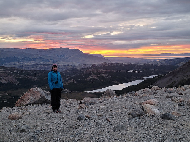
Unfortunately, the clouds had rolled in overnight and it was even drizzling a little bit when we started walking. The clouds were pretty high, so you could still see all the lower elevation mountains, but the top of Mount Fitz Roy was hidden. It’s an interesting experience to hike to the top for sunrise because you have to do pretty much the entire trek in the dark. It’s only 2km of hiking, but there’s 400 metres in elevation gain, so it’s very steep. You walk for a couple hundred metres on flat ground and you can see a steady trail of light criss-crossing the rockwall ahead of you where people are climbing. It’s not for the faint of heart!

20240226_070735

Like usual, I think I was running half on adrenaline. The rain didn’t really last and we ended up layering down once we started the climb. Eventually, I layered down to just a t-shirt, but I had to add every single layer back the second we got to the top because it was so cold! We ate some protein bars and took a lot of breaks on the way up, but Seth struggled with the steep climb. I felt like we were going really slow, but our pace was fine and we got to the top around 6:45am (with sunrise shortly after 7am). So it was ~2 hours of hiking for just 2km.

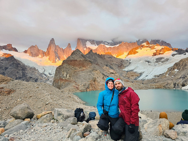
The top of Mount Fitz was in the clouds, but you could see everything else. It is quite a beautiful view and the sky was just starting to get light when we summited. But like I said, it was absolutely freezing! We quickly layered up into all our clothes and Seth made us hot oatmeal for breakfast. I mentioned in my last post about how Lago de los Tres and Laguna Torre are so iconic at sunrise because the sun comes up on the opposite horizon, turning Mount Fitz Roy orange at dawn. I experienced this at Laguna Torre, but we didn’t get the full ‘orange mountain’ thing at Lago de los Tres because the sun rose directly into the clouds. It peeked out for a few minutes now and then and would light up the mountain a little bit. So if we’d reversed the trip and done Lago de los Tres on the first morning, I think we would have nailed it, but weather is fickle and we still had excellent conditions, all things considered.

PSX_20240304_192340

The lake is packed with people at sunrise, but as soon as it’s over, the crowds disperse really quickly because of the cold. We still had to hike all the way back to town to catch a bus to El Calafate, but I didn’t want to rush our visit at the lake too much, so we hung around for about an hour exploring the lake. There’s a second viewpoint next to the lake that you can hike up (only takes about 10 minutes), and that lookout had a fantastic view of Laguna Sucia. So we got to see what we’d missed the previous evening and Seth was adamant that the trail looked like it would have been a struggle (which I think he is right about if you attempt this one in the future). 

As tough as it was hiking up the mountain, it’s worse hiking down. I think we left around 9am and returned to the campsite to pack up the rest of our equipment. The hike down was pretty hard on my knees and irritated them for the rest of the day. However, the remainder of the hike seemed to pass in a bit of a blur. I believe there was a bus at 2:30pm and 3pm, and then no more until 6pm, so we really wanted to catch the 3pm bus at the latest. Which meant we had to hustle for the rest of the hike.

PSX_20240304_192742
PSX_20240304_193225

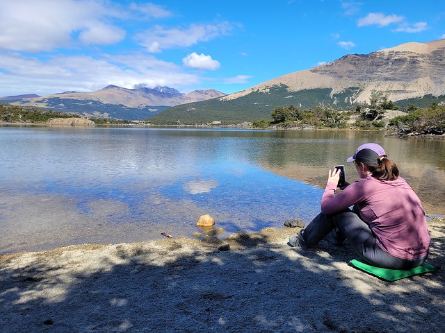
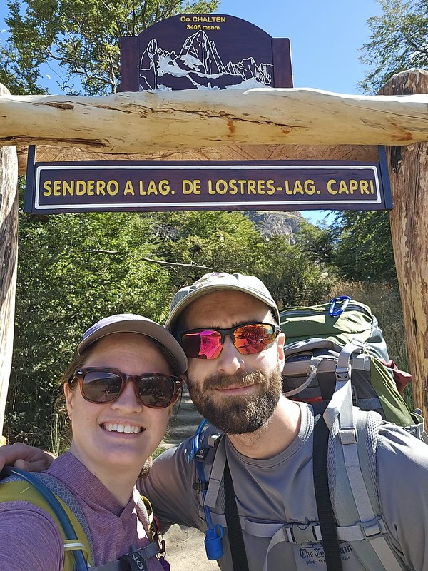
Once you leave the campground, the trail is pretty flat for ~5km to Laguna Capri. Our walking pace was really fast, but it was still slow going because the trail is SO crowded with day hikers. It can be narrow in some parts and you have to wait for people to pass often, so that slowed us down. The weather cleared up throughout the day and it was quite nice, but the clouds never did clear from around Mount Fitz. We stopped at Laguna Capri for lunch, which is the last big lake on the trek, but opted not to swim in the interest of time. 

The rest of the hike from Laguna Capri was much more beautiful than I was expecting. Overall, the entire 3 days of hiking was very scenic. I thought it would just be forested, but the last 5km of the trail follows the canyon back to El Chalten and has sweeping views down the valley, so it was a very different vibe than the rest of the park. You feel like you’re coming out of the mountains towards the desert; it was a cool vibe and I enjoyed the walk down, even if my legs were killing me.

20240226_122220

By far, the worst part of the trek was the 1.5km of hiking through town at the end. The bus station is located on the complete opposite end of town from where the trail starts, so it was brutal having to pound down the asphalt after 14km of hiking. We had to rush and made it to the bus station just in time to get a ticket! I pretty much passed out on the bus for the entire 3 hour ride back to El Calafate, but Seth had a fun time trying to count how many rheas’ he could spot running through the desert (a big bird like an emu)!

We returned to the same guesthouse and had a bit of a chaotic welcome back when we realized that our guesthouse did not have the advertised laundry services we were depending on and that my credit card had bounced our tour to Perito Moreno Glacier the following day and so they had cancelled our tour. To top it off, I had clearly started developing a cold while on the trek. The entire hike I tried to convince myself my throat was just dry from the desert air, but I had to finally admit I was getting sick.

PSX_20240304_213143
20240226_134828

Thank god for teamwork. I showered while Seth figured out an alternative option for doing laundry (which was desperately needed), and then while he showered, I found a replacement tour for the following day. I think things actually turned out better in the end. Our new tour was private (we basically just paid a guy to drive us to the glacier and wait for us), which had the benefit of a later start time, allowing us to catch up on sleep. Seth found a drop-off laundromat, and we dropped off everything on our way to town for dinner, with a pick-up time for the following day. We treated ourselves to a nice meal in El Calafate and enjoyed the Calafate berry ice cream for dessert! The town is obviously named for the berry, which is common in this region. If you eat a calafate berry, legend is that you are destined to return to Patagonia! I feel pretty confident I’ll be back, with or without eating the berry, but the ice cream was tasty! We tracked down some cough drops and tissues for me to manage my cold, and then hit the sack for the night! Check back next week to read about our visit to Perito Moreno!

20240226_131906