Taylor Swift in Lisbon

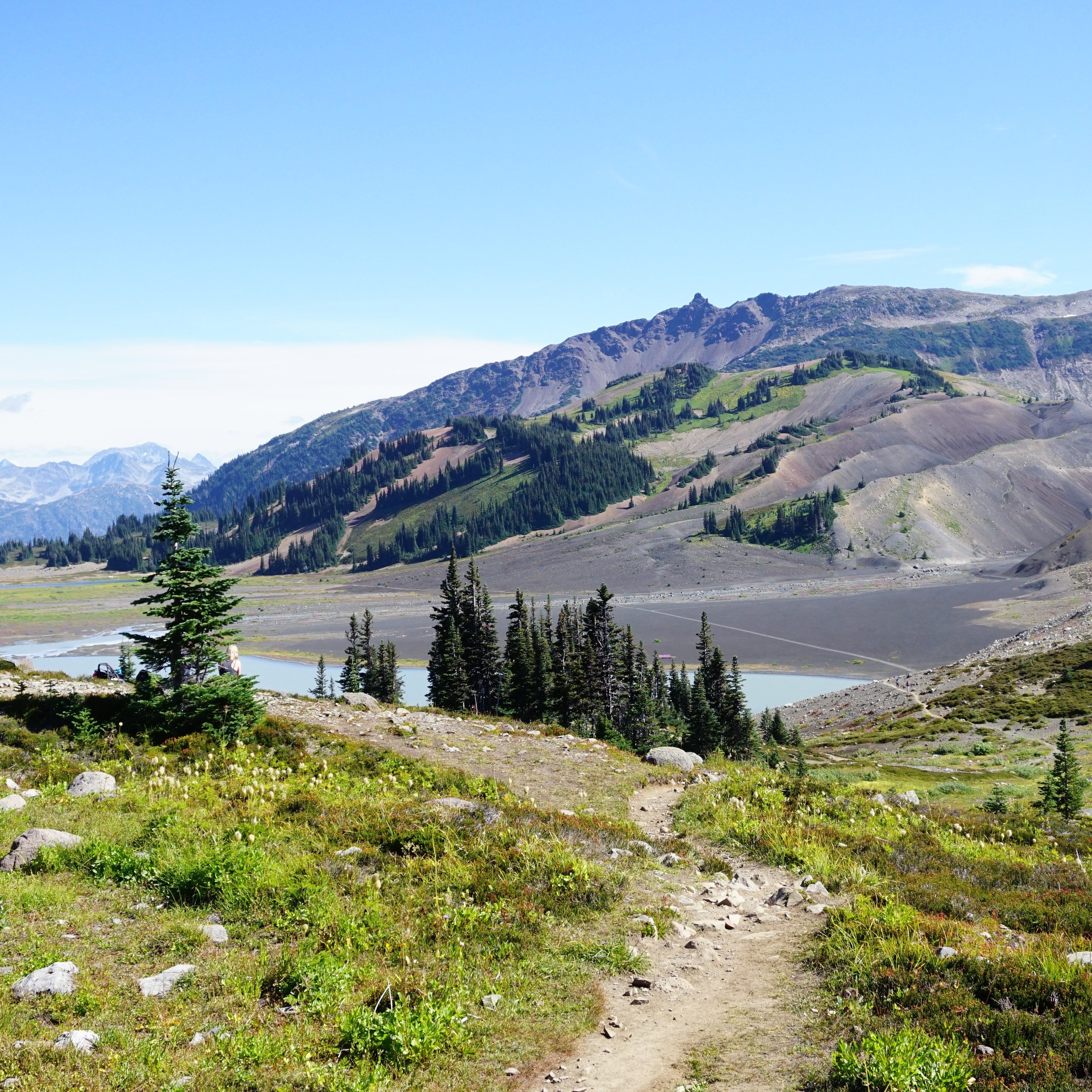
It’s been a very eventful year for me from a traveling perspective. I went to Patagonia in mid-February with Seth and then 3 months later I took another 2 weeks off to go traveling with Emily. Our original plan had been to go to Greece last September, but then something came up and we cancelled that trip. So I ended up with two major trips back-to-back, which was somewhat overwhelming, but also awesome, so I can’t complain.

The reason we cancelled our original trip is because Emily got tickets to see Taylor Swift in Lisbon! Like most people, we failed to get tickets to see Taylor on her US tour and couldn’t afford the resale tickets, so Emily signed up for a ton of presales in Europe and managed to score 4 tickets in Lisbon! The tickets were for May 25, so we planned a whole trip around the concert. We had a little over 2 weeks and we planned to start in Lisbon for the concert, and then we each picked a destination for the subsequent 2 weeks of the trip. Emily picked the Azores and I picked Marrakech, so stay tuned for that!

PSX_20240524_215315
20240524_154223

But first off, Lisbon. We were traveling from opposite sides of Canada, but the easiest way to get there was for both of us to meet in Toronto and then we caught a direct flight to Lisbon. It was an overnight flight, so we got as much sleep as we could and arrived in Lisbon around noon. It’s only a 3.5 hour time difference for Emily and she managed okay, but it was an 8 hour time difference for me, so my body had no idea what was going on.

As soon as we landed in Lisbon, you could feel the energy. Our pilot welcomed all the Taylor Swift fans to Lisbon and our uber driver started off by saying, “the traffic is really bad today! I don’t know if you heard, but we have a big concert happening this weekend”! We got dropped off at our hostel in central Lisbon, where we had booked a private room. The temperature was around 24 degrees, which we thought would be perfect, but it’s quite humid in Portugal, so it felt a lot hotter. 

PSX_20240527_160038
PSX_20240527_222430

We took a quick shower and then decided to go out exploring the city. We easily could have gone to bed, but that would not have helped the jetlag, so we pushed through. We meandered through the city and wasted no time sampling some pastries. Our cousins, Andrew and Emma, were using our other two tickets for the concert and were at the tail end of their Europe Trip, so we met up with them and toured the Lisbon Cathedral and went in search of dinner. 

Taylor was playing her first show the same night, so as we walked around the city, it was easy to spot all the fans. The streets were filled with women dressed in glitter, sequins, and cowboy boots. Everyone was smiling and there was just a really great vibe in the city! Europe actually has ticket resale laws that limit price gouging, and Emily tried to convince me that we should get tickets online for night 1 too, but we opted to catch up on sleep to prepare for our concert instead. 

20240524_173240

The next day, we did a walking tour in the morning to learn more about the city. It’s actually my second time visiting Lisbon, but the first time was in 2012 and I honestly remembered nothing. We learned a lot about Portugal’s history, of which I didn’t know that much. Like most of Europe, Lisbon is a very old city and was originally settled by the Moors, which is a term used to apply to Muslim Europeans, Arab, and Berber people. Lisbon was part of the Kingdom of Portugal for a long time, until Napoleon invaded in the early 1800’s, and the Portuguese monarchy fled to Brazil. The history is already a little foggy, but it was a pretty short lived occupation, and the monarchy returned until revolution in 1910, when the last king and his heir were assassinated.

The most interesting thing I learned was that following the revolution, Portugal lived under dictatorship for 50 years between 1926 and 1974. It was the longest European dictatorship and it ended in 1974 when there was a military coup known as the Carnation Revolution. Since then, Portugal has been a modern democracy.

20240525_104107(0)

Lisbon is a very hilly city and we visited several historical spots. It was also interesting to learn about Lisbon’s history of earthquakes, the biggest of which was a 9.0 earthquake that occurred in 1755 and leveled most of the city. There is still some architecture left which predates this earthquake.

After the walking tour, we returned to our hostel to get ready for the concert! There were other Swifties on our walking tour and we’d learned that the previous night had been a bit of a disaster in terms of venue management. The concert was late starting because there hadn’t been enough security to process all the fans. People had to queue for 3+ hours in the hot sun to get into the stadium. So we decided to go pretty early to the stadium and were prepared with sunscreen, hats, and water.

20240525_163158

We met Emma and Andrew on the Metro before the concert, but fortunately, we didn’t have any trouble accessing the stadium for our concert. They’d resolved whatever kinks had been present the previous evening and we were able to get in the stadium with no issues. Our seats were in the lower bowl and we were super lucky to discover that we had end row seats right next to the bathroom. Plus, our seats were under a bit of an overhang, so we had shade from the sun too! The bathroom situation at the concert is really interesting. At our stadium, all the sections were blocked off from one another, so there were only 4 bathrooms that we could use. 3 of the 4 bathrooms were male – the stadium has designated 1 of the male bathrooms as female, but fans seem to have made the decision that all bathrooms are unisex during the concert! We loved it because, of course, there’s a lot more women at the show.

20240525_163346
20240525_174836

The concert was obviously fantastic! It completely lived up to all the hype and we had the absolute best time! It’s just such a great vibe. Everyone is really happy and friendly. I’ve heard some European fans are mad about the number of North Americans coming to the show, but we didn’t experience that at all. We wandered the concourse trading friendship bracelets and generally had a great time talking to fans from all over the world! 

Taylor’s stamina for the show is incredible. I barely had time to pee during one of the transitions, so I don’t know how she manages with all the wardrobe changes! It’s hard to pick a favourite era because they are all wonderful. I loved the anticipation at the start of Lover; the energy of Red; and the vibe of Folkmore. It’s also incredible to watch her perform her new TTPD songs, but the surprise songs were probably the highlight of the concert for me. Before the concert, we’d all fantasized about our dream surprise songs. Emily wanted anything from Fearless, Emma wanted Long Live, and I said I’d die if she sang You’re on Your Own, Kid. 

20240525_203807
20240525_212414

She started with a mash-up of The Tortured Poets Department and Now That We Don’t Talk on the guitar, which was great. But I couldn’t believe it when she started playing You’re On Your Own, Kid on the piano!! I know she plays this song a lot, but I couldn’t believe I was so lucky as to get my first pick! I admit, I did tear up a little. Then she did a mash up with Long Live and Emma died a little inside too!

It could have been pandemonium trying to get the train home after the concert, but it was pretty orderly all things considered. We didn’t know that merch wouldn’t be for sale in the venue (only outside), so Emily and I lined up for merchandise after the show, but I’d recommend getting it before if you have the chance. Fortunately, we were right by the exit, so we beat most of the crowd.

I know it’s not affordable to see Taylor Swift in North America. We paid under $200 CAD each for our tickets in Lisbon, so pairing the concert with a holiday was 100% the way to go. I never thought I’d fly so far away to see a concert, but it was an experience and I would definitely do it again! It’s Taylor’s Summer for sure! Check back next week to hear about our experience in Sintra.

20240525_231905

10 Epic Thru-Hikes in BC

If you’re an avid backpacker already and looking for an epic adventure, there are lots of multi-day trips in British Columbia to whet your appetite. I’ve only done a small sample of what BC has to offer, but these are some of my favourite thru hikes! If you’re a beginner, check out my Guide to Backpacking and Overnight Trips for Beginners posts, as well as my safety resources.

A thru-hike is basically a trip that starts and ends at different locations, allowing you not to repeat any trail. They can be somewhat harder to coordinate and plan because 2 vehicles are often needed and the trailheads may be several hours apart from one another. I don’t recommend any of these trails for true beginners as they are all multi-night trips, several of which are in more challenging or technical terrain. But if you’re an intermediate or experienced backpacker and looking to get outside for extended periods of time, check out some of these trails!

Howe Sound Crest Trail 

The Howe Sound Crest Trail (or HSCT), is the closest trail to Vancouver on this list, as well as one of the shortest. That might lead you to believe that it’s one of the easier trails, but that is not the case. I think a lot of people stumble onto this trail who are not quite prepared for the steep and technical terrain, so definitely proceed with caution. The trail is 30km long and runs from Cypress Mountain to Porteau Cove. It can be done as a 1 or 2 night hike and most people start from Cypress because then it’s a net downhill trail. There are no facilities, so be prepared to do a bear hang and dig cat holes for your waste.

I prefer to do this trail as a 2-nighter and camp at the Enchantments and Brunswick Lake, but there is no water on trail until the halfway point, so if you camp at the Enchantments, you need to do a large water carry. The trail crosses between the Lions and up and down through several small summits. The start and end to the trail are pretty straight forward, but the trail gets very technical in the middle. If you’d like to extend the trip, you can consider summiting Mount Harvey and Mount Brunswick along the way. It’s a gorgeous trail with unparalleled views of Howe Sound. 

Helm Creek Trail

A hiking trail extends through the alpine of Garibaldi Provincial Park towards Helm Lake, with the forest and mountains in the background on a sunny day in British Columbia, Canada

This route doesn’t have a formal name, but extends from Rubble Creek to Cheakamus Lake in Garibaldi Provincial Park, near Whistler. If you’re on my website, most likely you’re familiar with this trail because of the popular trips to Garibaldi Lake, Black Tusk, and the iconic Panorama Ridge. Lots of people explore these trails as a day hike or a 1-nighter from Garibaldi Lake or Taylor Meadows. But I always recommend turning it into a multi-day trip by continuing on to Helm Creek. This trail is more appropriate for newer backpackers because of its substantial facilities. 

This hike can be customized to whatever length you prefer. Start at Rubble Creek and spend a few nights at Taylor Meadows or Garibaldi Lake and explore Black Tusk or Mount Price. When you’re ready to go to Panorama Ridge, pack up your camp and stop at the ridge on the way to the Helm Creek Campsite, which takes you through the gorgeous Helm Lake area. From there, you hike down towards the Cheakamus Lake parking lot. If you want to extend the trip further, make a detour to Cheakamus Lake or Singing Creek campsites. This hike requires camping reservations, which release 4 months in advance of your date from camping.bcparks.ca.

HBC Heritage Trail

A photo of Palmers Pond on a summer day, with the green meadows, forest, and mountains in the background, on the Hudson's Bay Company (HBC Trail) near Hope in British Columbia, Canada.

In my opinion, this is one of the most challenging trails on the list (except for maybe the North Coast Trail). HBC stands for Hudson Bay Company and is a historic trail that was originally used by the First Nations and later by the fur trade. The trail is 74km long and extends through the mountains from Hope to Tulameen. A lot of the trail is through the forest, but it has some gorgeous campsites and views along the way. It’s not an overly popular trail and you likely won’t see many people on it if you like solitude. 

What makes this trail challenging right now is the state of the trail. The trail has been revitalized in recent years and has a dedicated volunteer maintenance group, but the 2021 flood was particularly hard on this area. Volunteers have been working to clear the trail, but there is still quite a lot of blowdown in some sections and the trail does require fording at least 3 rivers. All of the campsites have nice facilities, so if you give yourself enough time to navigate the technical terrain, it is a beautiful trail.

Heather Trail

If you’re new to thru-hiking, the Heather Trail would be my recommendation. This is a relatively easy trail, with gorgeous views and brand new facilities. It’s located in E.C. Manning Park and can be done over 2-3 days. The trail starts at the top of Blackwall Road, which means most of the challenging elevation gain is done in the car. Technically, the Heather Trail is 21km, ending at Nicomen Lake and requiring an out-and-back trip. However, if you connect to the Grainger Creek and Hope Pass Trails from Nicomen Lake, you can turn this into a ~40km thru-hike, ending at Cayuse Flats.

Over 2 nights, I would camp at Kicking Horse and Nicomen Lake, or you could add a night at Buckhorn Campsite at the start of the trip and take your time. The trail is all in the trees after Nicomen Lake, and even though it’s 17km from Nicomen to Cayuse Flats, it’s a very easy trail, though there is another campsite option at Grainger Creek. You do need backcountry reservations to stay at these sites as of 2024, which can be obtained 4 months ahead of your trip at camping.bcparks.ca.

Skyline II Trail

I love Manning Park and the Skyline II Trail is one of my all time favourites. This trail is more difficult than the Heather Trail, but still a relatively easy trip. The trail is approximately 25 kilometres from Strawberry Flats in Manning Park to Whitworth Meadow in Skagit Valley Park. There is one campsite at the halfway mark, Mowich Camp. 

While this hike can be done in one night, I highly recommend doing 2 nights at Mowich Camp and making a detour to hike the 15km round trip trail along Hozomeen Ridge and back. This trail will take you to the border monument and a fantastic view of Hozomeen Mountain in the US. The trail itself is easy to follow and takes you through gorgeous alpine meadows. The campsite is pretty basic and the water source can run dry later in the summer. A backcountry permit is needed and can be obtained 2 weeks prior to your trip at camping.bcparks.ca.

Sunshine Coast Trail

Sunny view of the ocean and beach at Fairview Bay on the Sunshine Coast Trail in British Columbia, Canada

This is the longest trail on my list, but is hands down my favourite thru-hike ever! The Sunshine Coast Trail (or SCT) is 180km and extends through the entire upper Sunshine Coast, from Sarah Point on the Malaspina peninsula, to Powell River, and down to the ferry at Saltery Bay. The SCT is unique because it is a hut-to-hut hiking route, which means you can do the entire trail, staying in free mountain huts along the way. 

The trail can be a challenge to coordinate in terms of transportation and food carries, but it is incredibly well maintained by volunteers, with gorgeous facilities. You can do a section of the trail, or commit to the entire thing. The trail is primarily in the forest and tackles a lot of cumulative elevation gain. There are tons of lakes to enjoy a cool swim and some amazing viewpoints along the way. The trail can get busy, so if you plan to stay in the huts, you should still bring a tent with you as a back-up.

Juan de Fuca

The Juan de Fuca trail is often touted as a great beginner coastal trail. It is good in that it’s a lot easier than its more popular sister trail, the West Coast Trail, but it is still challenging in its own right. It’s a 47km trail on Vancouver Island between Port Renfrew and China Beach. There are several nice campsites located both in the forest and along the beaches, but like all the coastal trails on the island, it can be very technical and muddy.

It’s been several years since I did this trail and I have heard that some parts have received much needed maintenance since I did it, but it will still be quite muddy in early summer and there are several tidal points on the trail that require advance planning to cross. The nice thing about this trail is that there are several bailout points that connect to the highway if the trail is too challenging. Backcountry permits are required and can be obtained 2 weeks in advance from camping.bcparks.ca.

North Coast Trail

Two tents camping on a golden sand beach with drift wood and the forest and waves of the pacific ocean in the background at sunset on Irony Creek Beach in Shuttleworth Bight on the North Coast Trail on Vancouver Island in British Columbia, Canada.

The North Coast Trail (or NCT) is probably the hardest hike on this list. It’s much less popular than the West Coast Trail, but the traffic to this hike has definitely been growing. The NCT is a ~60km hike on the far north coast of Vancouver Island. It has a reputation for being extremely muddy and it doesn’t get very much maintenance. The NCT is only accessible by water taxi, so most people add on another ~25km of hiking to Cape Scott to finish this trail.

The Cape Scott Trail is accessible by dirt road and is better maintained than the NCT. The highlights of both trails are the gorgeous, remote beach campsites. There are several tidal points on the trail and you should be prepared for a very slow hiking pace through extremely technical terrain. But you’ll also likely get to view bears, eagles, and if you’re lucky, maybe even a wolf. Backcountry permits are required for this hike and can be obtained 2 weeks ahead of your trip at camping.bcparks.ca.

Mount Assiniboine

A photo of Mount Assiniboine and Sunburst Mountain and Cerulean Lake at sunset from the Nub in Assiniboine Provincial Park in British Columbia, Canada.

Mount Assiniboine can be accessed as a loop trail, thru hike, or by helicopter. Of course, I did the thru hike option. Mount Assiniboine is one of BC’s premier mountain campsites and there is a lot to explore from the core area of the park. We planned for 3 nights in the Magog Lake Campground, and 1 night on either end of the trip to hike in and out. While Assiniboine Park is located in BC, the hike is accessed through Banff National Park in Alberta.

Take the gondola up to Sunshine Village and hike through the alpine meadows to Porcupine Camp on night one, then continue to Assiniboine for several days in the park. Explore Magog Lake, Cerulean lake, and Sunburst Lake, as well as the iconic hike up to the Nub for sunset. On your way out, hike through beautiful Wonder Pass and camp at Wonder Lake before ending your hike at Mount Shark. You will need to coordinate 2 vehicles and book backcountry reservations for Assiniboine 4 months in advance at camping.bcparks.ca, as well as backcountry reservations for Wonder Lake at reservation.pc.gc.ca, which release sometime in March for the entire season. 

Rockwall Trail

The Rockwall on a sunny day with the mountains in the background and the forest in the foreground with blue sky in Kootenay National Park in British Columbia, Canada.

The Rockwall Trail is another extremely popular trail located in Kootenay National Park. It’s a 55km trail from Paint Pots to the trailhead for Floe Lake that is incredibly scenic. There are a number of campsites along the trail and it can be done in 3-4 nights. Floe Lake is the most popular campsite on the trail, but I also highly recommend staying at the Helmet Falls campsite. Along the way, you can stay at Tumbling Creek, Numa Creek, or both, they’re pretty similar sites. 

The trail is very well maintained and has lots of facilities. Campsites release for the entire season in March at reservation.pc.gc.ca, so make sure you watch for the release date, because the sites will sell out immediately. If you’re lucky enough to score permits, enjoy this beautiful trail through the Rocky Mountains and past the iconic Rockwall. 

Hozomeen Lake Backpacking Trip

Disclaimer: I’ve heard that this border crossing is now closed and I don’t believe it’s possible to do this hike from the Canadian side anymore. Below recounts my experience doing the hike in 2024, I wouldn’t advise doing this hike at this time.

The thing I love about BC is that there’s something to do in every season. I love skiing and snowshoeing in the Winter, and kayaking in the Spring, but there’s no question that backpacking season is my favourite. As soon as the warm weather hits, I always get the itch to go to the mountains. But it takes the snow a lot longer to melt in the mountains than in the city, so I always have to impatiently wait until almost July for alpine hiking (though there are still opportunities at lower elevations). 

It was a very poor ski season last winter, so I was expecting an early alpine season this year. Unfortunately, we ended up getting a lot of late season snow, and it’s been a cooler and rainier Spring than normal, so by the time July hit, there was still a lot of snow in the mountains. In the long run, I know this is a good thing for wildfire season, but it left me scrambling to find a trip for the Canada Day long weekend.

PSX_20240704_180704
PSX_20240704_181919

I monitor the snow in the mountains in several ways. First, I always check Sentinel Playground/Copernicus Browser, which has satellite imagery that allows you to check the snow levels. Availability of data depends on having a cloudless day when the satellite rolls over your area of interest, but generally you can get data on the conditions within the last 2 weeks. Second, I check AllTrails for trail reviews from other users, and finally, I search the location on instagram for recent photos. All this effort confirmed that most of the trails on my hiking list were still inundated with snow.

I spent weeks scouring the internet and maps, looking for an alternative that I hadn’t already done, wouldn’t have permits, and would be appropriate for my husband, Seth, and our dog, Sadie. After much searching, I stumbled upon a very interesting option – the Hozomeen Lake Trail.

PSX_20240703_210130
20240630_152059

Hozomeen Lake is located in North Cascades National Park in Washington State. It’s just south of Skagit Valley Provincial Park and east of Ross Lake. What makes this hike unique is that it’s primarily accessible from Canada, but there’s no formal border crossing. Silver Skagit Road continues through the entirety of Skagit Valley Park, and a few kilometres past the border, but it’s not a manned crossing, so there’s no border control (though there are cameras). Pre-pandemic, you could drive across the border and there were a series of frontcountry campsites located on Ross Lake. But the gate has been closed to vehicles since the pandemic and the campsites are no longer maintained. 

Fortunately for us, there is a series of backcountry trails that extend all the way down to Highway 20 in the US, and it appears that they are still being maintained. It’s a 2km hike on the road to the trailhead, and then ~6km of hiking along a forest trail to Hozomeen Lake, which sits at the base of Hozomeen Mountain. Me and Brandon hiked to the base of Hozomeen Mountain via the Skyline II and Hozomeen Ridge Trail in Manning Park in 2017, so we were excited to explore the trail from the other side of the mountain. 

PSX_20240702_083250
PSX_20240711_231338

Hozomeen Lake is beautiful and doesn’t receive many visitors, so it was a great pick for my extremely anxious dog. It does require a camping permit to stay there, which can be obtained from the National Park Service (NPS) via email. They only issue permits on the day before your trip, but the Ranger is really nice and called me the morning before the hike. I guess some other people emailed ahead of us because he told me the campsites were already full, but he kindly let us use the group site and gave us a permit for two nights. 

There’s only a few campsites, maybe 3 or 4, but it turns out the group campsite is actually the nicest one! They’re all located in the trees and have tenting areas (but no pads) and eating areas with a fire pit. But the group site is the closest to the lake, which is what makes it the nicest. There’s 2 open-air pit toilets, one for the single sites and one for the group site. The campground was full on our first night, but we didn’t meet any of the campers because everyone had a dog, so we kept our distance since Sadie doesn’t like other dogs. But on the second night, there were only two women at one of the other sites and Sadie adopted them into our herd. 

20240630_095934(0)
20240629_192944

It’s a pretty easy hike and the trail is super well maintained. The walk along the road is flat and easy for 2km. The first half of the trail is uphill with 400m of elevation gain, but it levels out as you get closer to the lake. It’s pretty much entirely in the trees, but it’s a nice walk and we didn’t see anyone (human or bear) on the way in or out. There was some evidence of bears on the trail, but none at the lake. 

It was overcast on our first day, but very humid, so we hiked in shorts. There was rain in the forecast, so we quickly set up our tents and tarps upon arriving and me and Seth went for a little skinny dip in the lake. Campfires were allowed when we visited, so we collected some firewood to store under the tarp for the next evening. It started to drizzle during supper, but it didn’t properly rain until 11pm, which was after we had gone to bed. It’s a gorgeous lake campsite, the only downside is that there is no bear cache. It took me and Brandon a long time to set one up, and I admit, it wasn’t our best work.

20240630_121648
PSX_20240711_230210

It rained pretty hard all night, but tapered off around 8am when we got up. It still sprinkled a little bit while we had breakfast, but then it stopped and didn’t rain anymore on the trip. We had a slow lazy morning by the lake and me and Brandon improved our bear cache until it was acceptable. We packed up our day bags and set out on a hike around 11:30am. 

The trail continues on for miles and miles and there’s a lot of backcountry to explore. We decided to hike to Willow Lake, which is approximately 3.5km further along the trail. Brandon seemed keen to go all the way to Nightmare campsite, which is another 3.5km, but we wanted to swim in the lake again later and opted not to (plus, the name didn’t sound super appealing). 

PSX_20240711_230655
20240630_173436

Hozomeen Lake is definitely a much nicer campsite than Willow Lake, but it was a great spot to stop for lunch. If you push through some of the brush, you can walk out over the dried up flats to the edge of the lake. This may have only been possible because the water level in the lake was super low! We ate on the banks of the lake and it proved a great spot for watching wildlife. We saw tons of different birds, amphibians, and insects. 

Seth and Brandon spent most of the hike back trying to identify the forest plants and we arrived back at Hozomeen Lake around 3pm. The temperature of the lake is really nice – it’s cold, but not glacier fed – so we spent a lot of time in the water. We befriended the new campers, who were also from Vancouver, and we all marveled at how awesome the campsite is and how there’s so few people!

PSX_20240704_183734
20240630_201953

We ate dinner by the lake and then had a campfire at the fire ring. Always practice fire safety and only collect dead wood on the ground (don’t destroy any natural habitat). There was lots of blowdown for firewood, which is another indicator the site doesn’t get a lot of visitors. Sadie was absolutely pooped after 2 days of hiking and snoozed for most of the evening.

In the morning, we packed up to head home again. It’s an easier hike on the way back and we stopped at the overgrown frontcountry site to admire the view across Ross Lake. Ross Lake is currently super low and dry for the entire 2km of road walking, but the mountains across the lake are pretty. Our new friends told us there were bats living in one of the outhouses, so that was a cool side trip on the way back. 

PSX_20240703_205508
20240701_130729

It is a fairly long drive to get to Ross Lake, the worst part being an hour and half on gravel road from Hope to the lake. We stopped in Hope for ice cream and then weathered the long drive back on the highway with all the other long weekend warriors. But overall, we all absolutely loved this trip! It was much more chill than some of my other backpacking trips, with the lake and lack of crowds being the main highlights! I would definitely recommend! 

20240630_080856