Joffre Lakes Backpacking Trip

My first trip to Joffre Lakes was in 2015. Then I didn’t go again for 6 years, only to return twice in 2 years!

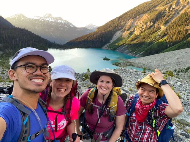
Joffre Lakes is one of the most popular and well known hikes in BC. It’s for a good reason – it’s jaw-dropingly gorgeous and easily accessible – but the crowds have definitely been a deterrent for me in visiting frequently. However, my friends from Toronto were visiting and they wanted to go there for their first ever backpacking trip, so I agreed to go with them since I’ve never actually backpacked there before.

DSC00384_1

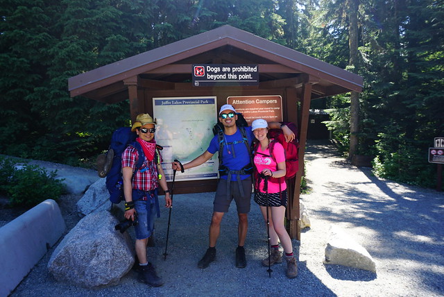
Joffre Lakes now has a day pass system – so you can’t visit the park at all without either a day pass or an overnight pass (which are limited). This helps a lot with the stress of parking, but there is still an impressive amount of people in the park every day, even with the pass system. Overnight passes are hard to get – me and Philippa logged on at the same time to try and get them – I lucky enough to score 2 tent pads on my device, but even with 3 devices of their own, Philippa and Justin didn’t get any. Fortunately we had all we needed, but it gives you an idea of the competition for tent sites on a Saturday Night. I definitely recommend going on a week day if you’re able.

20220724_121547

I won’t talk too much about the actual trail because I’ve written about it in my post about day hiking here. I’ll just say that as beginners, I do think this was a good trail for Philippa and Justin – it’s not too long or difficult, and it has washroom and bear cache facilities, which make things a lot easier. 

Brandon joined me for the trip and drove us all up to the trailhead early on Saturday morning. Unfortunately, we realized at the trailhead that Philippa and Justin had forgotten their lunch in the fridge, but I always carry a spare meal, so we decided to go anyways and they ate that. It was a gorgeous sunny day for it – definitely hotter than I prefer, but that’s how summers in Vancouver seem to be these days, so I’ve gotten pretty good at staying hydrated and no one suffered too much with the heat.

IMG-20220724-WA0020

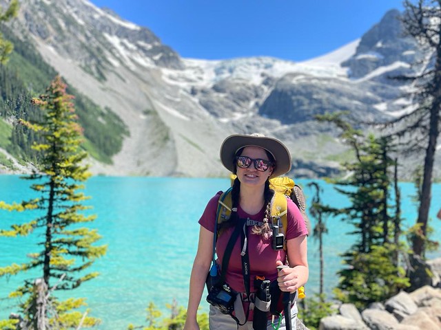
We stopped at the second lake for lunch and went for a quick dip in the freezing cold water, and then continued up to the third lake. This is where my account of the lake will diverge from my last post. When I visited last year, we just hiked to the base of the third lake, but if you’re camping overnight, you have to continue around the edge of the lake to the other side, where there are a bunch of campsites under the glacier. I’d never backpacked at Joffre before, so I was excited to check out the campground. Plus, one of the big benefits to staying overnight is that crowds are greatly reduced in the evening and you get to enjoy the view for much longer.

20220723_151704

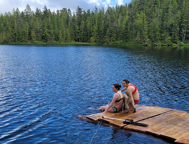
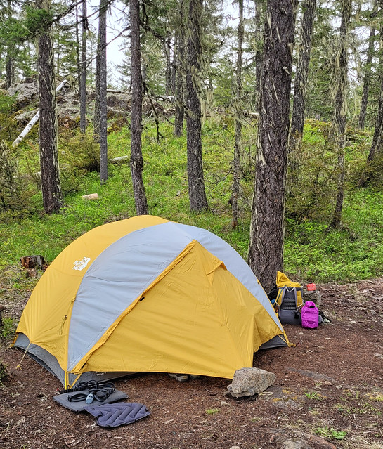
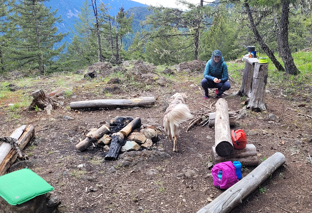
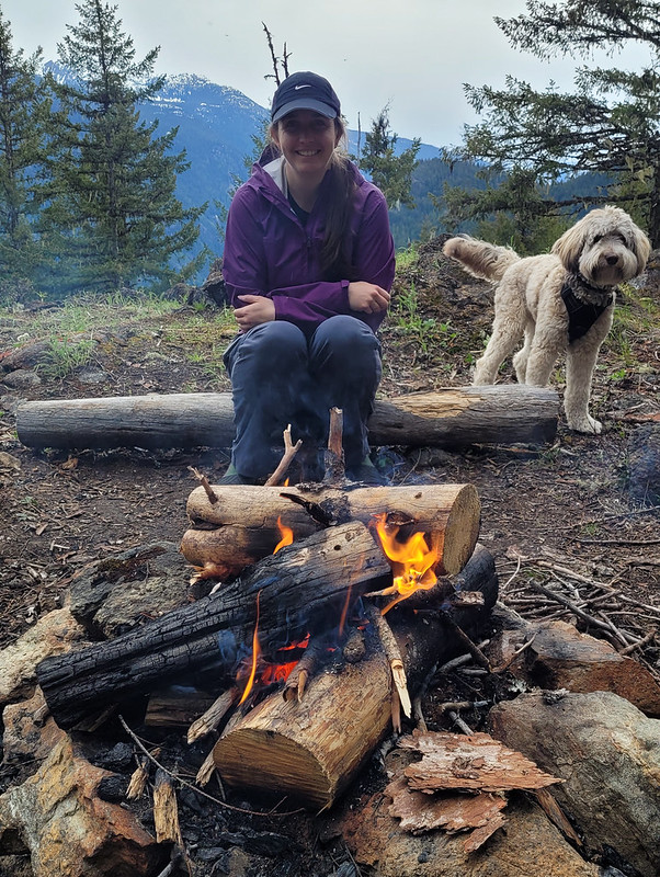
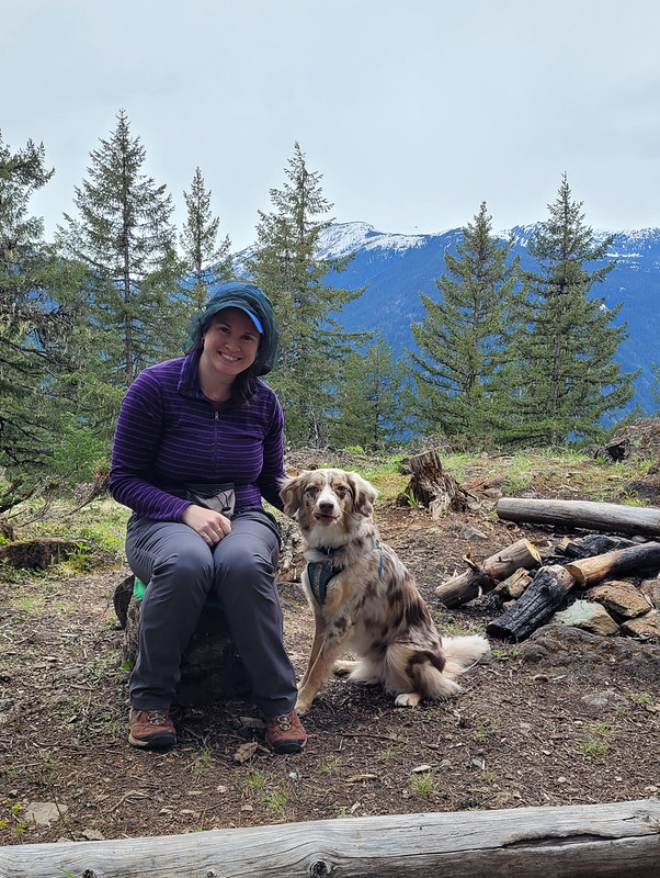
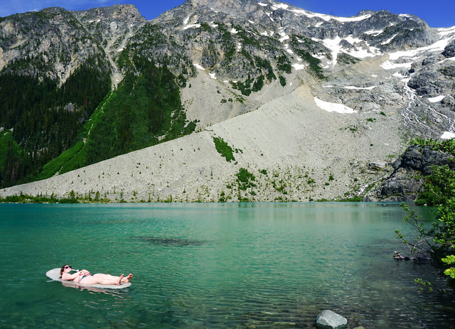
We chose a campsite along the edge of the lake and set up our tents. I was keen to go for another swim, so me and Brandon decided to take our thermarests out into the lake this time, since it’s so cold. We did this at Assiniboine to great success! However, I’ve since replaced my sleeping pad with a smaller one and unfortunately, it’s not really big enough anymore! I floundered around on it for a while, with lots of screaming about the cold water that kept swallowing me up, before Justin went and got his pad for me instead (which is actually my older, bigger pad that he was borrowing). So we all tried them out in the water for a bit, and while they do insulate against the cold, you have to lie perfectly still on them lest you disturb the water and cause your limbs to go numb. So maybe not our best idea!

PSX_20220801_090126

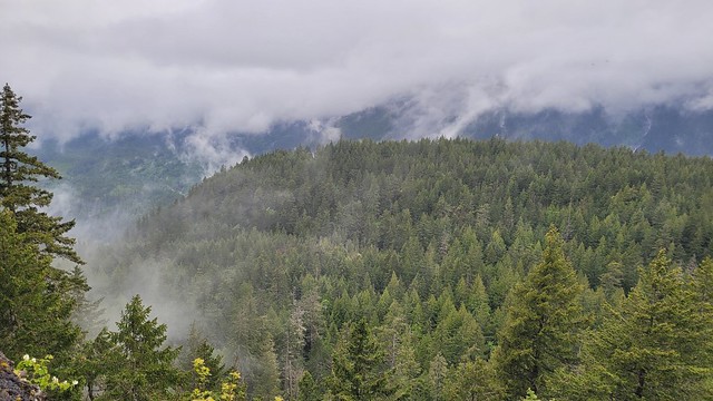
Instead, Brandon and I had the idea to hike up towards Matier Glacier for supper. Lien did the Matier Glacier hike last year and told me you could see all three lakes once you get high enough. There was still snow at the base of the glacier, so we didn’t plant to go the entire way, but we figured if we hiked up to the top of the moraine, we might be able to catch the view for supper. 

20220723_200145

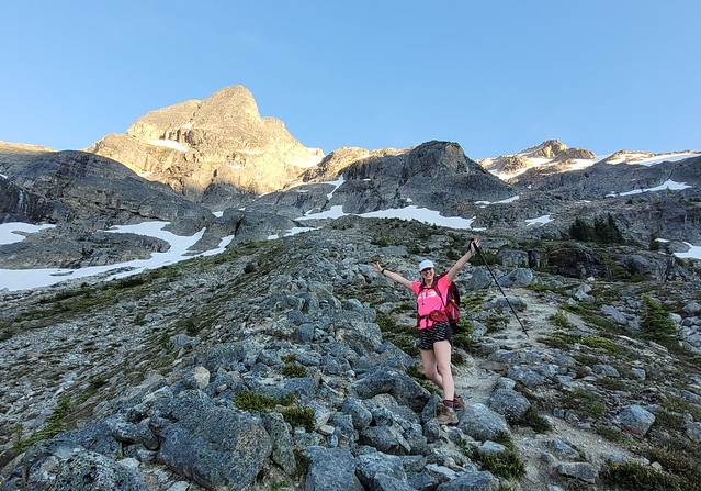
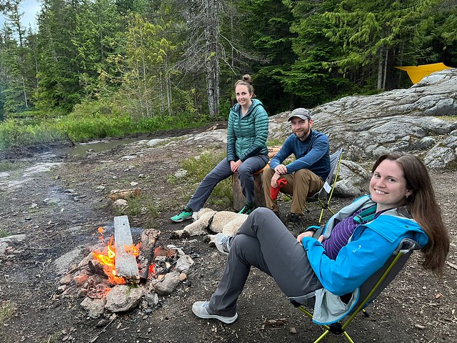
The hike to Matier Glacier is entirely a scramble up one of the old moraines. I didn’t find it too challenging, but it is pretty steep. It had cooled down, so we pushed up for about a half hour, but as it got steeper, Philippa got uneasy about having to go back down, so we pulled off to the side and found the flattest place we could to eat (not very flat at all, but we made it work)! Philippa and Justin had a mix of freeze dried meals to sample and Brandon made his legendary thai curry chicken for us. We were hoping for a sunset, but the sun goes down behind the mountains, so we just enjoyed golden hour instead. 

IMG-20220724-WA0040

It’s definitely worse hiking down the moraine than up, so it took us a while to go back. There’s a lot of loose rock that makes it slippery, so I wouldn’t recommend it for beginners. Philippa didn’t like the descent, but she still did a great job on it and her feedback for beginners is to go down sideways and focus on small steps! Nonetheless, they made it down and used their new skills when they went to Panorama Ridge a week later.

PSX_20220801_232337

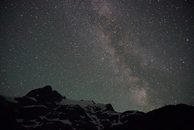
It was starting to get dark by the time we got back to the campsite, so we got ready for bed early. We were all super tired after the early start and I wanted to get up in the middle of the night to shoot the stars. I think I was asleep before 10pm! I had my alarm set for 1:30am, but I ended up waking up to pee just before midnight and decided to get up then. Brandon decided to join me and we spent about 45 minutes playing around with our cameras and got some lovely shots of the milky way! I brought my tripod on this trip, which always makes for a more enjoyable experience.

DSC00532

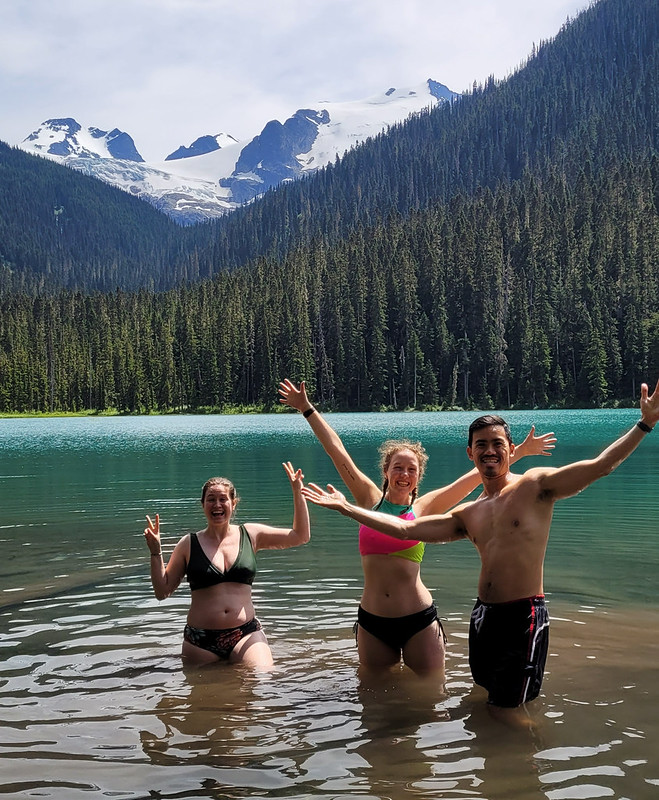
We managed to sleep in until after 7, but once the sun hit the tent it was time to get up. We had a lazy breakfast and then packed up the tents to start the hike back down. We had a little break again at the second lake, but decided to save our swim for the first lake. I loved this idea because I wanted to swim in all 3 lakes and liked the opportunity to wash my body at the end of the hike. All the lakes are quite cold, but they definitely get warmer the further away from the glacier you get. 

20220724_134345

So overall, a very successful trip! Even though me and Brandon have been to Joffre Lakes several times, we loved exploring it through new eyes with Philippa and Justin. I’m definitely not in a rush to go back, but I am always enthusiastic about hiking with anyone who loves adventure. I do think Joffre is a great option for beginners and wish you luck in getting permits to this beautiful location. Just remember to treat it with respect. Leave no trace and pack out all your garbage!

PSX_20220724_225533

Hut Lake Backpacking Trip

Please excuse the late post for this week – I have been having so many great adventures this summer that it’s been a struggle to find the time to write about them all!

As a result, I have a bit of a backlog of trips to write about, the first of which is Hut Lake, which I visited in early July. Vancouver had a really terrible Spring this year – it was very rainy and cold – and as a result, the snowpack in the mountains was extremely slow melting. I was planning to do an alpine hike in Pemberton, but it still had snow AND avalanche risk, so I had to come up with a back-up plan on short notice.

PSX_20220724_211015

So many of the hikes I want to do have a short season because of the snow, so we really had to rack our brains to find something that was both low elevation and dog friendly. In search of a trail, I took to my regular hobby of just scrolling around the GaiaGPS app and seeing what I could find. I focused on the Squamish area and discovered a few lakes that I had no idea existed.

The first is Levette Lake, which is very well known by the locals. When the road is freshly graded, anyone can drive all the way up to the lake, though later in the season I’m told the road conditions can become variable for lower clearance. There is a rec site at Levette, so you can pay to camp there, but we were looking for something a bit more remote and I noticed that the trail continues up past Levette to Hut Lake, where there is a free rec site. With no better ideas, we figured it was as good an idea as any.

IMG-20220716-WA0007

We ended up having a great time! It’s not the most scenic trail, but since it was threatening rain, it was totally empty. Unfortunately, when we arrived we noticed that Levette Lake was closed due to a human-habituated bear. This seems to become more and more common lately – Cheakamus Lake, Helm Creek, Golden Ears, and Rainbow Lake have all been having issues with aggressive bears and several of the sites were closed this year and sadly the bears were killed. A good reminder that all of our actions have consequences and that everyone needs to do their absolute best to leave no trace so as not to attract bears.

Fortunately, we weren’t going to Levette Lake, so we opted to park at the bottom of the road and walk past towards Hut Lake. Our party consisted of me and Brandon, and Carolyn and Steve with their dog Jasper. I wanted to bring Sadie, but with Seth not coming and the weather rainy, I decided she was too much to handle on her own. We kept Jasper close the whole trip to avoid any potentially negative bear encounters.

20220717_083148

It’s a steady uphill, but easy 3.5km hike along the road up to Levette Lake – a quick peak up the road revealed an outhouse, a bear cache, and several campsites, but a lot of garbage. Which is ridiculous because there are garbage facilities PROVIDED at the site! We did a quick clean up of the cans to deter the bears and then continued on towards Hut Lake.

If you’re into the 4×4 off-roading community, you might be familiar with this trail as it seems to primarily be used for off-roading. The road is still pretty easy going for the next 2km, but once you reach the 5.5km mark, there’s a very steep dip and it becomes more trail than road. It rained for most of our hike up, but it’s more shaded along this section of the trail, which slowed down the rain and we followed the fairly easy trail another 2.5km to the Hut Lake Rec Site. There’s not much to see on the trail besides the forest, which was prefect on a rainy day.

20220716_174404

We didn’t see anyone on the trail and we were the only people at the lake too. Like the road, it seems to be tailored to off-roading rather than backpackers. There are a few picnic tables, which is lovely, but they are located on most of the limited flat ground, so it was a bit of work to find a good spot to pitch the tents without being on the road. After we set up though, we discovered that there are a few more sites at the back of the lake (where there’s another trail that goes to some smaller lakes).

Fortunately it stopped raining when we got to the campsite, so we had a good time setting up and the sun even started to burn off some of the clouds! I was sweaty from the hike and decided to go for a swim before I cooled off and the whole group joined me, except for Jasper, who was very distraught about this new activity. I guess it’s easy for off-roaders to bring supplies up to the site and someone had constructed a huge floating raft that was tied to the shore. There was one tiny paddle, which was hilarious because the raft was much too large to paddle anywhere, but we left it tied on and pushed it out into the lake so that we could swim off it.

20220716_162359

Alpine lakes are really some of the most scenic lakes in the world, but there’s definitely something to be said for low elevation lakes! In Newfoundland we would definitely call this one a pond (it’s not very large), but it was very warm! Alpine lakes are always freezing because they’re comprised of glacier and snow melt, but Hut Lake was the perfect temperature for swimming and we easily hung out in the water for a half hour.

We had started making supper when we heard the low roar of a vehicle coming up the road. A small, but extremely lifted, jeep pulled in and we were weary about what kind of visitors we were about to get, but it ended up being a dad and his 2 kids out exploring for the day. Because the rec site is on crown land and there was no fire ban, you can have fires and the family asked to join us and got a fire started up! We had a nice chat with them about all the 4×4 roads in the area and learned about some other trails to check out. We had a good laugh though because the family was from Squamish and assumed we were too. The dad started ranting about the backpackers who come up from Vancouver just to party at the site, and then kind of paused as he was talking and noticed us smirking, to say “… you guys are from Vancouver aren’t you?” Fortunately he gave us a pass because “we look like we know what we’re doing and are properly outfitted”. Not sure if it’s a compliment, but I’ll take it because I like to rant about the partiers too.

IMG-20220717-WA0029

After a while they took off and left us a lovely fire to enjoy! Me, Carolyn, and Brandon went exploring around the edge of the lake while Steve and Jasper manned the fire. Our new friends had told us that there’s a great view of the Tantalus Range on the other side of the lake. We tried to find the trail he described and ended up bushwacking our way into the lake from the other side – but he was correct and even though we didn’t find the trail, we did find a gorgeous view of the Tantalus mountains!

20220716_201940

I was trying out my new bearproof sack on this trip, but everyone else needed to do a bear hang, so I watched Carolyn and Brandon struggle at that for the better part of 30 minutes. Their aim is not great and Carolyn hucked a doozy of a rock up at the tree only to have it fall down and land directly on my bear bag and break my stove, so I left them to it. The effort was worth it though and they produced one of the best bear hangs I think I’ve ever seen, so well done.

After that misadventure it started to rain again, so we decided it was time to hit the sack! It rained most of the night, but it was only drizzling when we woke up and we were able to make breakfast and take down camp without getting wet. We had a totally dry hike out and did the whole 8km return in 2 hours. It’s not a hike I’d recommend in the dead of summer because it’s not the most scenic, but I would definitely recommend it in the off season. The lack of crowds made for a very enjoyable experience, as did the swim in hut lake. There’s no outhouse or bear cache, so be prepared for that, otherwise we had a great time and I’m keen to return again sometime in the future!

20220716_205701

Tikwalus Heritage Trail Backpacking Trip

Despite the high levels of snowpack hanging around in the mountains this year, I had a good start to the season and got in a second backpacking trip the first week of June. I find Spring backpacking challenging because of the limited number of trails with campsites that are snow free, so me and Carolyn have been trying to branch out to find new trails. This was made somewhat more challenging because we wanted to bring our dogs with us (and even fewer trails are dog friendly), but fortunately Tikwalus Heritage Trail fit the bill!

Tikwalus is located about a half hour north of Hope on Highway 1, just before you reach Hells Gate. As we were driving up there we realized that neither of us had done any hiking in this area and I couldn’t recall ever driving the highway since I’ve lived in BC (though I did it once as a tourist before I moved here). It’s exceptionally beautiful driving along the steep walls of the Fraser Canyon and it doesn’t seem to get that much hiking traffic. Despite not arriving at the trailhead until noon, we were only the third car in the lot! A very promising sign for me since Sadie can be reactive to people and dogs.  

20220528_125416

At 6.5km to the campsite, it’s not an overly long trail, but it is very steep and you gain almost 800m in the first 4km. We took our time going uphill and the dogs had a blast alternating between playing with one another and guiding us up the trail. Sadie is almost 2.5 years now and is an Australian Shepherd, which is a very high energy dog, so she had no problem with the hike and carries her own food and equipment in her Ruffwear pack. Jasper is still a puppy and less than a year old yet, so he was freeloading off Carolyn until he gets old enough for a pack. He got a bit tired early in the hike from the uphill, but he also has a lot of energy and bounced back very quickly once he got used to the climbing.  

20220528_153208

As the name suggests, Tikwalus is a heritage trail and covers both indigenous and colonial history. The trail has been used for many, many years by the Nlaka’pamux for hunting and gathering and there are several culturally modified cedars along the trail. In later years, the trail was used as a trade route through the Cascades by the Hudson’s Bay Company. There are several placards along the trail providing lots of information about the history of the trail, so it made for an educational hike and a nice respite from the uphill monotony on the way in. About halfway up there’s a beautiful viewpoint looking out on the surrounding mountains.  

20220528_140213

Once you get to the top of the steep section (~4km), you’ve done most of the elevation gain and the trail branches into a loop around the summit. If you do it as a day trip, it’s about 13km round trip. It’s mostly flat around the top, so we decided to take the slightly longer lake route to shorten our journey for the following day. Unfortunately there’s not a ton of views around the lake route, but there is a huge viewpoint on the other route. It was clouded over on day 2, so we never got to take advantage of the viewpoint, but it’s still quite scenic at the campsite, so it wasn’t that big a deal. Just something to note if you’re in a similar position as us with the weather. The viewpoint route does go along a narrow spine though, so if you have any issue with heights, the lake route felt a bit safer.

It took us about 3.5 hours to reach the campsite. We didn’t take any long breaks, though we did stop to get water when we crossed over a fast flowing creek on the way up. This was a really good choice because the water options near the campsite are not ideal. There are two creeks on either side of the campsite. I would say the option on the lake route is the better of the two. It’s closer to the campsite (maybe a 10 minute walk?) and it has a decent flow rate. The placard said there used to be a cabin in this area in the past because it was used as a water source. The second option is on the viewpoint route.

20220528_164759

It’s a bit farther (maybe a 15 minute walk?) and it’s not as fast flowing as the other one. To be honest, neither are great, so make sure you bring a filter, I wouldn’t want to rely only on water tabs. I’ve read in some comments online that people get water from the first lake, but I would definitely avoid – it’s very still and a terrible water source. Just walk a bit further to use either of the creeks.

There were two other groups at the campsite when we arrived, but it’s very large and we had no trouble finding a good spot to pitch our tent away from other people. We were joined later by a few more groups, but at no point did it feel crowded. The trail seems to be used primarily for backpacking. We didn’t see a single person on the way up or down, so it seems like most people who go up there plan to stay the night. It’s a mostly forested trail and campsite, but there are some really nice views looking out over the mountains.

20220528_164804

We had really nice weather on the way up and it threatened rain in the early evening, but mostly held off. Campfires are allowed at this campsite and there were several established rings around, so we collected wood debris from around the site and got a small fire going. I’ve done a whole post on responsible campfires, so make sure to only take dead wood and to avoid harming any natural habitat. Fires aren’t permitted in so much of the backcountry (and even when it is permitted there’s often a ban), so it was really nice to have one! We forgot a firestarter, but Carolyn worked some magic to get one going.  

20220528_190008
20220528_165001

The rain finally moved in around 8pm and we decided to call it an early night. It was really just a bit of drizzle, but neither of us wanted to sleep with 2 wet, stinky dogs. However, it was still light, so it took the dogs a while to settle down and we did some reading before falling asleep early. Unfortunately, the dogs get up with the light, so they had us up and awake at 6am. It rained on and off throughout the night, but was mostly mist when we got up. We had a quick breakfast and then packed everything up and were back on the trail shortly after 8am. Quite early for us!

I thought it was going to be a brutal walk down based on how steep it was, but it ended up not being too bad. We saw nothing but clouds from the viewpoint on the return loop, but they lifted enough for us to get a misty view of the mountains at the halfway viewpoint. We finished the hike around noon and stopped into the General Store on the way back to Hope for lunch.

20220529_095612

Overall, it’s a pretty understated hike. It’s mostly in the trees and it is quite steep, but we really enjoyed it. It’s very green in the Spring and we loved that it wasn’t crowded. The large campsite gave us lots of space and we liked the rare opportunity to have a campfire. It was a great choice for taking the dogs and we loved exploring a new part of the region that we’d never been to before and learning a little bit about the history of the area. Would definitely recommend if you’re looking for an early season hike and don’t mind a climb. It is tiring, but it’s not a technical trail, so I think it would be good for beginners looking to build up their stamina and abilities. It has both an outhouse and a bear cache and you can bring your furry friends!  

20220529_104025